Map size in jpg-format: 937116B
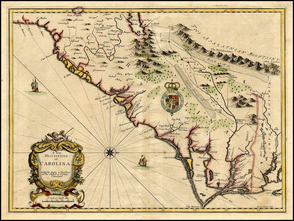
Important early map of the Carolinas, engraved by Francis Lamb for the 1676 edition of Speeds A Prospect . . . of the World.
The map is Speed's edition of the famous Lords Proprietors' Map of Carolina, based upon Charles II's grant to 8 of his supporters of all the lands between Virginia & Florida (overlooking the fact he did not own the land).
Speed's map is drawn from the account of John Lederer, a young German explorer who had crossed the Blue Ridge Mountains in hopes of seeing the Pacific Ocean. Lederer introduced numerous geographical myths, including a description of Piedmont NC as being under water for part of the year, a massive interior lake, and an arid region he named the Arenosa Desert. Speed's map and the text on the verso were the first to give extensive credit to Lederer & contributed to the survival of these myths for nearly 100 years.
If you are a student, write to us in telegram: @antiquemaps and indicate what material you need and for what work you need a map in high detail. We are ready to provide material on special terms. For students only!


![[The First Maps in a la poupée Printed Color] Cartes en Couleur des Lieux Sujets aux tremblements de Terre Dans toutes les parties du Monde Selon le Sisteme de l’impulsion Solaire](/map/small/52293op.jpg)