Map size in jpg-format: 653019B
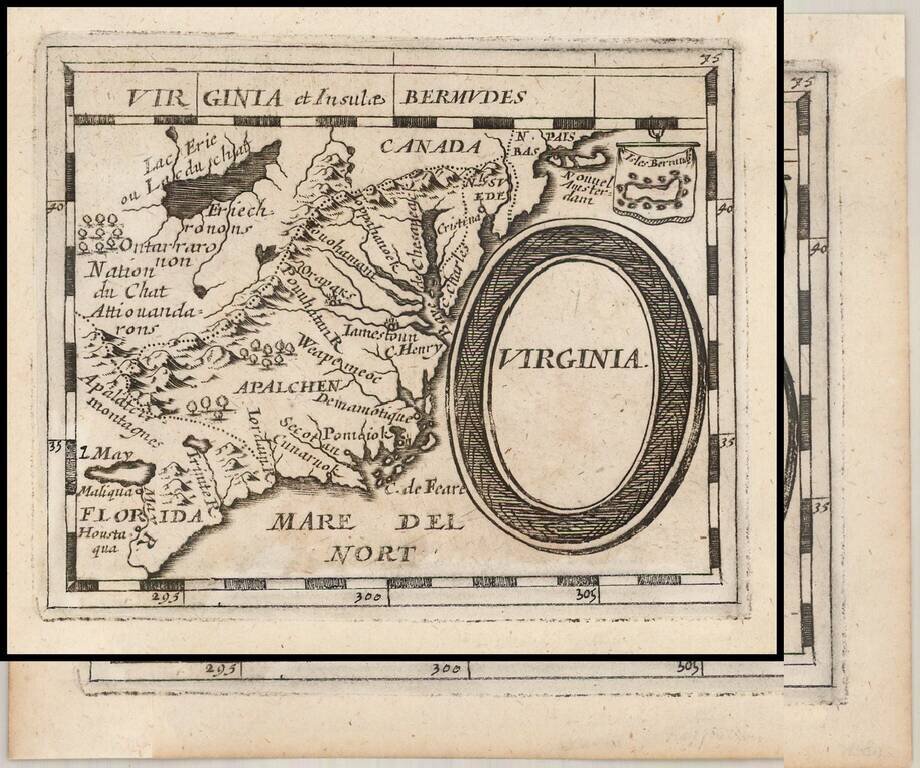
Early German Map of Virginia.
Rare German edition of Pierre Duval's map of the region centered on Virginia, the Chesapeake and the Carolinas, published by Johann Hoffman in his Geographiae Universalis, first issued in 1678.
The map is a close copy of the second and third states of Duval's map, which has been re-engraved by Sigismund Hipschmann. A second edition was published in 1681. The map includes an early depiction of the Chesapeake region, the mythical Lake May above Florida, Jamestown, Cape Henry, Secot, Pomeiok, an early reference to Manhattan and New Amsterdam and an inset of Bermuda.
If you are a student, write to us in telegram: @antiquemaps and indicate what material you need and for what work you need a map in high detail. We are ready to provide material on special terms. For students only!


![[The First Maps in a la poupée Printed Color] Cartes en Couleur des Lieux Sujets aux tremblements de Terre Dans toutes les parties du Monde Selon le Sisteme de l’impulsion Solaire](/map/small/52293op.jpg)