
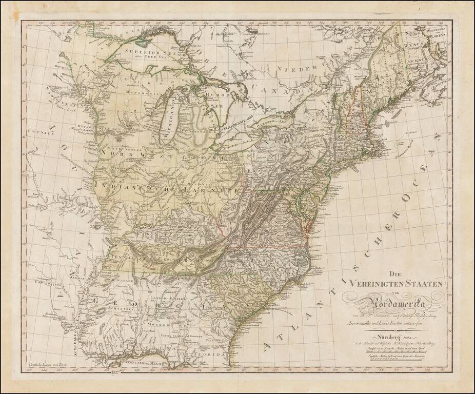
Rare separately issued map of the United States by Daniel Freidrich Sotzmann, engraved for Christoph Daniel Ebeling's Beschreibung. The present example has wide uncut deckled edges, similar to Sotzmann's individual maps of the states. The words "No....
![Charte von Den Vereinigten Staaten von Nord-America nebst Louisiana . . . 1805 [Rare 1st State of Gussefeld's Louisiana Purchase Map]](/map/small/63496.jpg)
Rare first state of Gussefeld's map of the United States, published in the same year as the Louisiana Purchase and highlighting Jefferson's United States on the eve of the expedtitions of Lewis & Clark, Zebulon Pike, etc. Following the Louisiana...
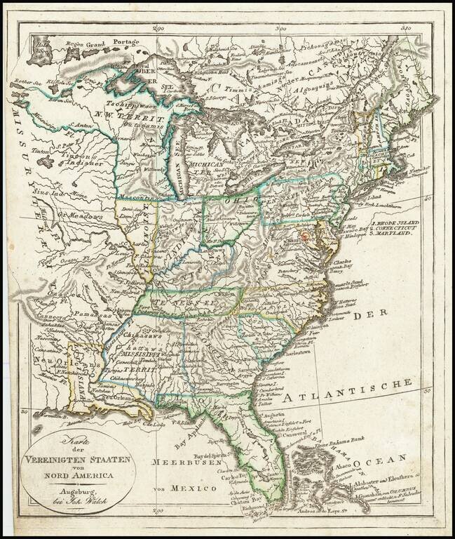
Mississippi Territory ! Rare early state of Walch's map of the United States, showing a number of early and transitional territorial configurations. This map vividly illustrates the fluid nature of American territorial boundaries between the Louisiana...
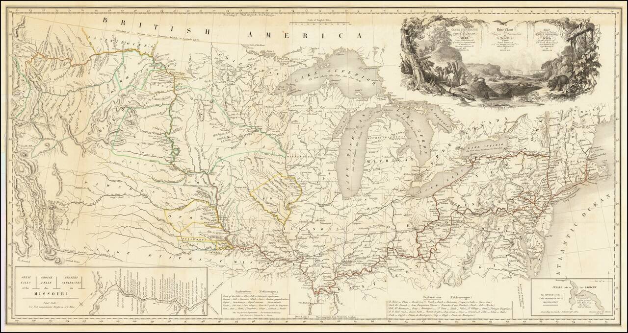
One of the Finest Early Maps of The Missouri Valley & American Plains Nice example of this remarkable map illustrating the account of the travels of Prince Alexander Phillip Maximilian, of Wied's, in the Plains and Rocky Mountain regions, in the...
![[The Mississippi-Missouri: A Geographical Blunder -- An Illustrated Argument For Renaming The Lower Mississippi River Put Forth By A Prominent American Educator To The Author of a Best Selling American School Geography]](/map/small/56241.jpg)
"The Geographer who shall first have the boldness to teach the truth . . . will be opposed for a time by interested book publishers and conservative pedagogues, but will triumph as Galileo did in the end." The Mississippi-Missouri: A Geographical...

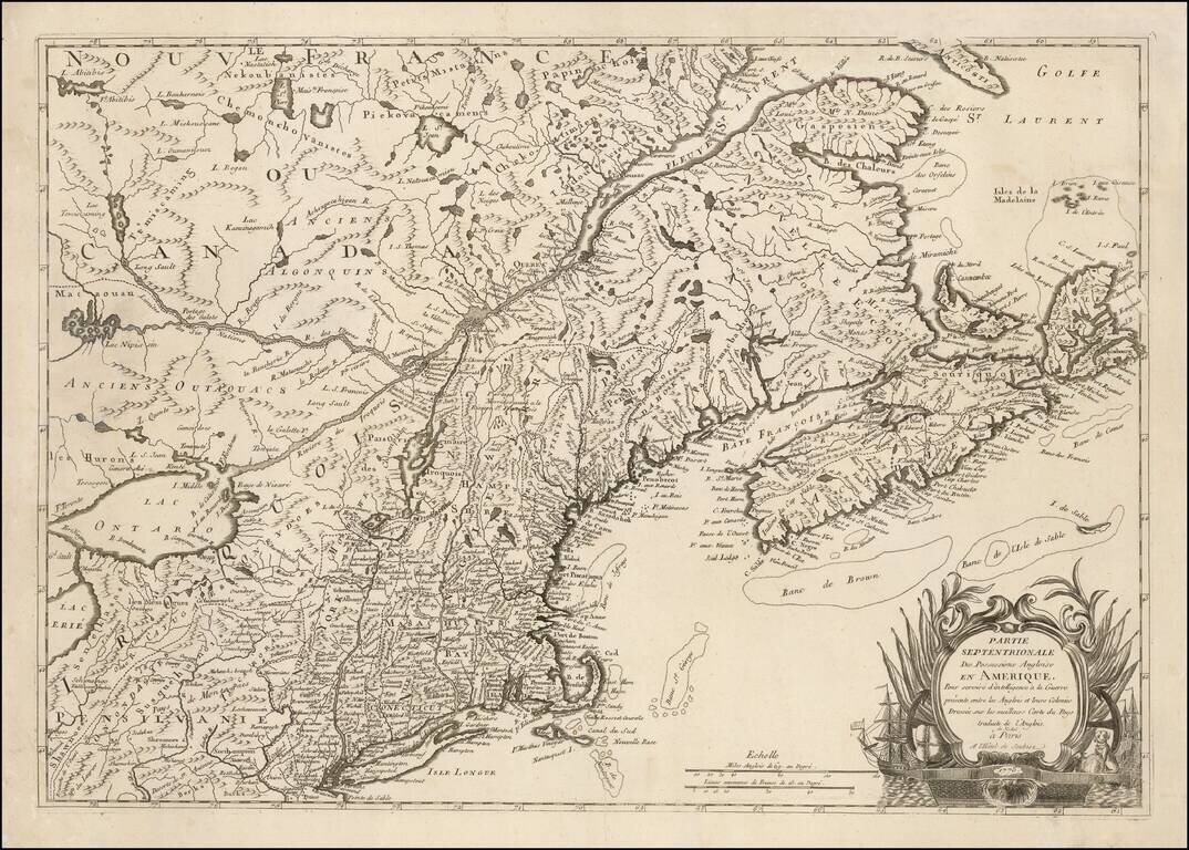
Detailed map of the Ohio Valley and regions to the East Nice example of Robert de Vaugondy's map of the Northern British Colonies, French interests to the North of the Great Lakes, and contested "Back Settlements," including a fine detailed treatment...

A highly decorative and important sea chart showing Florida, the Gulf Coast, Caribbean, Central America and the region from south of the mouth of the Delaware River. This fine separately published map was first engraved around 1650, but is based...
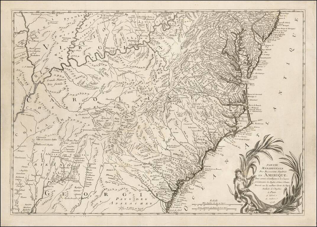
One of the Earliest Regional Maps of The Southern Theater of War Published in Paris. Rare separately published map of the Southern British Colonies, shown at a time when the French were just beginning to actively join the American Rebel cause in...
One of the Earliest Regional Maps of The Northern Theater of the Revolutionary War Published in Paris. Rare separately published map of the Northern British Colonies, shown at a time when the French were just beginning to actively join the American...
![Observations sur la Virginie [with the map:] A Map of the country between Albermarle Sound, and Lake Erie, comprehending the whole of Virginia, Maryland, Delaware, and Pensylvania, with parts of several other of the United States of America. Engraved for](/map/small/51828.jpg)
First Published Edition of Jefferson's Notes on Virginia, with the Only Map Attributed to Thomas Jefferson. Engraved folding map, folding table. [4], viii, 190, [6], 197-387, 288-290, [5, errata] pages of French text (i.e., complete). 8vo, 8 x 4.75...
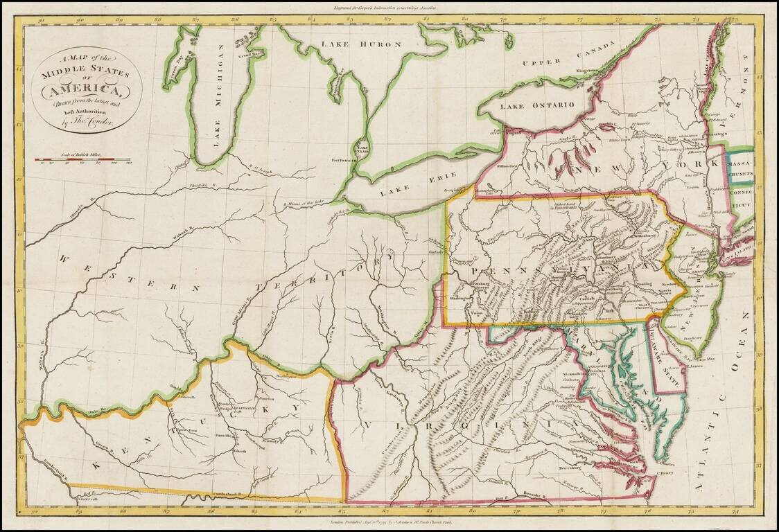
Rare map of Western Territory and the Mid-Atlantic regions of the United States in the last decade of the 18th Century. The map extends to the Illinois & Wabash Rivers, Lake Michigan and the confluence of the Ohio and Cumberland Rivers in western...

Fine large map illustrating the route of the Richmond & Louisville Railroad. Exceptionally detailed Railroad map of portions of Virginia, West Virginia, Kentucky and Tennessee, on a scale of 12 miles per inch. Timber and coal regions are noted,...
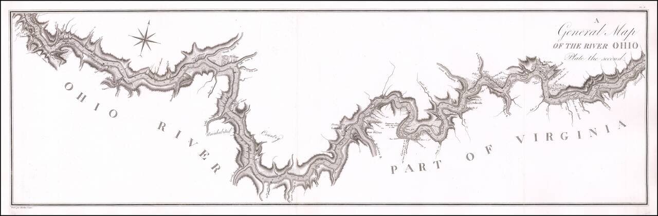
Antique Map of a Section of the Ohio River Prepared By A French Spy Important early map of the Ohio River from Maysville, Kentucky to just south of Wheeling, West Virginia, prepared by the French military officer and spy George Henri Victor Collot,...
![La Florida [with] Guastecan [with] Peruviae Auriferae Regionis Typus](/map/small/61587.jpg)
Ortelius’ Map of Florida—The First Separately Printed Map of Florida! An excellent example of Abraham Ortelius’ seminal map of Florida and the North American South, shown within a trio arrangement of maps focused on Central and South America....

Jacques Le Moyne's Landmark Map of Florida & The Southeast, Based On The Expedition of Laudonniere to Florida in 1564 Jacques Le Moyne's map of Florida and the Southeastern portion of the United States is one of the most important 16th Century...

The earliest obtainable maps of the Southeastern United States. De Laet's description of America is arguably the finest of the 17th Century. The map was almost certainly engraved by Hessel Gerritsz, based upon the work of Claesz in 1602, and Jacques...