logo

1938. An Historical and Geographical Map of Arkansas

  • An Historical and Geographical Map of Arkansas

An Historical and Geographical Map of Arkansas information:

Year of creation: 
Resolution size (pixels): 
 14508x11155 px
Disk Size: 
 39973600B
Number of pages: 
 1
Place: 
 Louisville, KY
Author: 

Print information. Print size (Width x height in inches):
Printing at 72 dpi 
  201.5 х 154.93
Printing at 150 dpi 
 96.72 х 74.37
Printing at 300 dpi 
 48.36 х 37.18

An example of detailing the file of this map of in a printable high-resolution:

Click to open in high resolution (open in new tab).
Attention! this is just the central piece (central area 960x960 px) of the map file!
This is an example, so that you can see and study the level of detail of a given map. The entire Map will be fully available after payment!

An Historical and Geographical Map of Arkansas

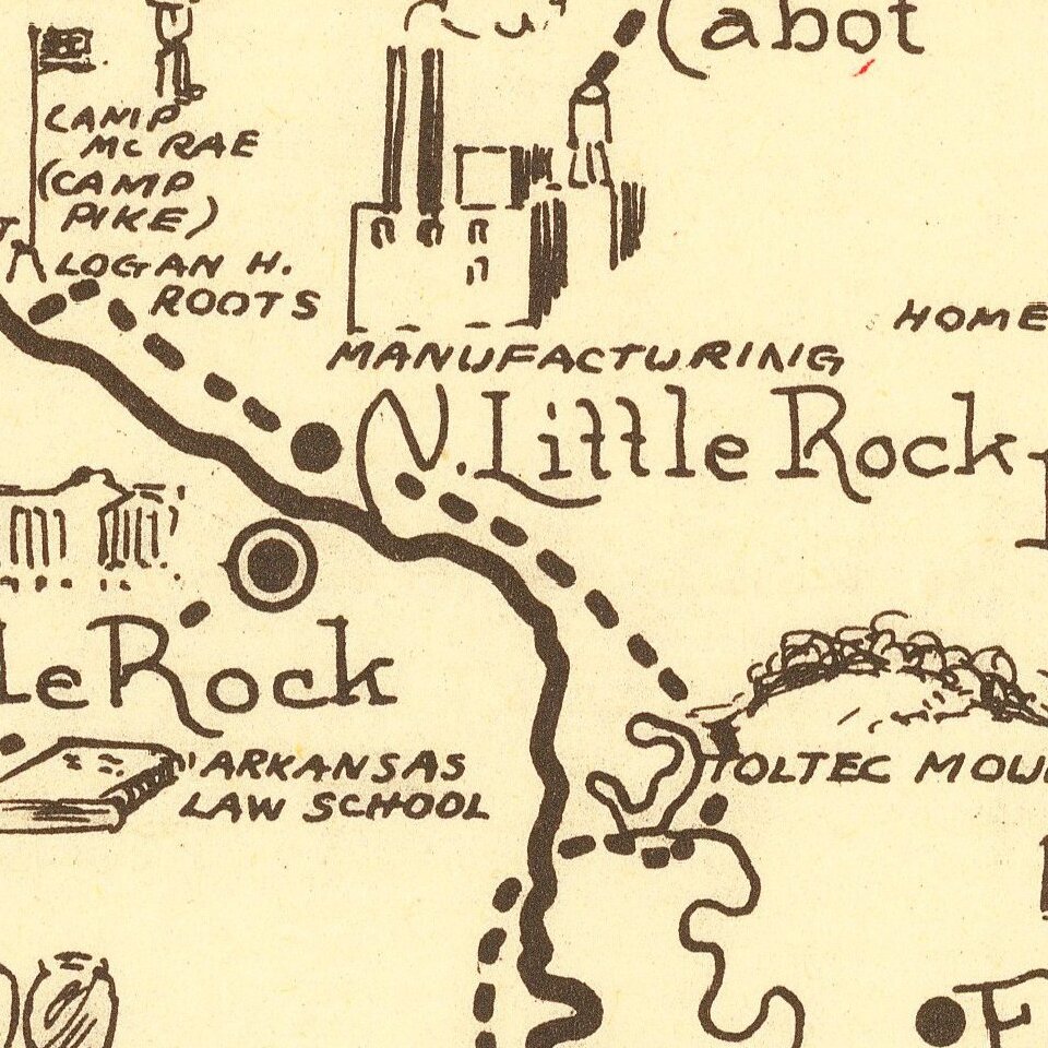
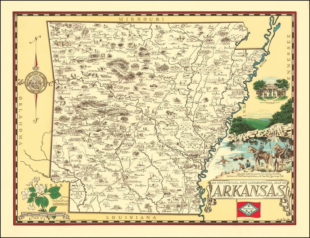
Rare pictorial map of Arkansas, drawn by Karl Smith.

The map shows historic sites, locations of significant events, cities and towns, Indian settlements, agricultural products, industry, parks, historical trails, rivers, and recreational activities.

At the sides are views of War Memorial Building, Little Arkansas, De Soto and his party ..., the State flag, the State flower, and compass rose decorated with the State seal.


Special conditions for students!

If you are a student, write to us in telegram: @antiquemaps and indicate what material you need and for what work you need a map in high detail. We are ready to provide material on special terms. For students only!

Item information:

Year of creation:
Size:
14508x11155 px
Disk:
39973600B
Number of pages:
1
Place:
Louisville, KY
Author:
Karl Smith.
$14.99

Related item