logo

1805. Kentuckey

  • Kentuckey

Map size in jpg-format: 4.87362MiB

Download "Kentuckey", in high resolution.

Kentuckey information:

Year of creation: 
Resolution size (pixels): 
 5310x4177 px
Disk Size: 
 4.87362MiB
Number of pages: 
 1
Place: 
 Philadelphia
Author: 

Print information. Print size (Width x height in inches):
Printing at 72 dpi 
  73.75 х 58.01
Printing at 150 dpi 
 35.4 х 27.85
Printing at 300 dpi 
 17.7 х 13.92

An example of detailing the file of this map of in a printable high-resolution:

Click to open in high resolution (open in new tab).
Attention! this is just the central piece (central area 960x960 px) of the map file!
This is an example, so that you can see and study the level of detail of a given map. The entire Map will be fully available after payment!

Kentuckey

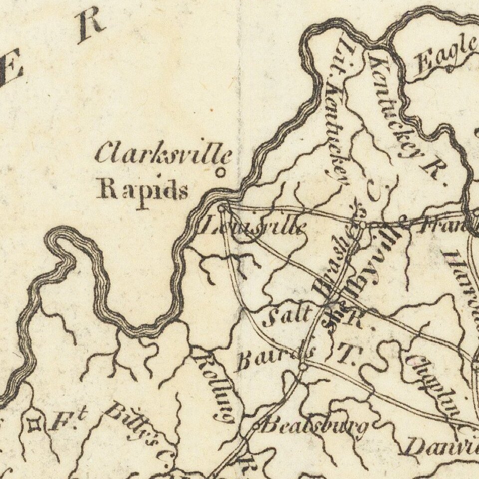
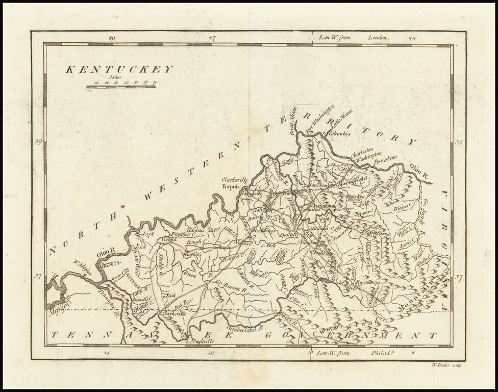
One of the earliest printed maps of the State of Kentucky.

The map provides a fine and extensive treatment of Kentucky's early roads.

Numerous towns and courthouses are also shown, along with the Rapids below Louisville on the Ohio River.

Includes an early appearance of Fort Washington or Cincinnati on the Ohio River.


Special conditions for students!

If you are a student, write to us in telegram: @antiquemaps and indicate what material you need and for what work you need a map in high detail. We are ready to provide material on special terms. For students only!

Item information:

Year of creation:
Size:
5310x4177 px
Disk:
4.87362MiB
Number of pages:
1
Place:
Philadelphia
Author:
Mathew Carey.
$14.99

Related item