logo

1855. Fort Smith Arkansas

  • Fort Smith Arkansas

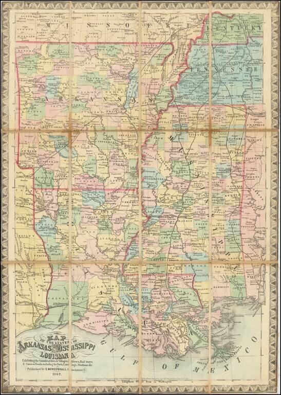
Map size in jpg-format: 285240B

Download "Fort Smith Arkansas", in high resolution.

Fort Smith Arkansas information:

Year of creation: 
Resolution size (pixels): 
 1425x1038 px
Disk Size: 
 285240B
Number of pages: 
 1
Place: 
 Washington

Print information. Print size (Width x height in inches):
Printing at 72 dpi 
  19.79 х 14.42
Printing at 150 dpi 
 9.5 х 6.92
Printing at 300 dpi 
 4.75 х 3.46

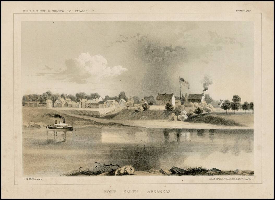
Fine early view of Fort Smith, Arkansas, prepared as part of the United States survey for the most practicable route for a railroad line to the West Coast of America, conducted just prior to the Civil War.


Special conditions for students!

If you are a student, write to us in telegram: @antiquemaps and indicate what material you need and for what work you need a map in high detail. We are ready to provide material on special terms. For students only!

Item information:

Year of creation:
Size:
1425x1038 px
Disk:
285240B
Number of pages:
1
Place:
Washington
Author:
U.S. Pacific RR Survey.
$9.99

Related item