Map size in jpg-format: 70.1616MiB
Click to open in high resolution (open in new tab).
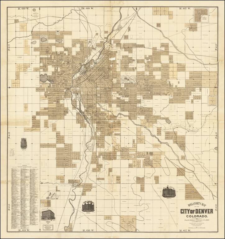
Fine separately issued map of Denver, published by Edward Rollandet in Denver.
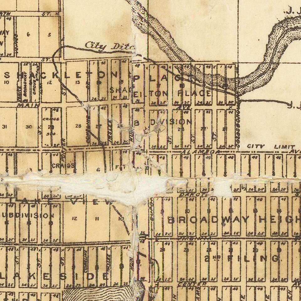
A fine large map, illustrating the early subdivisions in the city of Denver, with vignettes of the Windsor Hotel, Albany Hotel, Essex Building and Johnson Block. The map includes the names of early land owners, streets, buildings, parks, creeks, rivers and lakes, canals, property owners, farms, and rail, cable, horsecar, and motor lines and much else is clearly presented.
Rollandet was a Denver map publisher who issued a series of maps of Denver from about 1886 to 1905.
A very rare map of early Denver. Only 1 copy of the map has appeared in AMPR in the past 30 years. American Exhange reports no auction sales.
If you are a student, write to us in telegram: @antiquemaps and indicate what material you need and for what work you need a map in high detail. We are ready to provide material on special terms. For students only!
![Mexique par Th. Duvotenay…1843 [Republic of Texas]](/map/small/67925.jpg)
