Map size in jpg-format: 34.512MiB
Click to open in high resolution (open in new tab).
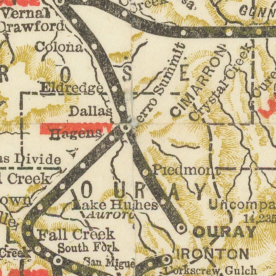
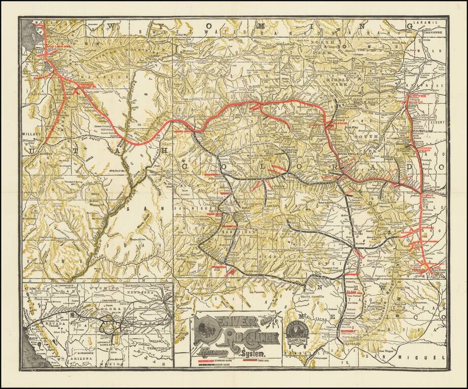
Detailed railroad map of Colorado and part of Utah. Promotional map for the Denver & Rio Grande Railroad. The border of Grand and Unitah Counties suggests a date of 1889 to 1890.
The map was produced in numerous editions over the decades.
If you are a student, write to us in telegram: @antiquemaps and indicate what material you need and for what work you need a map in high detail. We are ready to provide material on special terms. For students only!
![Mexique par Th. Duvotenay…1843 [Republic of Texas]](/map/small/67925.jpg)
