Map size in jpg-format: 87.4947MiB
Click to open in high resolution (open in new tab).

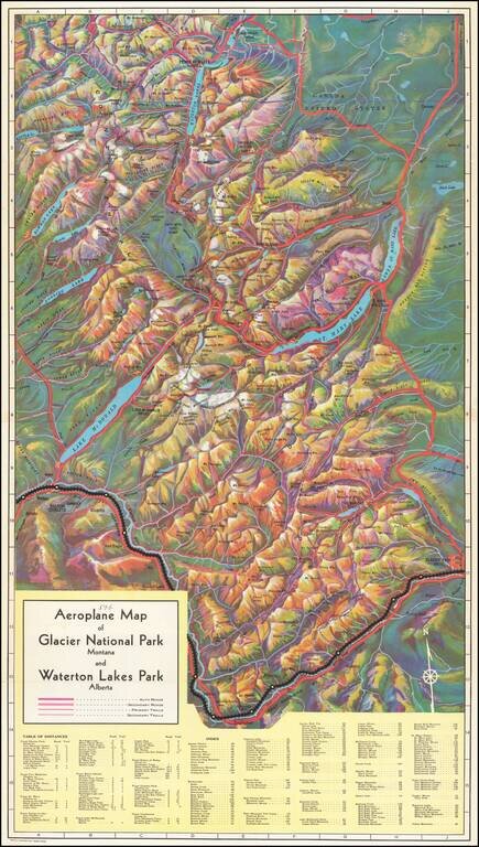
Rare birdseye view illustrating Glacier Park and environs, intended to promote the Great Northern Railway.
Provides a fantastic topographical illustration of the area between Flathead River and the Glacier Park Hotel, with towns, mountains, roads, rivers, hotels and other details shown.
The Great Northern Railway ran from Saint Paul, Minnesota, to Seattle, Washington. It was the creation of 19th-century railroad entrepreneur James J. Hill and was developed from the Saint Paul & Pacific Railroad. The Great Northern's route was the northernmost transcontinental railroad route in the U.S. This map was created with an appearance liking to that of a watercolor painting. Depth is given by way of mountain peaks, rivers, valleys, and lakes. Auto roads and trails distinguish routes one can take when exploring the two parks. Chalets, hotels, tent camps, mountain passes and peaks are all noted throughout the map.
The view is apparently quite rare on the market.
If you are a student, write to us in telegram: @antiquemaps and indicate what material you need and for what work you need a map in high detail. We are ready to provide material on special terms. For students only!