
Rare old maps of the United States.
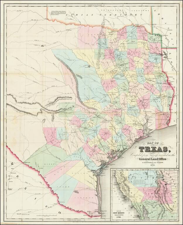
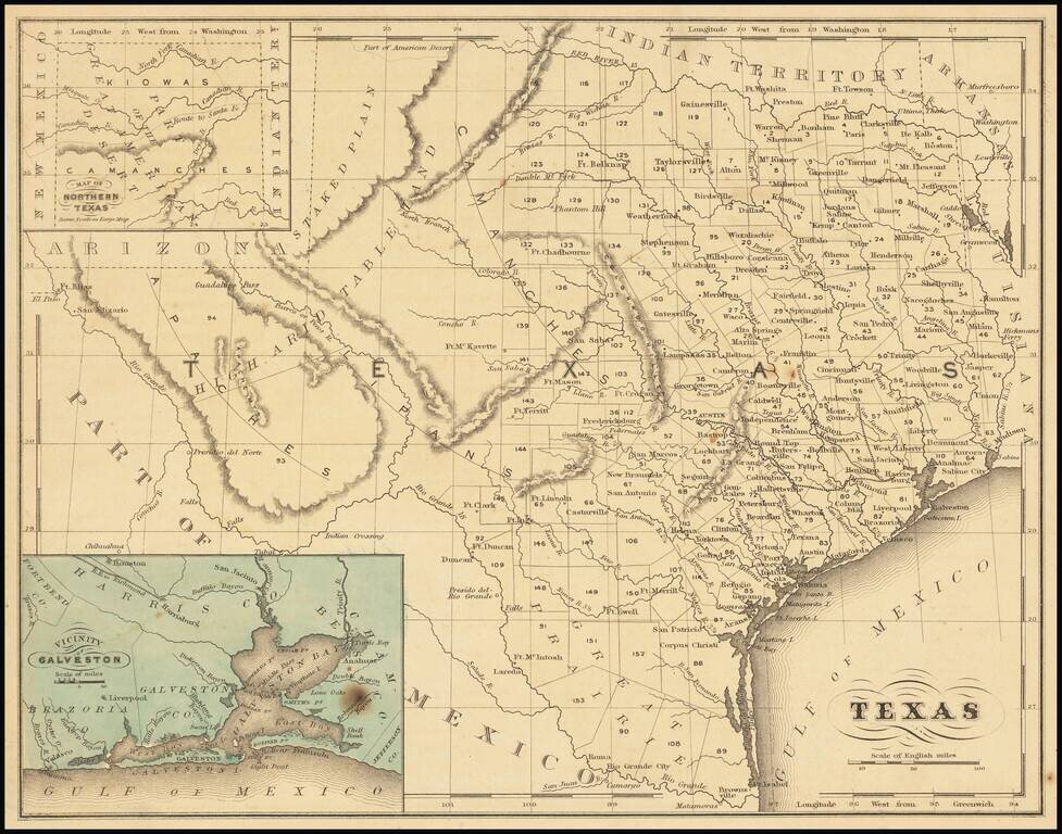
Very rare 1852 edition of this large, hand-colored engraved map of Texas. The map shows a plethora of development east and south of San Antonio, Austin, and the Cross Timbers. There is no meaningful development west of this line. This is one of the...
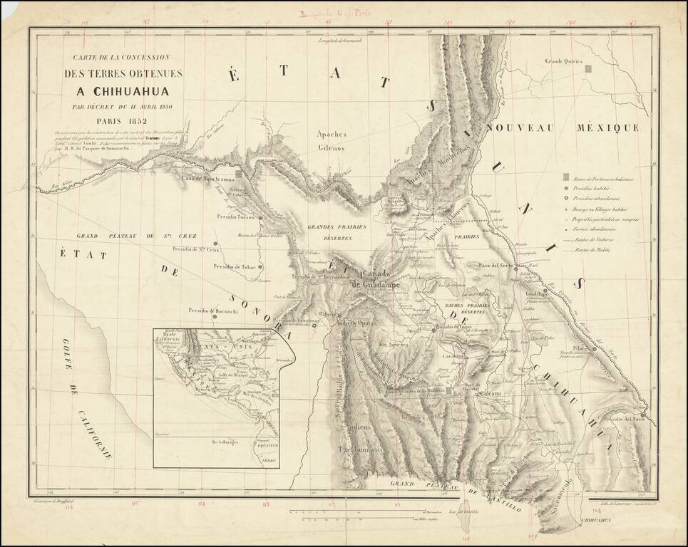
A French European Colony In Sonora and Chihuahua To Resist US Expansionism Scarce map of the borderlands between the United States and Mexico, illustrating the colonization scheme of Frenchman Hippolyte du Pasquier de Dommartin. The map provides a...
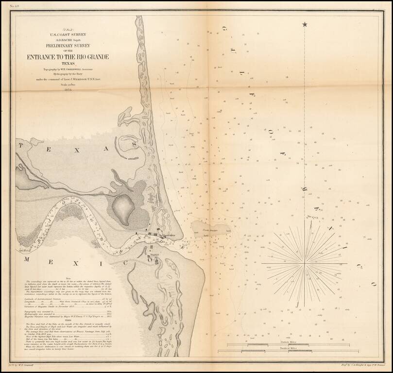
An early Sea Chart of the Mouth of the Rio Grande River One of the earliest obtainable charts of the region around the mouth of the Rio Grande River. Shows Bagdad, the observatory and a number of geographical details, soundings, etc. Includes tidal...
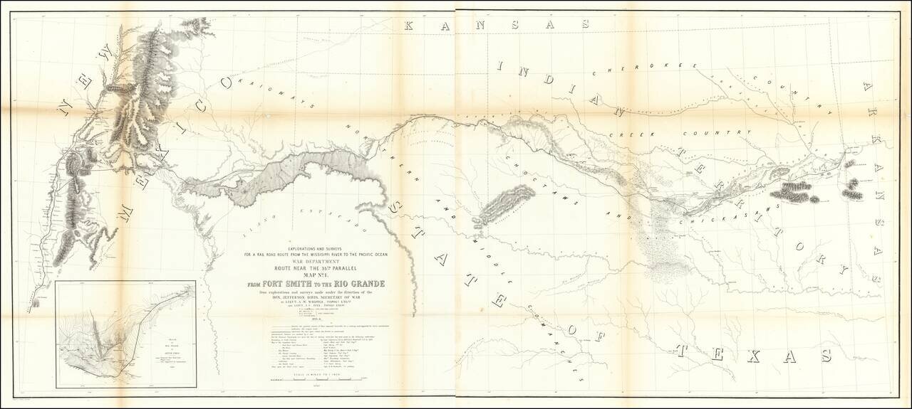
Important early map of the region between Fort Smith Arkansas and the Rio Grande River (Santa Fe, Taos, etc), prepared by the US Pacific Railroad Survey. The primary cartographic detail is in the Rio Grande Valley of New Mexico and along the Canadian...
Detailed map of Texas, published in McNally's School Geography. Dallas is shown on the map. Most of the western counties are still not formed.
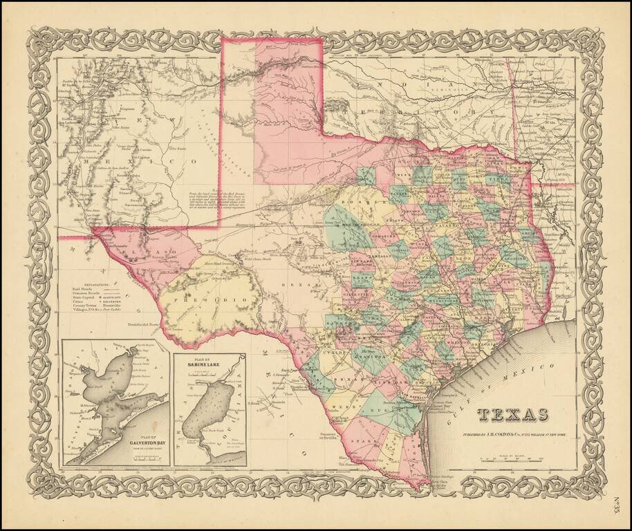
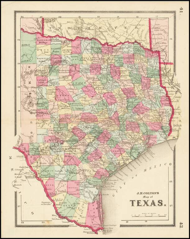
Early State of Colton's Atlas Map of Texas Fine early map of Texas, from Colton's General Atlas, the only edition to appear in a single page format. The map shows a very incomplete set of Western Texas Counties. The German Settlements in Gillespie...
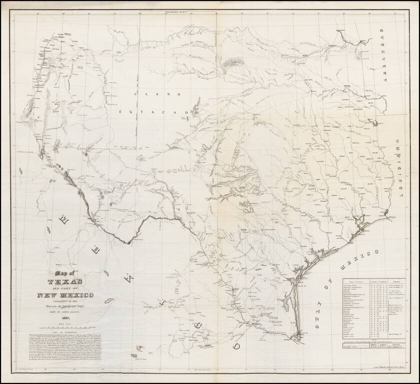
One of the Rarest Great Modern Maps of Texas First edition of this remarkable separately issued map of Texas and part of New Mexico, prepared by the United States Topographical Engineers in 1857 and issued in very small numbers, likely only for use...
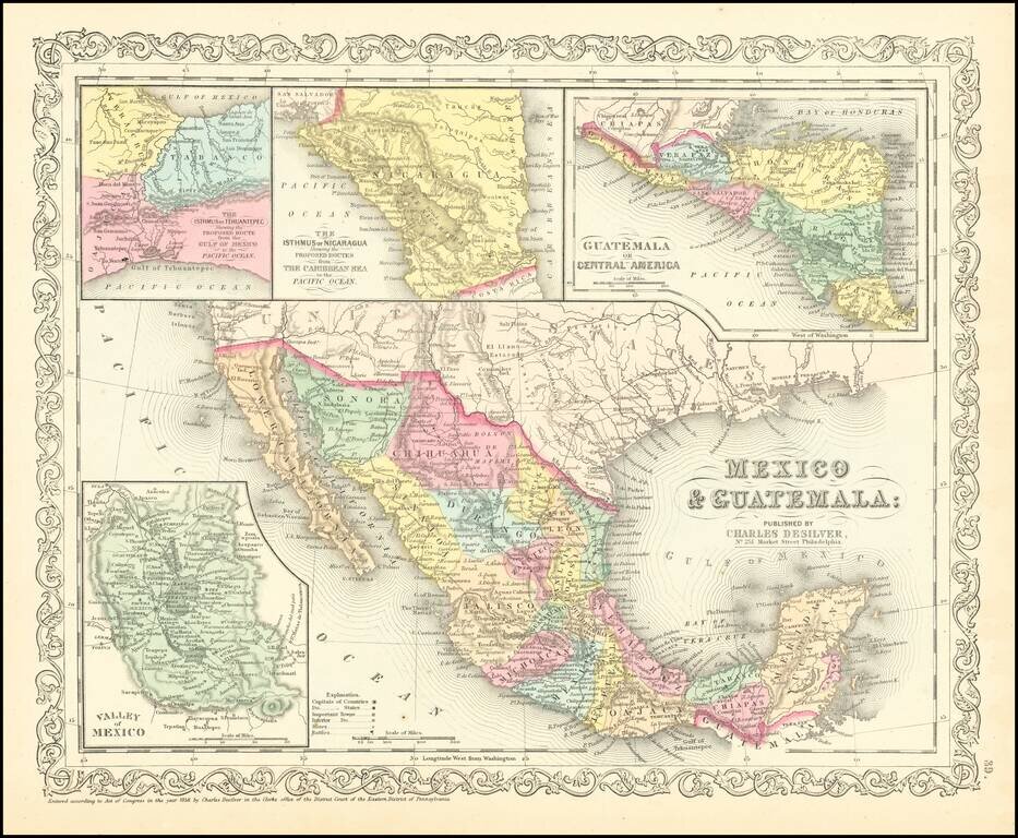
Scarce Charles Desilver map of Mexico and the Southwest. Many of the early place names in Texas still appear. Pre-Gadsden Purchase border with Mexico. Large insets of the Valley of Mexcio, Ithmus of Tehuantepeci, Isthmus of Nicaragua and Guatemala.
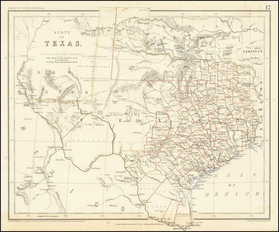
A Texas Rarity One of the rarest English Language maps of Texas to appear in a commercial Atlas. Rogers & Johnstons' map of Texas appeared in the extremely rare Atlas of the United States. The map was derived from the monumental and equally rare...
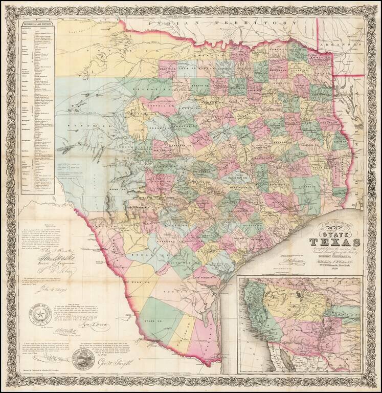
One of the rarest and most important of maps of Texas, and a foundation map for all future Texas cartography. Jacob de Cordova was a land developer in Texas following its annexation by the United States in 1845. De Cordova and Robert Creuzbaur,...
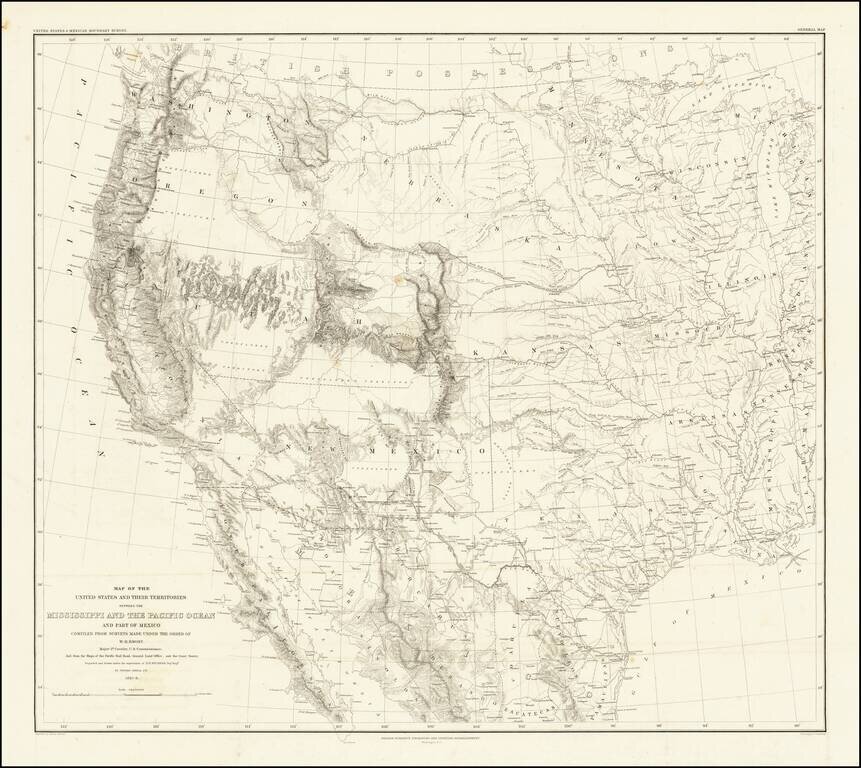
Emory's Map of the Transmississippi West. Marvelously detailed map of the Western Territorial US, published by W.H. Emory in his Report of the United States and Mexican Boundary Survey. The map is one of the fundamental post-Gadsden Purchase maps of...
![[Matagorda Bay: Pictorial Letter Sheet]](/map/small/40810.jpg)
Rare Letter Sheet View Drawn From Original Sketches By Helmuth Holtz Fine early Texas lettersheet, with 6 views of Matagorda, Texas. The views show six buildings, with eagle and flags at top of page. The buildings represented are: a church...
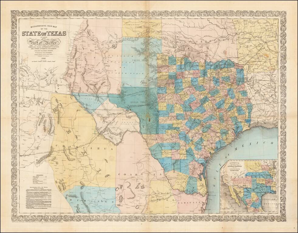
Fine large format map of Texas, published in 1860. Richardson's map was one of the best and most accurate maps of Texas on the eve of the Civil War. Hand Colored by counties, it is of particular not for its excellent depiction of the existing and...
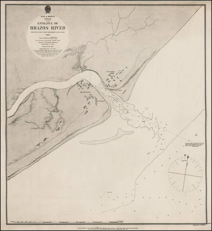
Extremely rare British Admiralty Sea Chart of the Mouth of the Brazos River, first surveyed by the US Coast Survey in 1858. The mouth of the river includes the towns of Velasco and Quintana, including an Observation Station and PIlots Range and...
Scarce map of Texas, published at the beginning of the American Civil War. We have dated the map based upon the configuration of Edwards County, which lasted until January 1862.
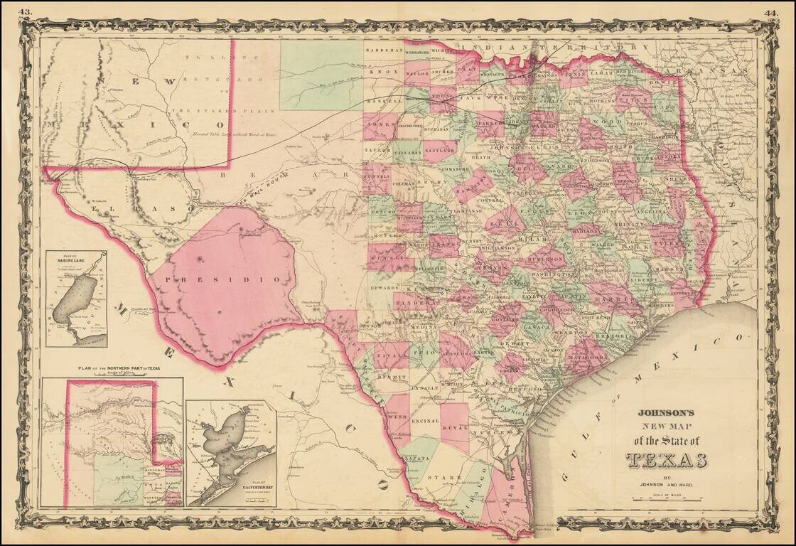
A striking large format map of Texas, colored by counties, with large insets of the northern panhandle, Galveston and Sabine Lake. The map reflects the relative expansion of the Counties of Texas, with more or less the current configurations in the...