
Rare old maps of the United States.
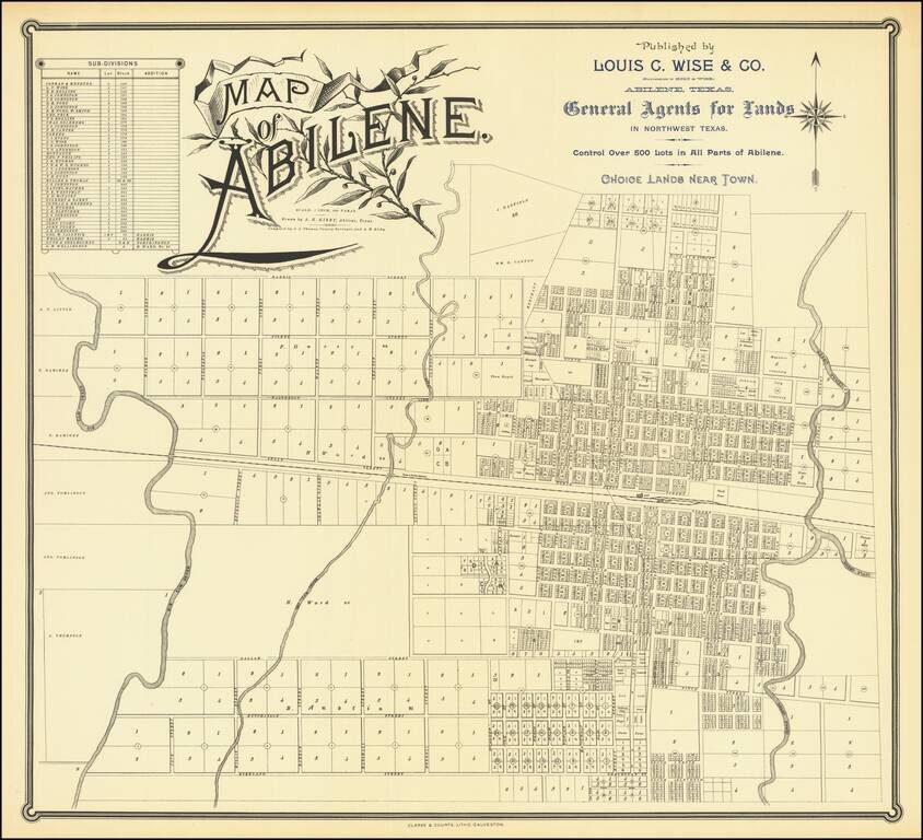
Rare Texas City Plan Flawless uncirculated example of this rare map of Abilene Texas, drawn by A.H. Kirby and compiled by J.A. Thomas, County Surveyor, quite likely the earliest printed map of the city. Printed by Clarke & Courts of Galveston,...
Some of the first Anglo groups to settle in the area were the families of John, Silas, and Ben Parker, all of whom helped build a fort near the site of present Groesbeck (Limestone County) in 1833. This fort was attacked on May 19, 1836, and all of the...
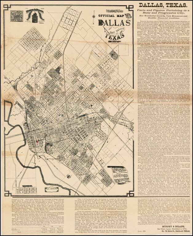
Extremely Rare - one of the earliest obtainable separately issued maps of Dallas, Texas, Murphy & Bolanz's highly detailed promotional broadside. This fascinating map is a promotional broadside, extolling the virtues of Dallas, Texas as "the...
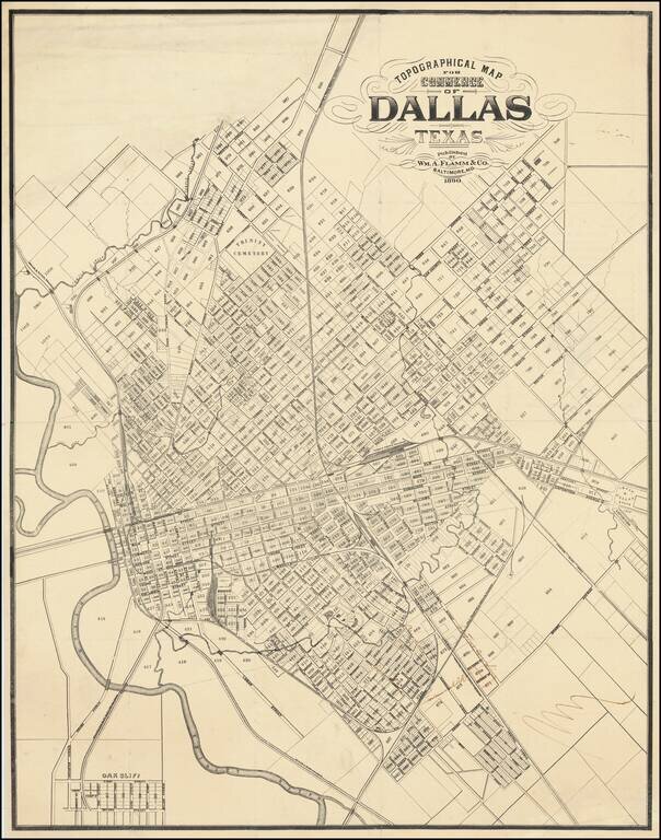
Important 19th-Century Map of Dallas. The Only Known Example. The only known example of this 1890 map of Dallas, Texas, by William Flamm & Co. of Baltimore, Maryland. Curiously, Flamm calls the map a "Topographical Map for Commerce" but there is...
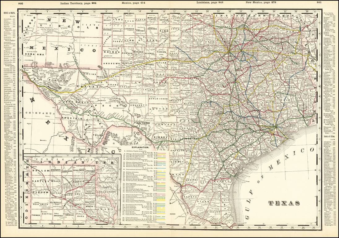
Detailed and interesting railroad map of Texas, which appeared in Cram's Standard American Railway Atlas. Includes the routes of approximately 40 different railroads (with each identified by name and color key), towns, counties, post offices, rivers,...
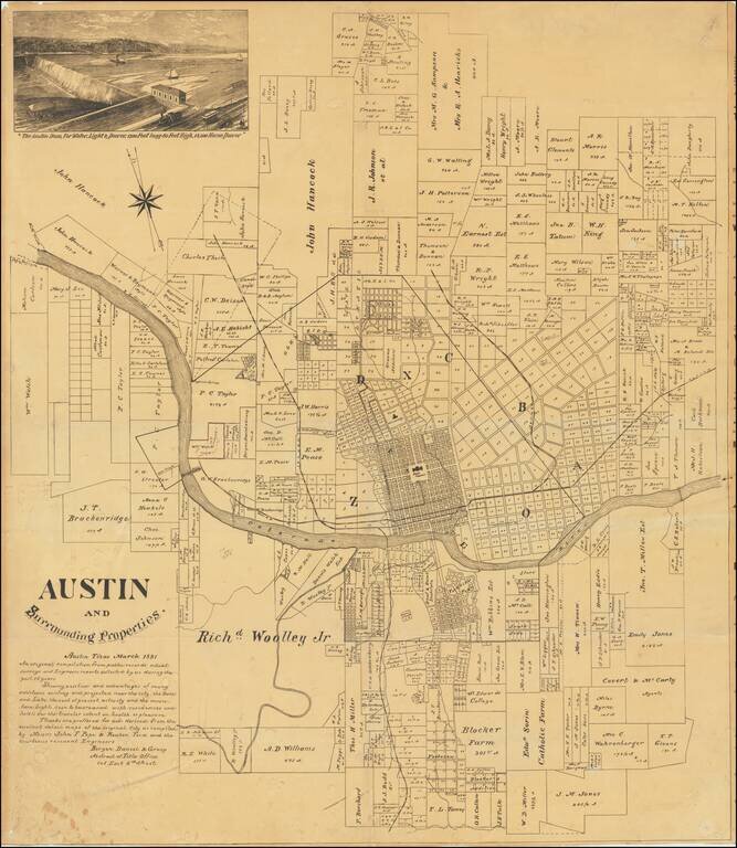
An Early Wall Map of Austin, Texas -- Includes Contemporary Developer's Annotations Rare promotional plat map of Austin, Texas, published by the Bergen, Daniel & Gracy Abstract Title Company. Fine cadastral map identifying dozens of land owners...
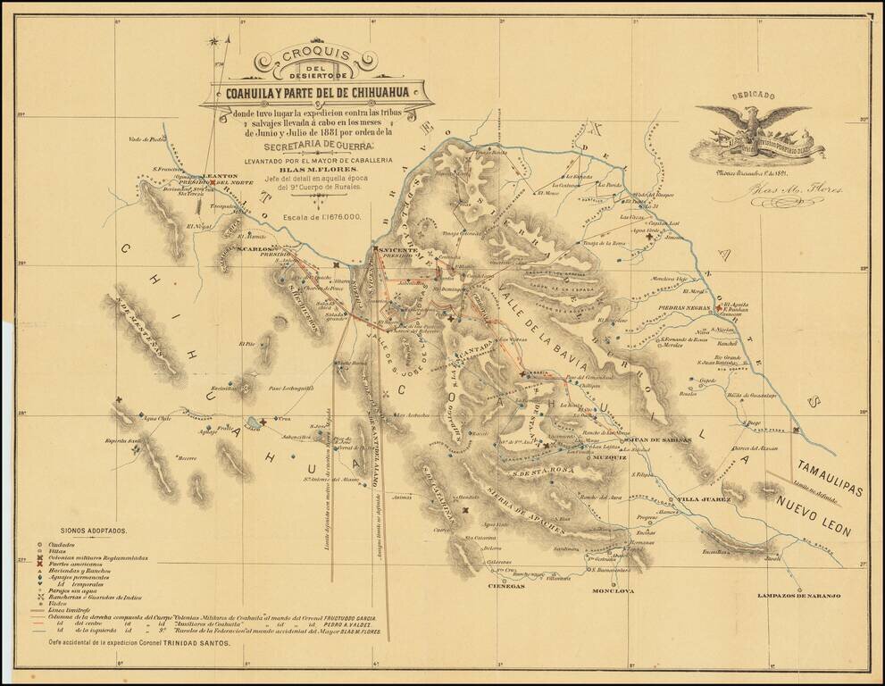
Extermination of the Lipan Indians in Northern Mexico Finely executed map of part of Coahuila and Chihuahua, illustrating the theater of war between the Mexican Cavalry and the Lipan Indians. At the direction of President Porfirio Diaz in 1881, the...
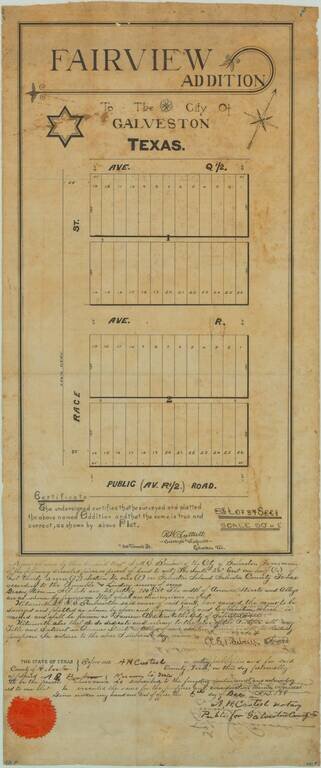
19th-century Manuscript Map of Part of Galveston Texas. Unique antique manuscript map of the "Fairview Addition" to Galveston, Texas, produced by one of Galveston's most important early surveyors, R.W. Luttrell. The map covers two blocks of plots,...
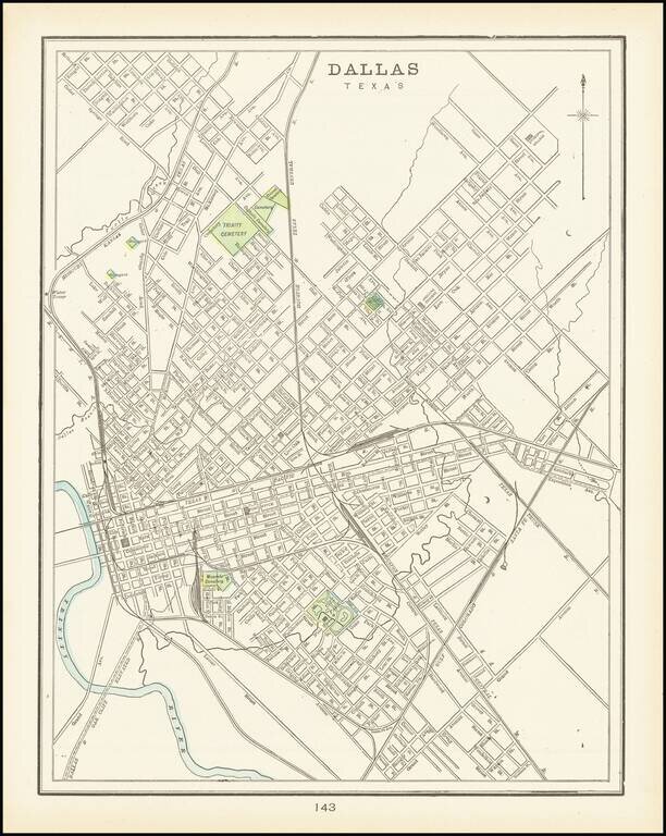
A detailed plan of the city of Dallas highlighting major parks and cemeteries and showing a portion of the Trinity river as well as local creeks. The first separate map of Dallas to appear in a Commercial Atlas and one of the few maps of Dallas...
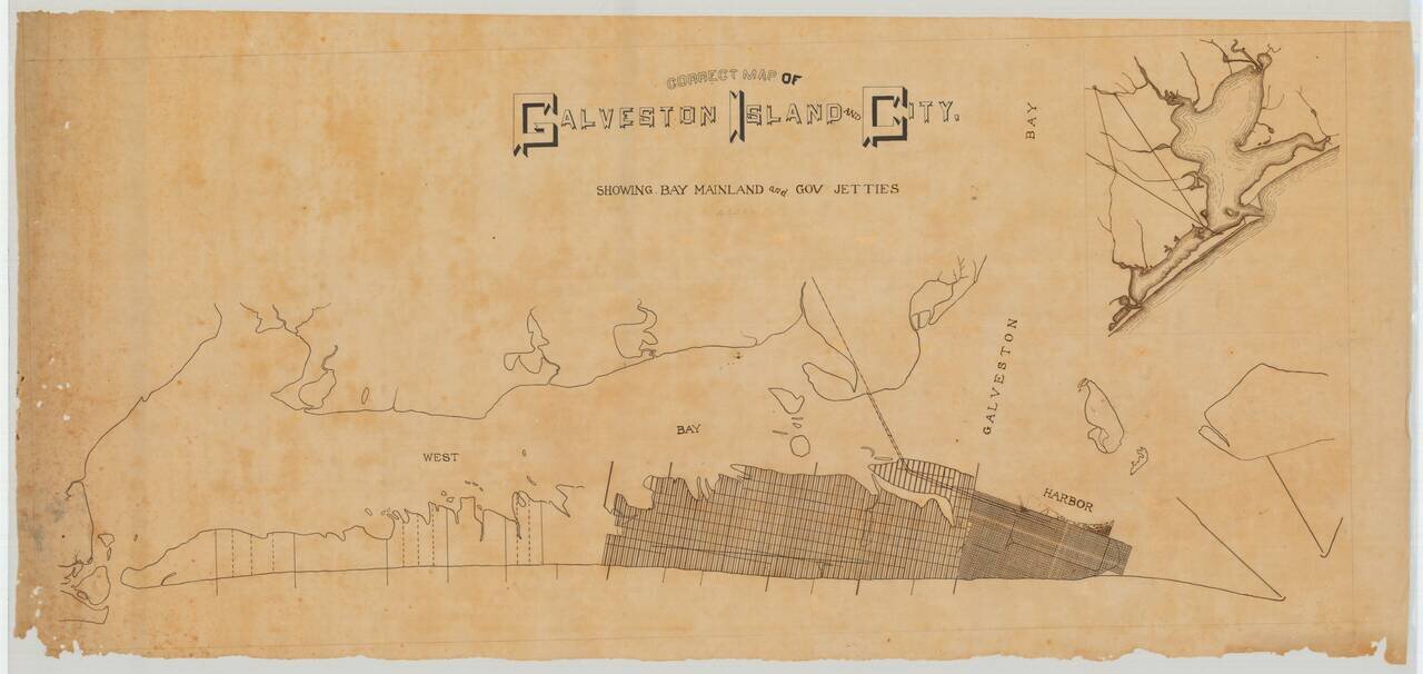
A Pre-Hurricane Manuscript Map of Galveston. Detailed manuscript map of Galveston Island and the city of Galveston, Texas. The map was prepared before the Galveston Hurricane of 1900, when the city was booming and plans for its expansion across the...
Manuscript 19th-century Galveston Survey Map. Unique manuscript map of an early addition to Galveston, Texas, produced by a Galveston-based surveyor circa 1895. The addition probably occurred (or was to occur) on the west side of the City of...
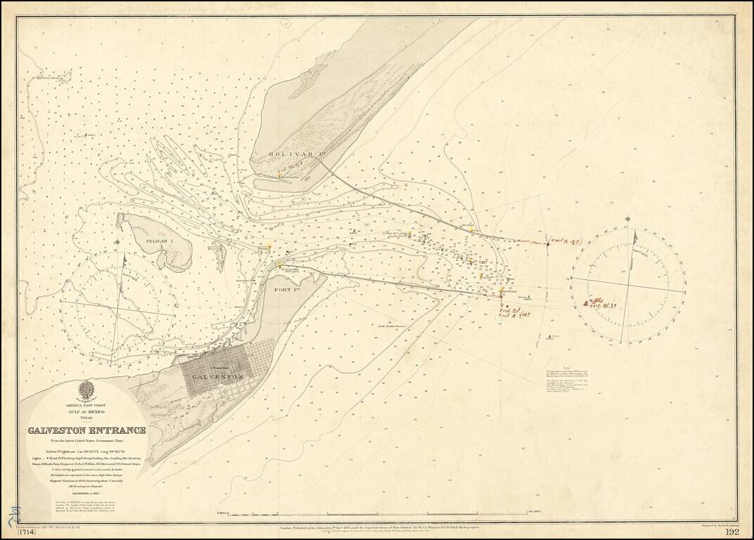
Galveston in the Year of The Great Hurricane (1900) Scarce separately published map of the area around Galveston, Texas, published by the British Admiralty. The coding at the bottom left of the map suggest this is the third revision in 1900, and...
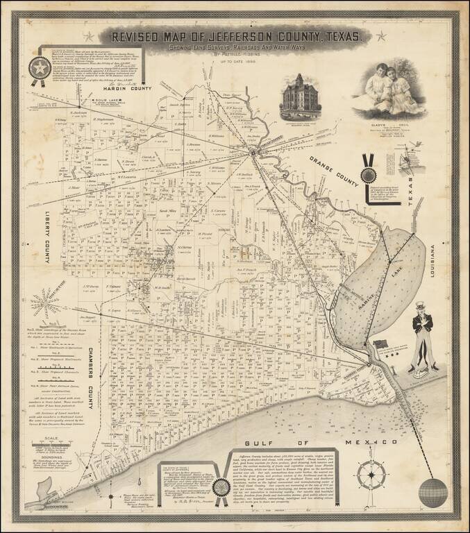
The Birth Certificate of the Texas Oil Industry. A rare promotional map published by the Father of Texas Oil, Pattillo Higgins, pre-dating the discovery of oil at Spindletop. Upon its discovery in 1901, the gusher at Spindletop became the most...
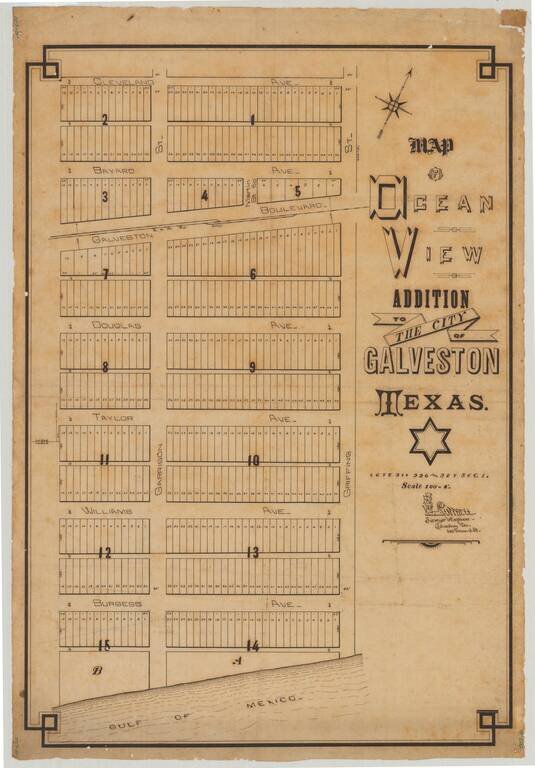
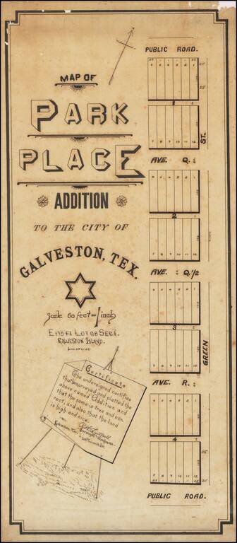
Attractive manuscript plan for an early subdivision in Galveston, Texas, drawn by Galveston-based surveyor R.W. Luttrell. The map shows a Gulf of Mexico-adjacent 15-block addition called the "Ocean View Addition". The addition is centered around the...
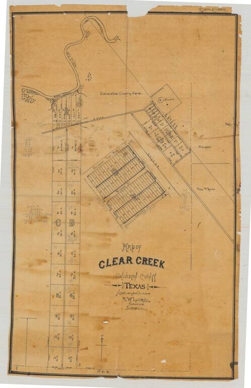
Original manuscript plat map of "Clear Creek", now League City, in Galveston County, Texas, drawn by Galveston-based surveyor R.W. Luttrell probably around 1900. The map shows a series of plots and roads just south of Clear Creek, which enters Clear...
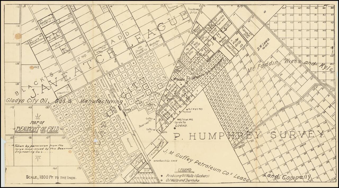
One of the first printed maps of the first major Texas oilfield centered on the Spindletop "Lucas" Gusher. The map is reflective of the frenzy of commercial and oil-drilling activity that took place around the Lucas Gusher in 1901, especially in the...