
Rare old maps of the United States.
![Carte Des Etats-Unis Du Mexique…1838 [Republic of Texas]](/map/small/70909.jpg)
Fine example of Alexandre Emile Lapie's map of the Republic of Texas, New Mexico, Upper California and Mexico. One of the best large format maps of Mexico, Texas and Upper California to appear in a commercial atlas in the 1830s. Texas is clearly...
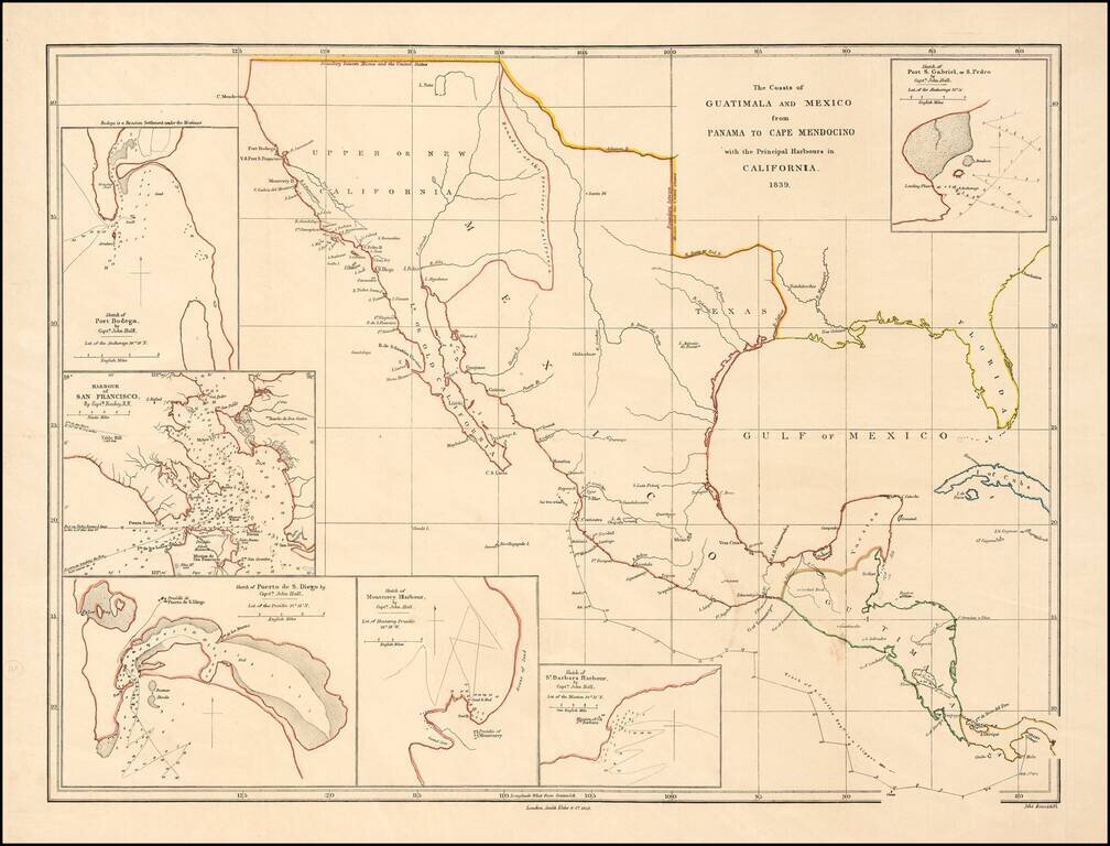
Rare early map of Mexico and Upper California, focusing on the harbors along the California Coast. Includes some of the earliest harbor plans for: Santa Barbara San Gabriel or San Pedro San Diego San Francisco Monterrey Bodega Bay Rumsey...
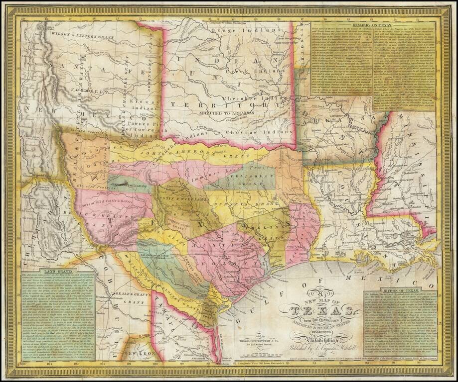
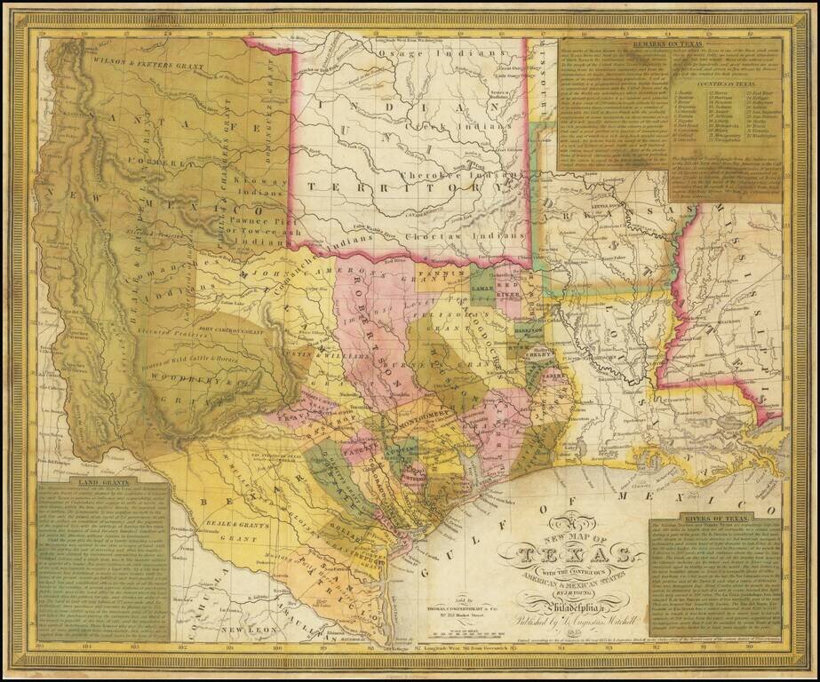
An Important Early Map of The Republic of Texas. Young & Mitchell's A New Map of Texas is one of the great monuments of Texan cartography. This is an essential piece for any serious collection of Texana. This is Streeter's 4th state (of 8, 1178D)...
![[Republic of Texas] Texas Compiled from the latest and best Authorities.](/map/small/61225.jpg)
The Republic of Texas in 1842 Early map of the Republic of Texas, published by Jeremiah Greenleaf. Greenleaf's map follows the cartographic details David Burr's map of 1833, distinguished as the first large-scale map of Texas to show all of what...
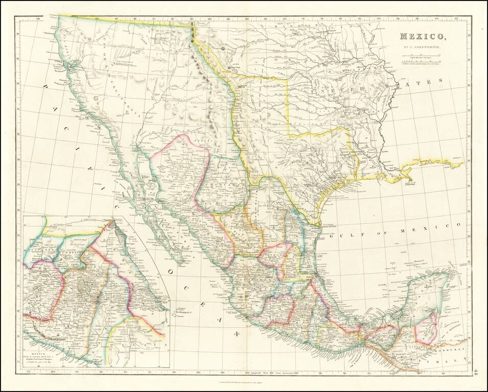
Mexico & The Republic of Texas Striking example of Arrowsmith's Map of Mexico, from the London Atlas, including the Republic of Texas in its largest configuration. The map provides a fantastic example of the Republic of Texas in earliest Republic...
![Mexique par Th. Duvotenay…1843 [Republic of Texas]](/map/small/67925.jpg)
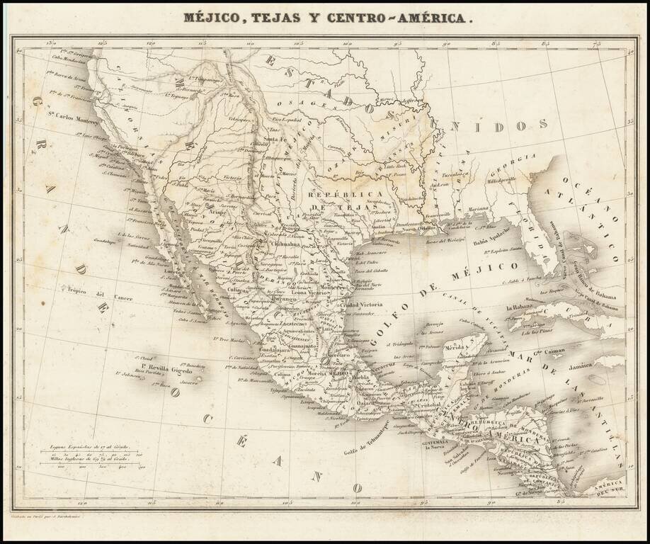
Detailed map of Texas, Upper California, the Plains and Mexico, published in Paris. The map prominently shows the Republic of Texas, a mythological Lake Teguayo and pre-Fremont Western United States. Western border of Texas includes an odd eastern...
A Separate Map of the Republic of Texas Scarce map of the Republic of Texas, extending west to the Presidio Rio Grande and the Rio Colorado and its tributaries. Shows early land grants and counties, towns, roads, forts, rivers and other details....
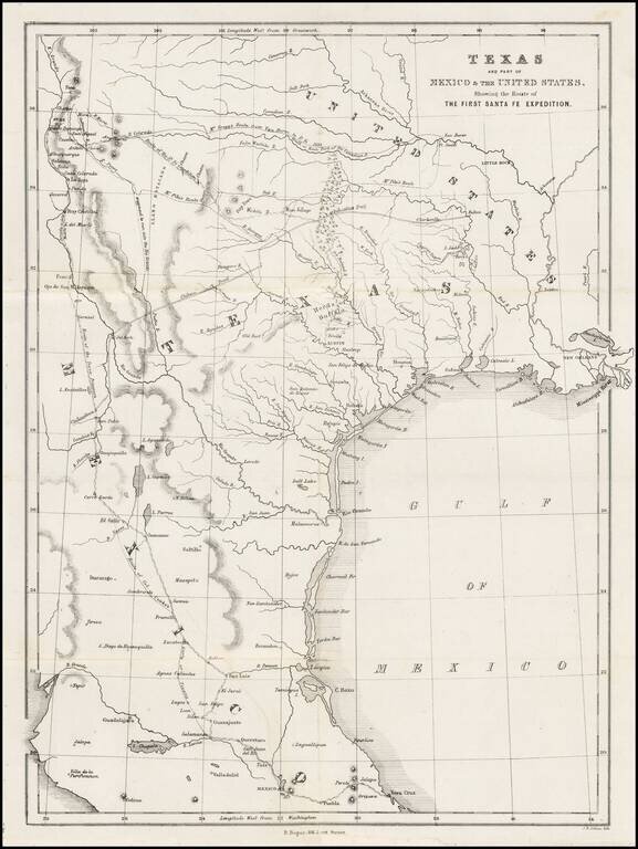
Map of the Republic of Texas, which appeared in Kendall's Narrative Of The Texan Santa Fe Expedition .... This map shows efforts of the Republic of Texas, under President Mirabeau Lamar, seeking to take control over Santa Fe and develop trade links...
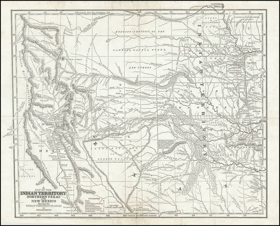
Josiah Gregg's Landmark Map of the Southwest & Northern Texas Fine example of Josiah Gregg's monumental map of Northern Texas & the Plains, from his monumental Commerce Of The Prairies, one of the classic accounts of the Transmississippi West...
Rare map showing the Republic of Texas (República de Tejas), one of only a few maps to specifically refer to Texas as "Republic of Texas," during the period between 1836 and 1845. The map was originally published in Sanchez de Bustamante's Nuevo...
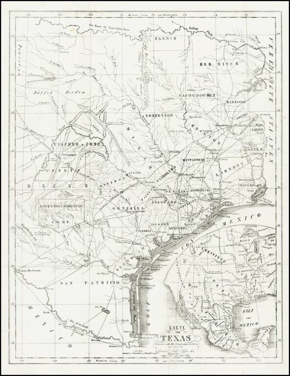
Rare and important early German immigration map of Texas prepared in connection with the Solms-Braunfels promotion of German colonies in Texas, based upon the larger Hunt & Randel map of 1839. The map provides a detailed look at Texas during its...
![[Republic of Texas] Map of Texas From the most recent authorities . . .](/map/small/32223.jpg)
Nice example of Henry Schenk Tanner's map of the Republic of Texas, issued in Tanner's Universal Atlas. The present example is the rare first state of Tanner's 1845 map of the Republic, pre-dating, the addition of a number of Texas Counties formed in...
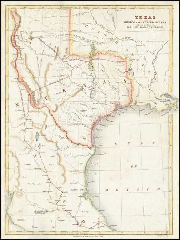
A Milestone Work, Which Re-Invigorated Interest In Settlement in the Republic of Texas Detailed map of Texas, eastern New Mexico and part of Mexico, illustrating the region covered by the Santa Fe Expedition. Based upon the maps of Zebulon Pike and...
![Mexico, Mittel-America, Texas [Republic of Texas]](/map/small/64181.jpg)
Nice example of Carl Flemming's detailed map of Texas and the Southwest, published shortly after Texas was annexed by the United States in 1845. The map was issued immediately after the annexation of Texas and prior to the creation of Utah and New...
The Final Edition of the Mitchell-Young Map of Texas. One of Only Two or Three Known Examples. Hand-colored engraved antique map of Texas as a republic, by S. Augustus Mitchell and J.H. Young. This is the last edition of the map, from 1845, and this...
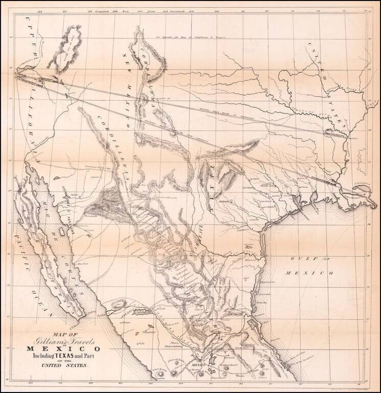
Transcontinental Railroad Routes To San Francisco in 1846! Scarce map of Texas, Upper California, Mexico and the Southwestern United States, prepared for Gilliam's Travels over the Table Lands and Cordilleras of Mexico during the Years 1843 and 44....