
Rare old maps of the United States.
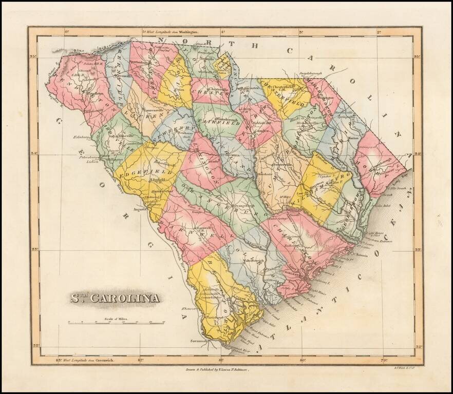
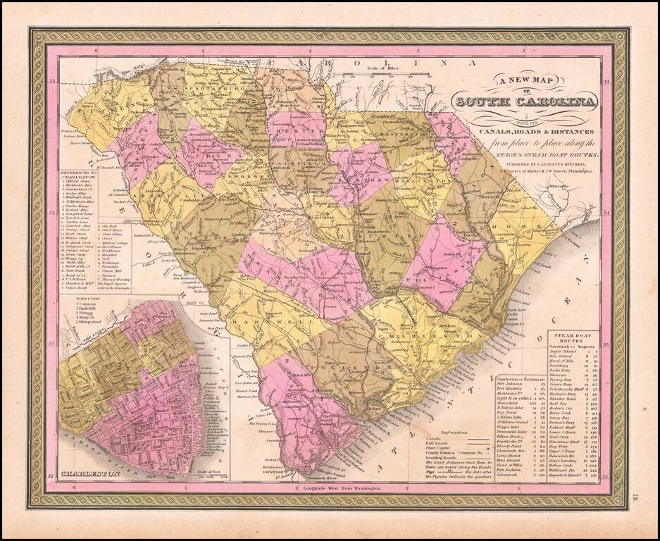
Striking example of Fielding Lucas' finely executed map of South Carolina. Lucas's maps were typcally printed on a higher quality paper than contemporary maps by Carey & Lea and demonstrate a superior engraving quality and more attractive coloring...
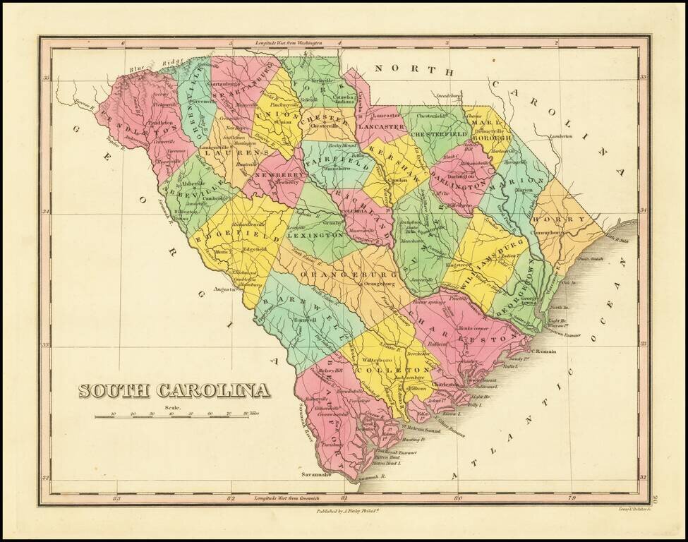
First edition of Anthony Finley's map of South Carolina from Finley's atlas. The map is hand colored by counties and shows towns, roads, rivers, mountains and other geographical features. Early county configurations.
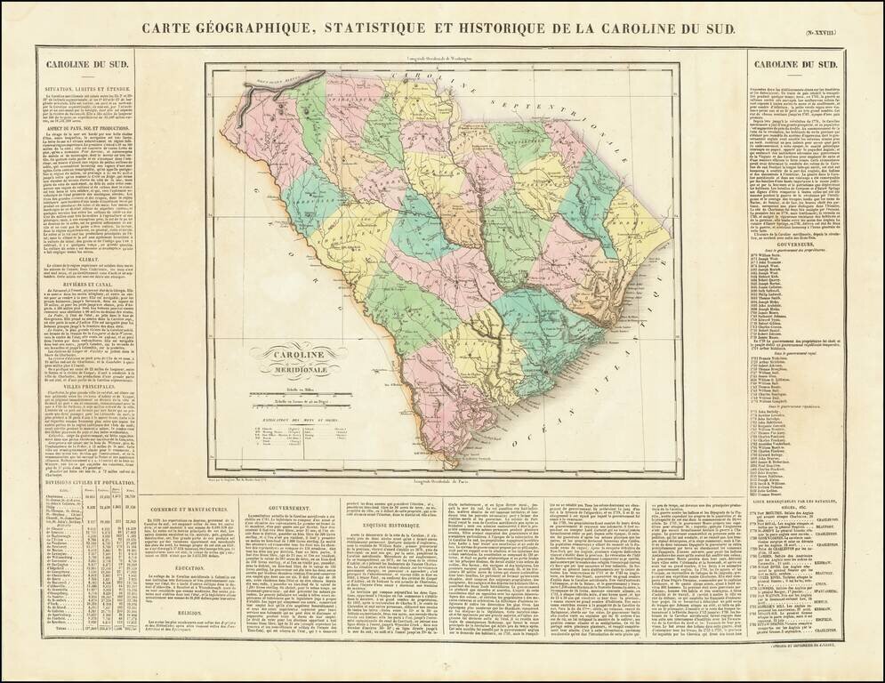
The First Map of the State of South Carolina published in France. The map is hand colored by counties and shows the various towns, roads, rivers, bridges, and a host of other details. Surrounded by text describing the state, its population,...
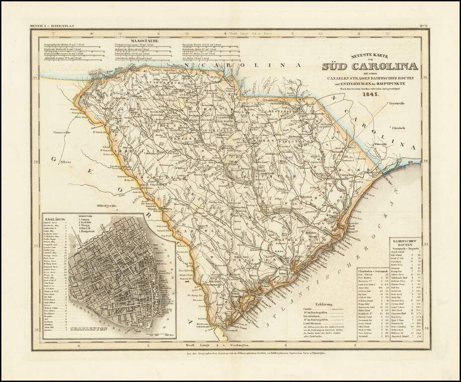
An antique map of South Carolina with German-language description based upon H. S. Tanner's map. The map purports to show the routes, railroads, and distances in the state, though it also locates various other features including rivers, canals, and...
A fine map of South Carolina from the Antebellum Era. This interesting map depicts all of South Carolina, as it appeared in 1846, during an era of rising political tensions, which would eventually lead to the U.S. Civil War (1861-5). However, it was...
![Colton's South Carolina [Charleston Inset]](/map/small/69996.jpg)
Antique map of South Carolina from one of the most prolific American mapmakers of the 19th century. The map shows the routes, railroads, and settlements in the state, though it also locates various other features including rivers, canals, and even...
![Americque Septentrionale Par le Sr. Sanson d'Abbeville Geographe du Roy . . . 1705 [Rare Peninsular California edition, with unusual Mississippi River depiction]](/map/small/61024.jpg)
Antique Map of North America -- California as an Island Old color example of Sanson's revised map of North America. In 1705, Pierre Moullart Sanson radically revised this map of North America, modifying perhaps the three most significant features of...
![Nuovo Messico appartiene alla Spagna [with] A. Luisiana Inglese B. Luisiana Francese](/map/small/7075.jpg)
Extremely rare pair of miniature maps on one sheet, from a miniature Italian Atlas. The first example we have ever seen. The upper map extends from Baja California and the Pacific to Texas, centered on the Rio Grande. Full of very curious place names....
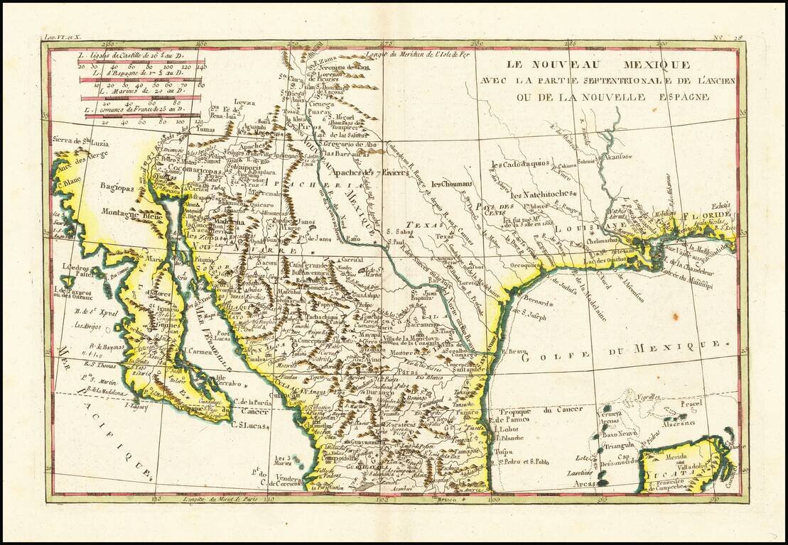
Fascinating map, showing excellent detail in Texas, Arizona and New Mexico. Includes a badly misprojected Baja California, as was normally the case with French maps of the period. Missions and settlements shown in the Texas interior. Indian tribes...
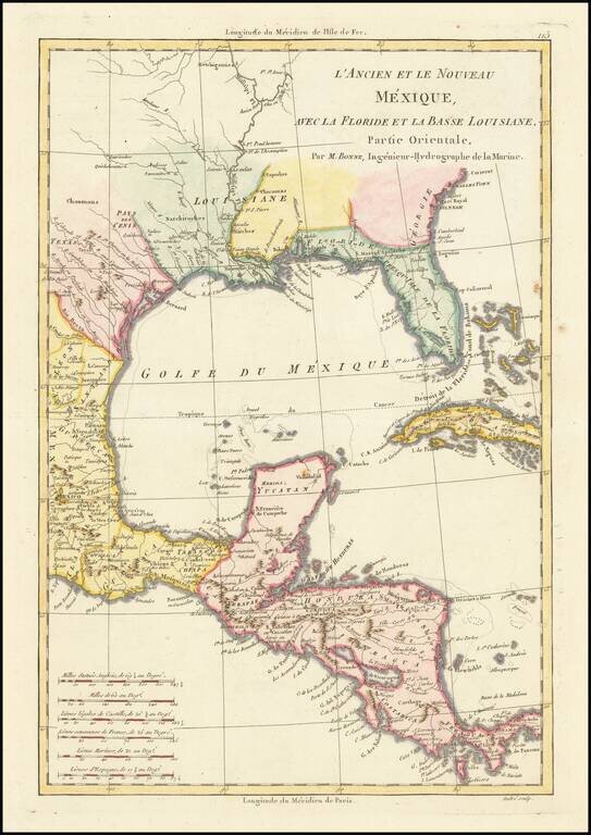
Excellent colonial era map of the Gulf Coast, Florida, Texas and Central America, with the Western part of the Caribbean. Nice detail in Florida and Texas. Attractive wash colors. From Bonne's Atlas Supplement, published in Paris in 1787.
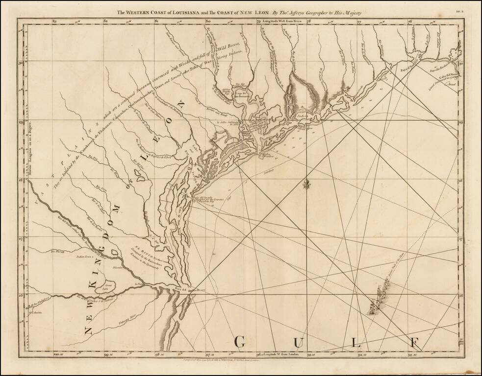
The First Map of the Texas Coastline Second state of this highly sought after map of Texas, which includes the Robert Sayer imprint. This is the first map to focus on the Texas coastline. and the only 18th century map of the Texas coast. An...
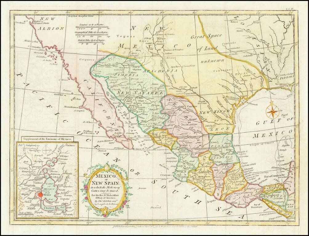
Nice example of the map of Texas, the Southwest, Upper California and Mexico, from Doctor Robertson's History of America. Extends from the Harbor of Sir Francis Drake (San Francisco) and the Farallones to New Orleans in the North and to Guatimala,...
![[California & The Southwest] La Parte Occidentale Dell'Antico, E Nuovo Messico Con Florida E La Bassa Luigiana…. 1798](/map/small/18560.jpg)
Striking full color example of Cassini's map of California, Arizona, New Mexico, part of Texas, Baja California and Mexico. This is perhaps the only 18th Century map of the region to feature a decorative cartouche and vignette. The Rio Grande extends...
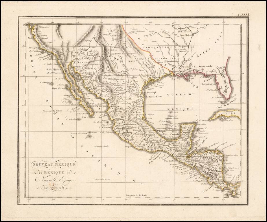
The West at the Time of the Louisiana Purchase Detailed map of Mexico and the American West, published in Paris. The map shows the limits of the United States at the Mississippi River, with Louisiana shown to the west, albeit somewhat vaguely. The...
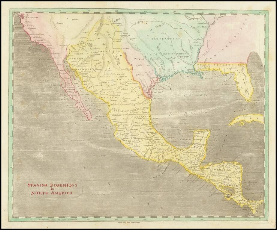
A Fascinating Pre-Louisiana Purchase Map of Texas and the Southwest Scarce early map of Mexico, Upper California, Texas and Louisiana Territory. The map extends on the west coast from San Francisco to Cabo San Lucas, with a detailed account of the...
![[Matagorda Bay] Bahia De S. Bernardo](/map/small/54374.jpg)
Fine example of the first separately printed sea chart of Matagorda Bay, published in the Portulano de la America Septentrional, under the auspices of the Direccion De Hidrografia in Madrid. As noted by Streeter this map of Bahia de S. Bernardo is:...