Map size in jpg-format: 24.6432MiB
Click to open in high resolution (open in new tab).
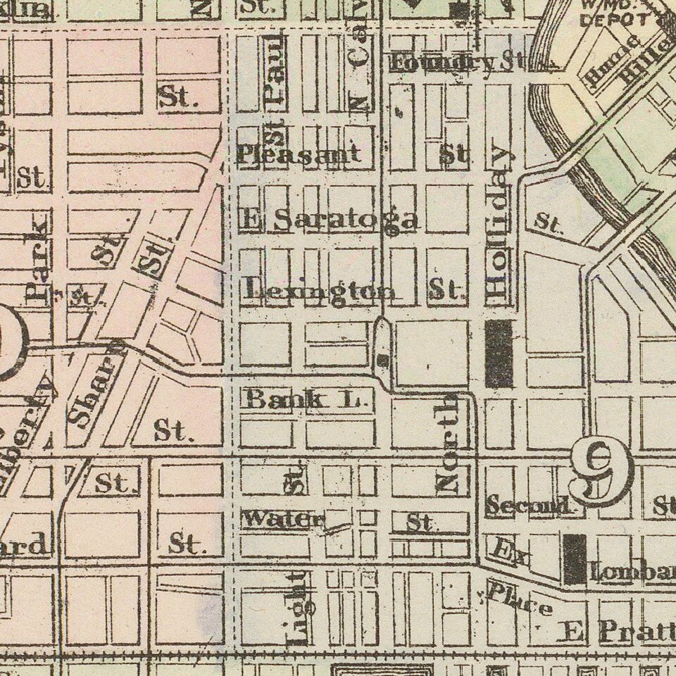
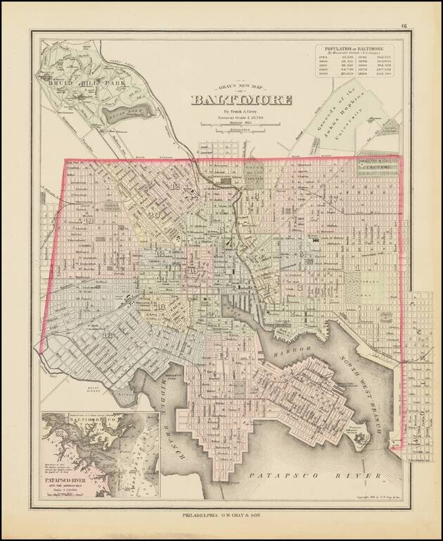
Detailed map of Baltimore, colored by wards and showing streets, rail lines, parks, buildings, stations, and a host of other details.
Large inset of the Patapsco River and approaches. Includes a population table, showing the various census populations dating back to 1790 and the current census by wards.
Druid Hill Park is shown in the upper-left of the map.
O. W. Gray was a publishing firm based in Philadelphia. Later, they published as O. W. Gray & Son. They published atlases in the late nineteenth century. Gray's National Atlas was one of the most successful commercial ventures of the 1870s and one of the last to employ hand coloring on maps.
If you are a student, write to us in telegram: @antiquemaps and indicate what material you need and for what work you need a map in high detail. We are ready to provide material on special terms. For students only!