Map size in jpg-format: 6.20016MiB
Click to open in high resolution (open in new tab).
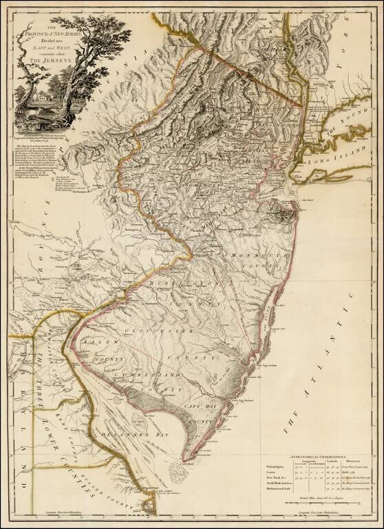
Rare second state of Faden's map of New Jersey, based upon Bernard Ratzer's surveys in 1769, as significantly revised and improved by Faden in December 1778.
This rare second state of the map, issued 12 months after the first edition, is based upon information provided to Faden during the course of the 12 months after the publication of the first edition of the map. Below the title cartouche, Faden notes:
In This Second Edition Great Use Has Been Made of Several Military Surveys Generously Communicated By Officers of the British Troops and of the Regiments of Hesse and Anspach.A close study of the two maps reveals the accuracy of this annotation, with the addition of dozens of towns, roads and new topographical features, along with the location of several key battles.
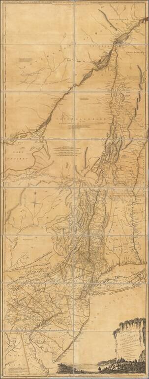
William Faden's map of New Jersey is based upon Ratzer surveys in 1769, which were conducted to resolve a 100 year long boundary dispute between New York and New Jersey. Faden's map was the first to show New Jersey's northern border with New York, and also depicts the area as known to George Washington immediately prior to the battle of Monmouth and a fortified Valley Forge. The most important map of the area from the Revolutionary period, it was also the largest map of New Jersey that had ever been produced.
The map was the largest format and most detailed representation of the New Jersey colony made up to that time, taking in the entire breadth of the future State of New Jersey, as well as the Hudson Valley, most of Long Island, eastern Pennsylvania and all of Delaware Bay. It exhibits the state's rich topography, including the Jersey Highlands and the Palisades in the north and the broad Pine Barrens and coastal marshes in the south. The county divisions, major roads and towns are all carefully depicted, indicating that New Jersey was heavily populated, having over 120,000 inhabitants.
For this map, Faden has supplemented Ratzer's work with surveys of the northern part of the state made by Gerard Bancker. Bancker's surveys reached Faden via John Murray, the Earl of Dunmore and former governor of Virginia, who was given a draft by Bancker when he stopped in New York on his way back to London.
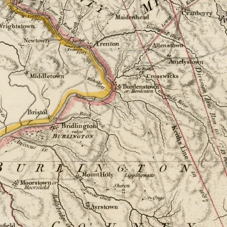
The two lines bisecting the state are the boundary lines between the archaic colonies of East and West Jersey. In 1664, Charles II granted the New Jersey charter jointly to Lord Berkeley and Sir George Carteret. Berkeley sold his share to John Fenwick, who in turn, passed it on to a consortium that included William Penn. The king elected to renew only Carteret's charter to the colony, and from 1676 the province was split into two colonies. One of the lines present on this map is "Keith's Line" referring to the 1687 demarcation of the boundary by surveyor George Keith. While the two colonies were reunited under a royal governor in 1702, certain private land ownership questions predicated on the partition necessitated that an internal line of division persist, which was re-demarcated as the "Lawrence Line" in 1743.
Following the death of his partner Thomas Jefferys, William Faden assumed sole control of England's leading commercial map making establishment, with a reputation for the finest quality engraved maps and atlases. Faden's fine engravings, in fact, made him one of the greatest cartographers of the 18th century. Faden's talent for mapmaking was such that he was named official geographer to the king in 1775, two years before he produced this map, a landmark in the cartography of New Jersey.
The Province of New Jersey was included in Faden's North American Atlas, a large folio work that is the most rare and important cartographic record of the early years of the American Revolution. All of the maps contained in the atlas possessed a wealth of topographical detail based on information obtained by first-hand observation, a factor that makes them historical documents of great importance. Faden's map was much consulted during the Revolution, and represents the best state of knowledge regarding New Jersey in the 18th century.
A seminal Colonial American map, updated to incorporate information from Revolutionary War surveys.
If you are a student, write to us in telegram: @antiquemaps and indicate what material you need and for what work you need a map in high detail. We are ready to provide material on special terms. For students only!
![(American Revolution) [Manuscript Map of New York City and Northern New Jersey]](/map/small/69609.jpg)