Map size in jpg-format: 9490240B
Click to open in high resolution (open in new tab).
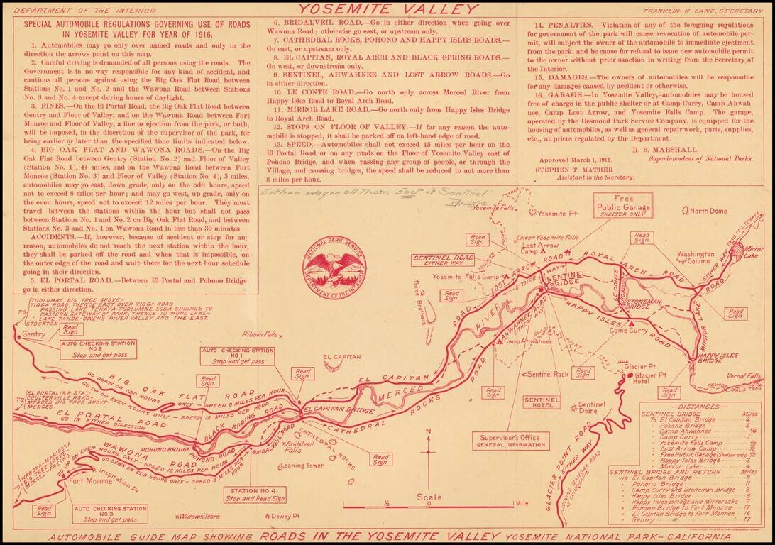
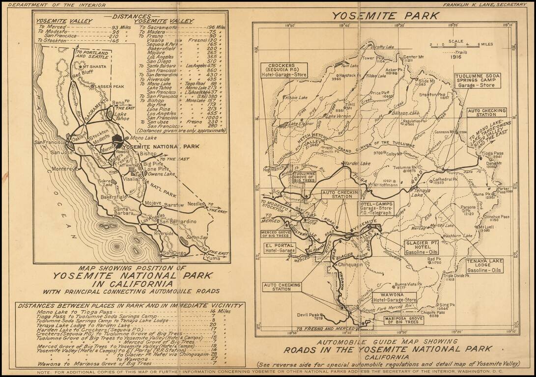
Rare early Automobile Guide map of Yosemite, printed (in red) by the Department of the Interior.
Includes "Special Automobile Regulations Governing Use of Roads in Yosemite Valley For Year of 1916." Includes a list of distances and major landmarks.
On the verso are two maps, A map of California and wider map of Yosemite Park.
The map is rare--this is the first example we have ever seen.
If you are a student, write to us in telegram: @antiquemaps and indicate what material you need and for what work you need a map in high detail. We are ready to provide material on special terms. For students only!
![[Photo Album: Urban Military Academy -- Yosemite Summer Camp -- Hollywood Boys School -- Black Face Images]](/map/small/68607.jpg)
![California and Nevada [Yosemite, Sacremento and SF Vicinity Insets]](/map/small/63484.jpg)