Map size in jpg-format: 5.13626MiB
Click to open in high resolution (open in new tab).
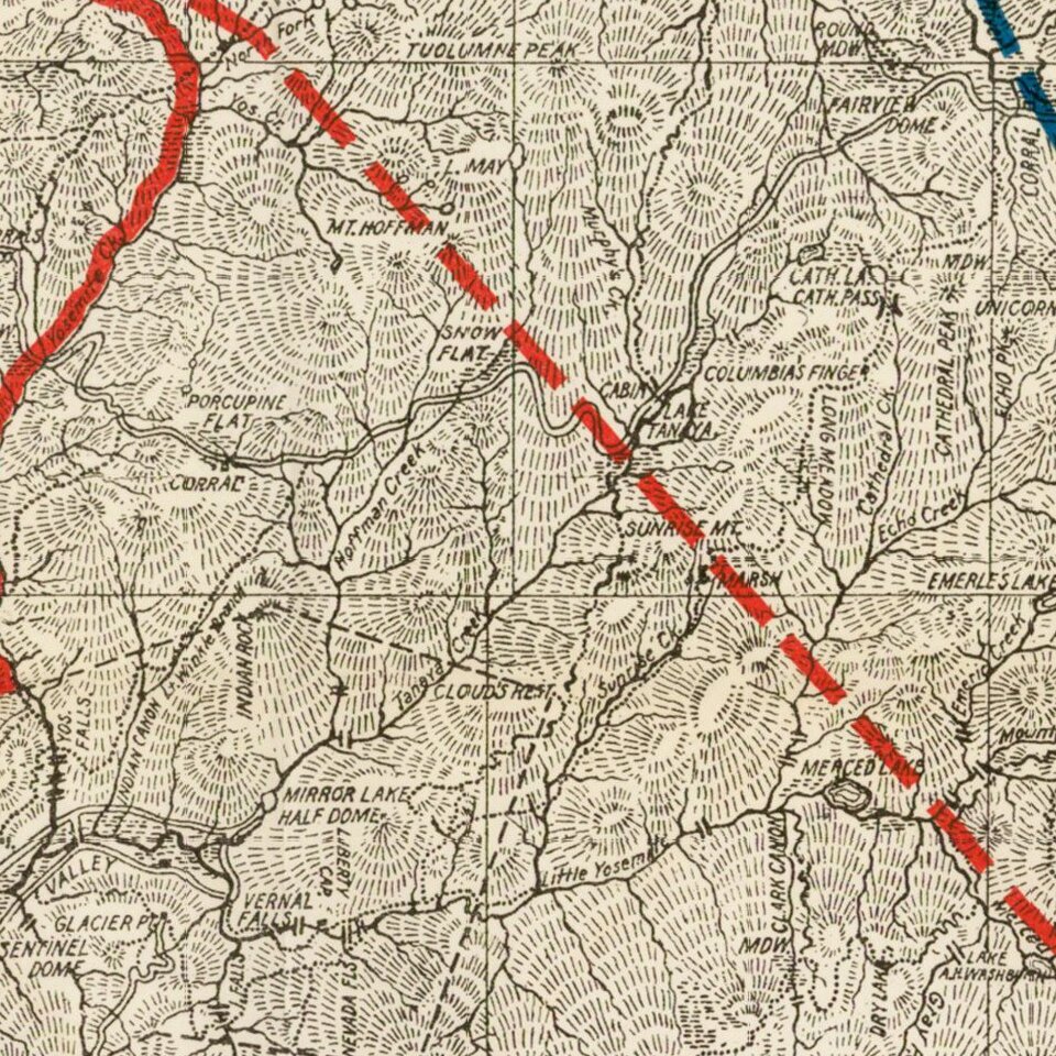
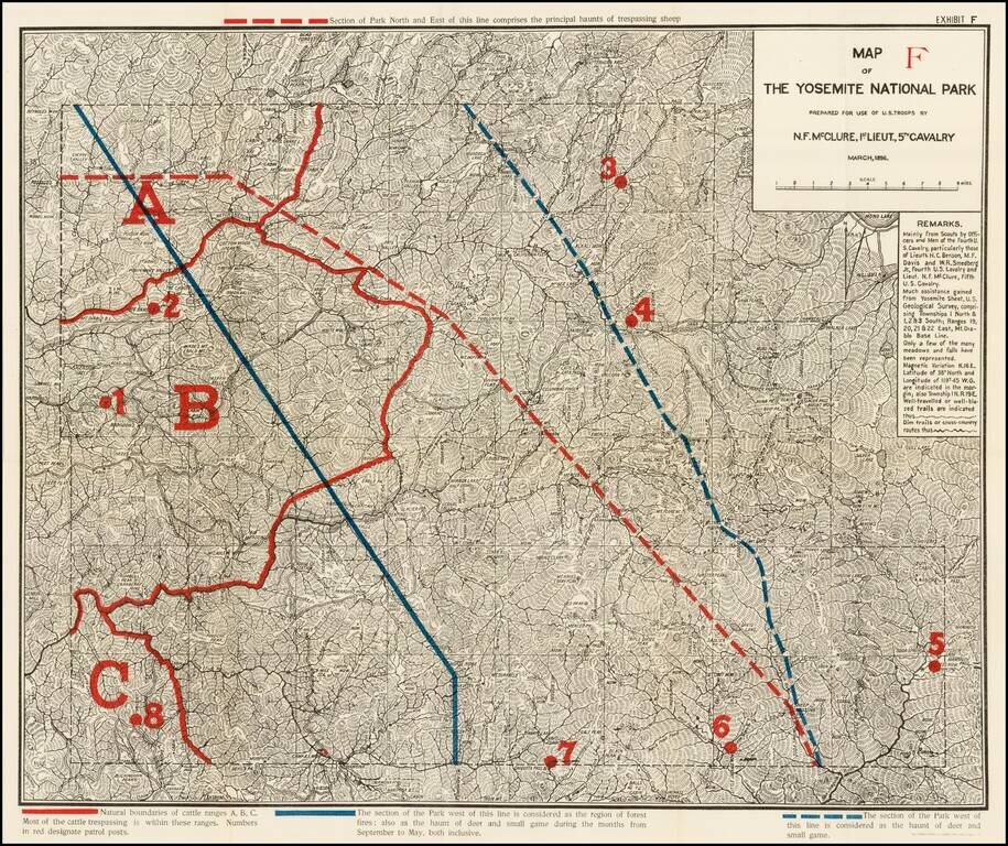
Highly detailed map of Yosemite National Park, prepared by N.F. McClure, during the period when the Park was controlled by the U.S. Army.
Includes outlines in Red and Blue, showiing natural boundaries of cattle ranges, section of the park susceptible to forest fires, and delineating location of certain animals.
McClure's map was made shortly after the establishment of Yosemite as a protected park in 1890. During this period, the Army's Fifth Cavalry Regiment controlled the park, and the map was made for their use. The map shows wagon roads, army patrol posts, direction and extent of patrols, routes used by pack trains supplying the posts, and cattle- and sheep-grazing areas.
McClure's map includes a number of early details, many of which reflect the Park in its earliest days. For example, the map notes the route identified by Charles Leidig, who stated that his parents, Fred and Isabel, came to Yosemite Valley in 1866 over a horse trail via Jenkins Hill down into the Merced River canyon. They then followed up the canyon to the valley, suggesting this is one of the earliest historic routes into Yosemite Valley. McClure's map shows a trail running along the north side of the Merced River to a point just below the Coulterville Road junction at The Cascades. The trail appears to originate from Hazel Green, allowing access from areas west of the present park. One branch comes south through Anderson's Flat to Jenkins "Mill," while the other comes south from Hazel Green through Big Grizzly Flat and the Cranberry Mine area.
The Pohono Trail route also appears in McClure's map, but its original builder and date of construction are uncertain. Originally an Indian trail, it led from Yosemite Valley up past Old Inspiration Point.
If you are a student, write to us in telegram: @antiquemaps and indicate what material you need and for what work you need a map in high detail. We are ready to provide material on special terms. For students only!
![[Photo Album: Urban Military Academy -- Yosemite Summer Camp -- Hollywood Boys School -- Black Face Images]](/map/small/68607.jpg)
![California and Nevada [Yosemite, Sacremento and SF Vicinity Insets]](/map/small/63484.jpg)