Map size in jpg-format: 72.7993MiB
Click to open in high resolution (open in new tab).

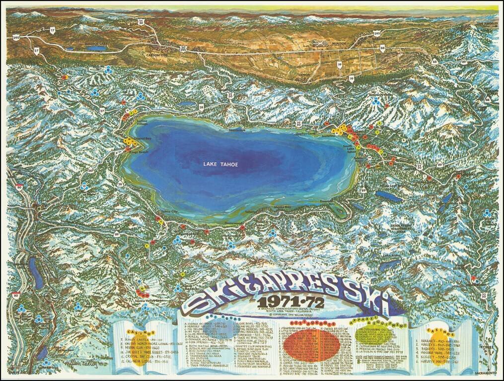
Attractive vintage pictorial bird's-eye view map, depicting Lake Tahoe as viewed from west to east.
Truckee is shown at the far left; Kings Beach, Crystal Bay, Incline Village, Zephyr Cove, Stateline, South Lake Tahoe, Tahoe keys, Emerald Bay, Meeks Bay, Tahoma, Homewood, and Tahoe City are all labeled ringing the lake proper. In Nevada, as the top of the view, Carson City, Virginia City, Minden, Genoa, and Gardnerville are all shown.
At the bottom of the map is a color-coded key listing casinos (12, in yellow), ski areas (A-O and a-r, in blue), restaurants (36, in red), and apparel and equipment stores (10, in green).
An attractive and rare promotional map published in South Lake Tahoe in 1971.
If you are a student, write to us in telegram: @antiquemaps and indicate what material you need and for what work you need a map in high detail. We are ready to provide material on special terms. For students only!