Map size in jpg-format: 37.105MiB
Click to open in high resolution (open in new tab).
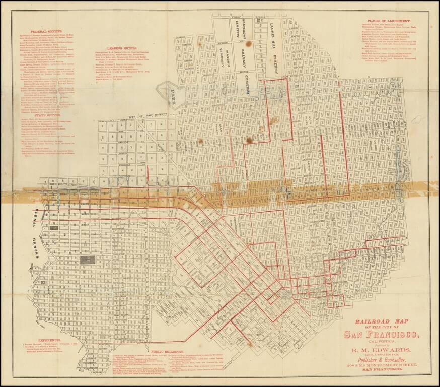
Scarce folding map of San Francisco, with west at the top, printed in black and red, focusing on the city's budding urban rail system.
Rumsey (258) dates his example to 1874 on the basis of the "new mint" at 5th and Mission. The first successful San Francisco cable car line began operation in 1873, so most of these routes are traditionally powered with horses or other means of propulsion.
The author of the map has included lists of federal offices, state offices, leading hotels, public buildings, and places of amusement in red at the sides of the map.
If you are a student, write to us in telegram: @antiquemaps and indicate what material you need and for what work you need a map in high detail. We are ready to provide material on special terms. For students only!
![[Chinese-Language San Francisco Chinatown Business Directory and Lunar Calendar for 1892]](/map/small/66981jc.jpg)
![[San Francisco Fire Satirical Cartoon] Uncle Sam --](/map/small/70102.jpg)