Map size in jpg-format: 25.6698MiB
Click to open in high resolution (open in new tab).

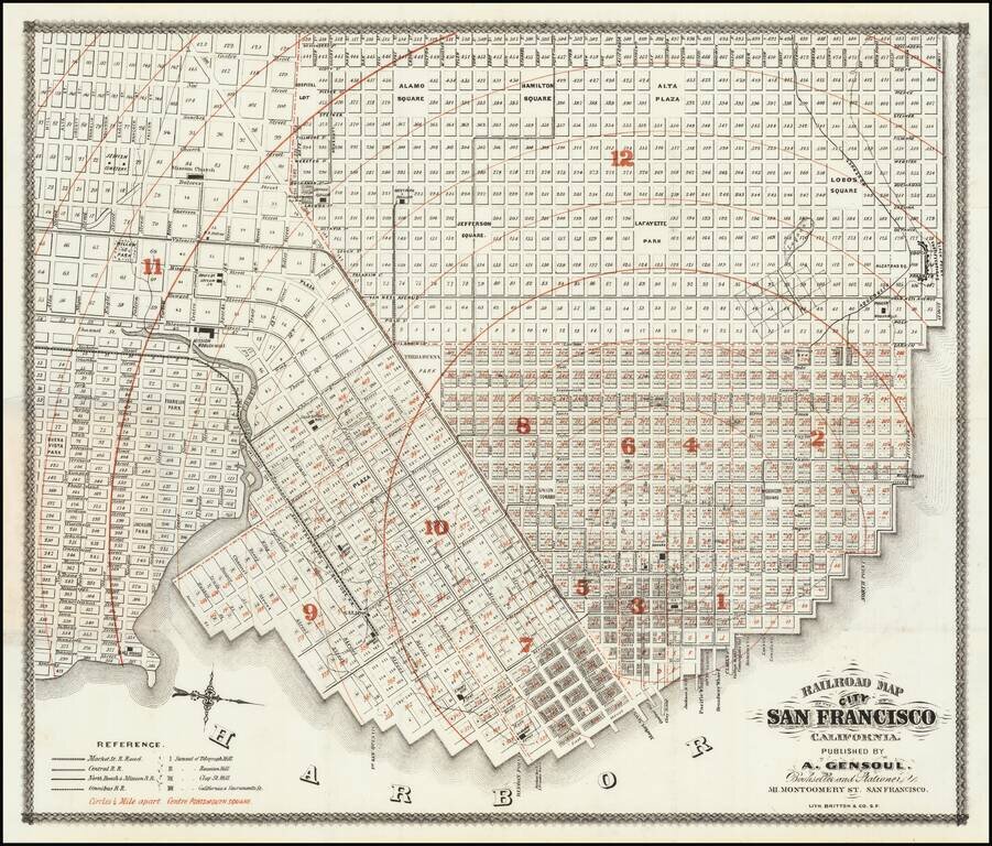
First state of "one of the rarest maps of the City of San Francisco" and one of the earliest printed in the city.
The map shows the city in remarkable detail. Rumsey notes:
Norris: "Very scarce railroad map of San Francisco." Streeter purchased the Norris copy, which was not in as good condition as [the Rumsey] copy. Not in any of the standard references. Red circles emanate from City Hall showing distances at 1/4 mile intervals. Four railroads are identified. The map goes west to Divisadero and south to Alta Street. . . . A later issue was published in 1866 by Gensoul; a similar map was used in various editions of the San Francisco Municipal Reports in the 1860's.Later editions of the map were bounded into the SAN FRANCISCO BUSINESS DIRECTORY AND MERCANTILE GUIDE, also published by Britton & Co.
The map notes the city blocks, plat map numbers, streets, wharfs, parks, squares, election districts and most notably, the location of the Market Street R. Road, Central R.R., North Beach and Mission R.R.; Omnibus R.R. etc. The Summit of Telegraph Hill, Russian Hill, Clay St. Hill and California and Sacramento St. Hill are shown, along with 1/4 mile circles from the center at Portsmouth Square.
One of the rarest and most detailed of all early San Francisco city maps.
If you are a student, write to us in telegram: @antiquemaps and indicate what material you need and for what work you need a map in high detail. We are ready to provide material on special terms. For students only!
![[Chinese-Language San Francisco Chinatown Business Directory and Lunar Calendar for 1892]](/map/small/66981jc.jpg)
![[San Francisco Fire Satirical Cartoon] Uncle Sam --](/map/small/70102.jpg)