Map size in jpg-format: 80.0935MiB
Click to open in high resolution (open in new tab).
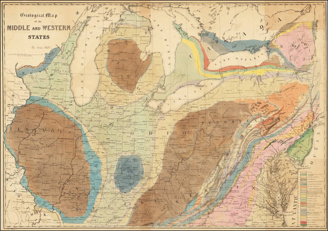
Finely executed geological lithograph map of the Midwest and contiguous regions, published by American geologist James Hall.
The map is color coded by 23 geological formations for which there is a key in the lower right.
Hall’s map is one of the earliest known maps to employ the “New York System,” of stratigraphic nomenclature developed by members of the New York Geological Survey. The system emphasized the importance of paleontology for illustrating geological units and introduced the concept of "type locality," a primary reference location used for defining the characteristics of geological formations.
If you are a student, write to us in telegram: @antiquemaps and indicate what material you need and for what work you need a map in high detail. We are ready to provide material on special terms. For students only!
![[The First Maps in a la poupée Printed Color] Cartes en Couleur des Lieux Sujets aux tremblements de Terre Dans toutes les parties du Monde Selon le Sisteme de l’impulsion Solaire](/map/small/52293op.jpg)