Map size in jpg-format: 657364B
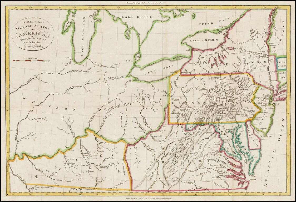
Rare map of Western Territory and the Mid-Atlantic regions of the United States in the last decade of the 18th Century.
The map extends to the Illinois & Wabash Rivers, Lake Michigan and the confluence of the Ohio and Cumberland Rivers in western Kentucky. A number of early towns west of the Ohio are named, including Lexington, Frankfort, Woodford, Danville, Lincoln, Washington, Clarkesville and Louisville in Kentucky. Fort Detroit is shown, as is Kuskusky. Very few settlements west of the Alleghany Mountains.
The map shows all of Michigan and also labels the Chicago River.
The map is from Cooper's Information concerning America, published in Manchester. The work is quite scarce.
If you are a student, write to us in telegram: @antiquemaps and indicate what material you need and for what work you need a map in high detail. We are ready to provide material on special terms. For students only!
![[Wall Map] West-Indische Paskaert waer in de graden der breedde over weder zyden vande middelyn wassende so vergrooten dat die geproportioneert syn tegen hunne nevenstaende graden de lengde.](/map/small/60169.jpg)

![[The First Maps in a la poupée Printed Color] Cartes en Couleur des Lieux Sujets aux tremblements de Terre Dans toutes les parties du Monde Selon le Sisteme de l’impulsion Solaire](/map/small/52293op.jpg)