Map size in jpg-format: 840720B
Click to open in high resolution (open in new tab).
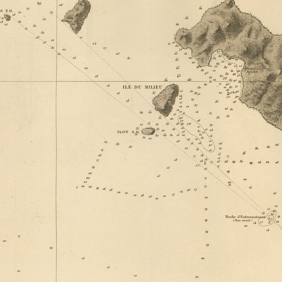
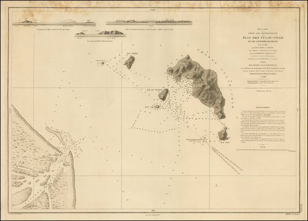
Detailed French chart of the entrance to Hội An, in Vietnam.
Hội An has an interesting history related to foreign attempts to establish trade in Vietnam. In 1535, the Portuguese explorer and sea captain António de Faria attempted to establish a base there. In the 18th century, Hội An was considered by Chinese and Japanese merchants to be the best destination for trading in all of Southeast Asia. Portuguese Jesuits also had one of their early Asian establishments in Hội An.
With the triumph of Emperor Gia Long, the French were awarded exclusive trading rights in the area, in repayment for their assistance in his struggle. The French focused on Đà Nẵng as the main trading post in the area, and Hội An largely fell by the side. Still, in this map the area is closely guarded with forts and batteries protecting each side of the river.
The map includes three coastal profiles and covers the archipelago situated just off the coast.
If you are a student, write to us in telegram: @antiquemaps and indicate what material you need and for what work you need a map in high detail. We are ready to provide material on special terms. For students only!
![[Signed Political Satire Artwork] Vietnam ... Vietnam ... Vietnam ...](/map/small/68726.jpg)
![[Martin Behaim Globe / Book] Pars Globi terrestris Ao. 1492 a Martino Behaim Equite Lusitano Norimbergae confecti Delineavit Christoph. Theoph de Murr 1778 (bound with:) Diplomatische Geschichte des Portugesischen berühmten Ritters Martin Behaims](/map/small/68828.jpg)
![Il Disegno Della Terza Parte Dell' Asia [Gastaldi's Wall Map of SE Asia with extra panels!]](/map/small/30554hbp.jpg)