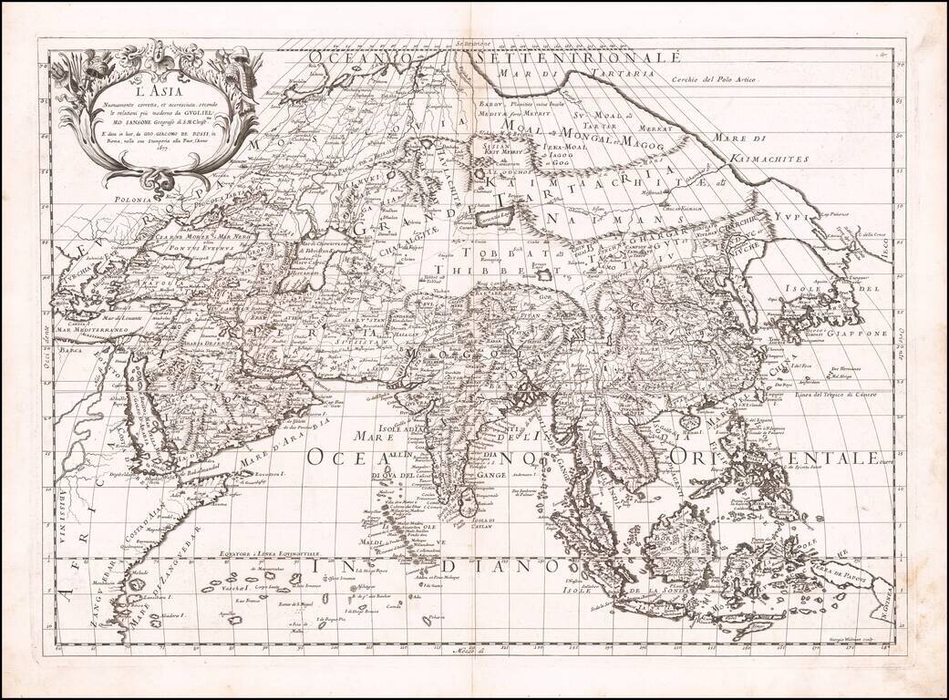
First state of Giacomo Rossi's map of Asia, published in Rome. The map provides an excellent depiction of the Philippines and China (revised to based upon Martini). To the north of Japan, the lands and coastal features are still largely unknown and...
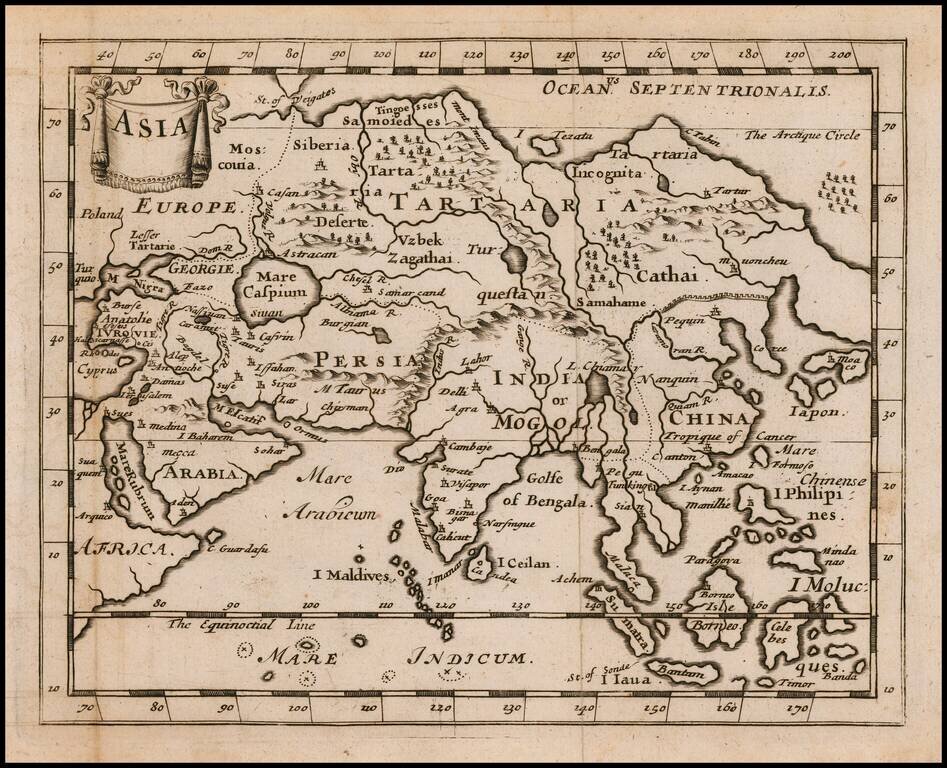
Rare Miniature English Map of The Asian Continent Rare English map of Asia by Jonas Moore, published in London. The map appeared in Moore's A New Geography. Many of the plates in the work were engraved by Herman Moll, who had moved to London in 1678...
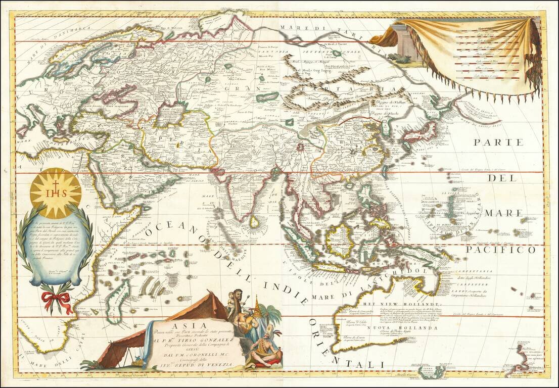
Striking Example of Coronelli's Striking Two-Sheet Map of Asia Fine example of Coronelli's detailed map of the Asian continent. The map shows the latest discoveries in Southeast Asia and the Pacific, and is dedicated to the Jesuit missionaries at...
Nice example of Nolin's scarce map of Asia. The map is the work of the remarkable collaboration between Venetian mapmaker Vincenzo Maria Coronelli and Jean Baptiste Nolin, who would later become the Royal Geographer under Louis XIV in 1701. The most...
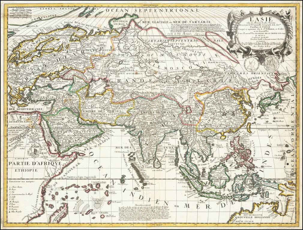
Superb Original Hand-Color Example. Striking large format map of Asia, by Jaillot. Although the imprint line has not been updated, this example was probably published by Mortier in Amsterdam around 1696. The map extends as far east as New Guinea and...
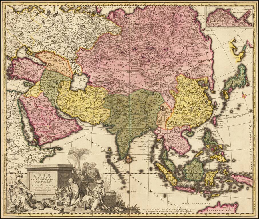
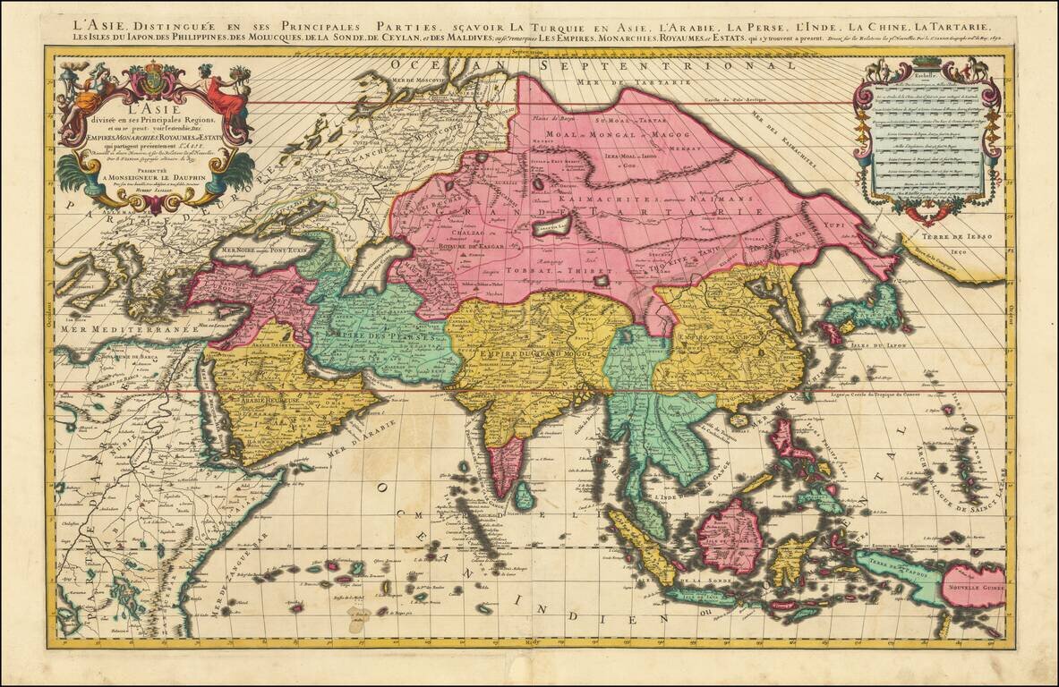
Handsome Map of Asia from Golden Age of Dutch Cartography Fine, old-color example of Carol Allard’s map of “exact Asia, divided into its principal regions,” published in Amsterdam in 1695. This map marked a substantial step forward in the...
Decorative map of Asia, published in Oxford, circa 1700. The map extends from Saudi Arabia and the Black Sea to Japan, New Guinea and unknown parts which would appear to be the northern Australia coastline. This decorative map was part of a set of 22...

Scarce map of Asia, typically attributed to Robert Morden. Korea is referenced as an island, but appears to have been reattached to the mainland. The Great Wall of China is shown. Nice detail in the Philippines. Oversized Maldive islands configuration.
Fine map of Asia, published in Nuremberg by Christopher Weigel. At the top left, there are a list of major religious groups. It is likely that the intent was to color code the map by religious groups, but this apparently did not happen. Includes a...
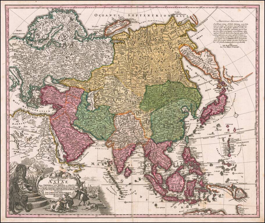
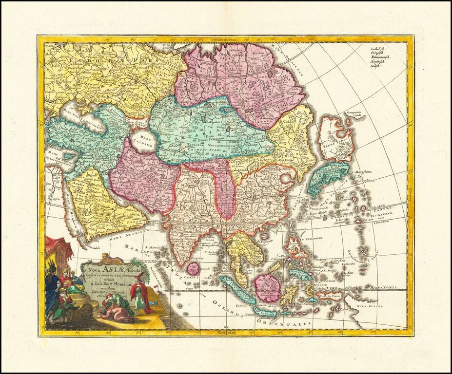
Nice example of Johann Christoph Homann's first map of Asia. The map extends from the Mediterranean to the Pacific and including parts of Nova Hollandia, Carpentaria, Nova Britannia and the Marianas, along with a nice incomplete version of the...
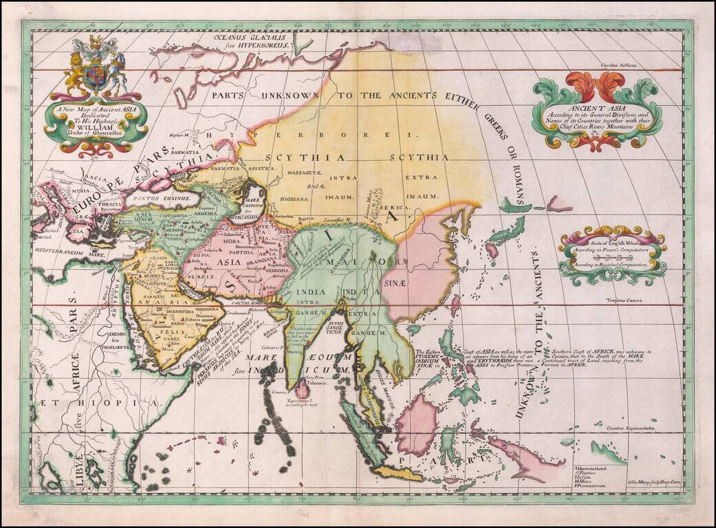
Rare late state of Wells modern map of Asia. This decorative map was part of a set of 22 maps dedicated to William, Duke of Glouchester, who was then an 11 year old student at Oxford.
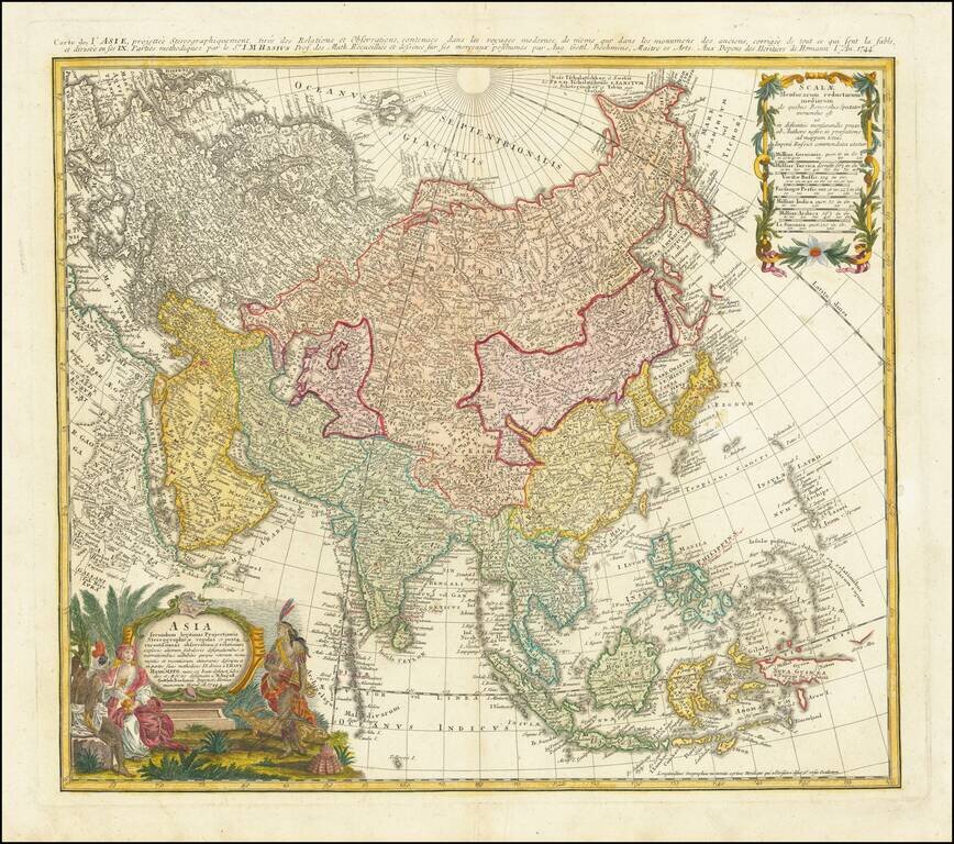
Antique Map of Asia Published in Nuremberg Detailed map of Asia, based upon Johann Mattheus Haas' stereographical projection of the world. As noted in the key at the bottom center, the map is colored based upon the Religious Groups within Asia,...
Rare antique engraved map of Asia by Paolo Santini, one of northern Italy's most important mapmakers of the first half of the 18th century. The few examples of the map that have appeared on the market have been cataloged with publication dates of...
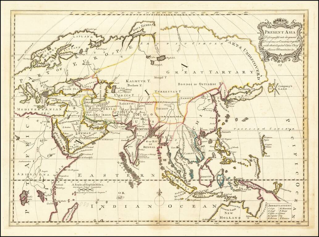
Detailed map of Asia and Australia, which appeared in Middleton's Geography. Shows a still largely speculative Southern Australian coastline. Among the most notable features is the reference of the Sea of Korea.
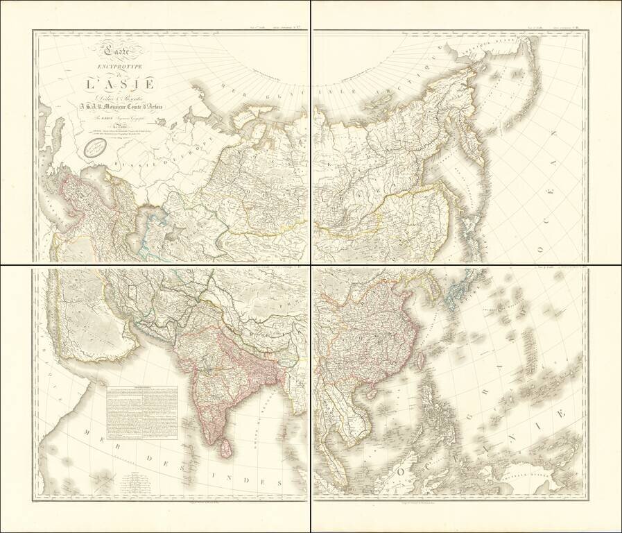
Large antique four-sheet wall map of Asia, by Hubert Brué, one of his "Carte Encyprotype" series, first issued in 1814. The map is exceptionally detailed and is comparable to Aaron Arrowsmith's work in its quantity of information and quality of...
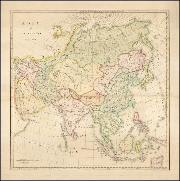
Finely executed manuscript map by F.D. Zachary. We suspect that FD Zachary is Francis Daniel Zachary, who appears to have gone on to practice law in England and whose name appears as a Chess player of some notariety.