![[Map of Asia] Карта Азіи](/map/small/66748.jpg)
Detailed and very rare Russian-language Asia, published in Saint Petersburg in 1836. The map is probably most valuable for its mapping of Russia and Central Asia. Elsewhere, particular at the extremities of the map, it is less accurate in interesting...
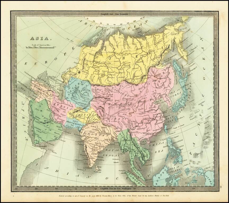
Striking full hand-color example of Burr's map of Asia, which first appeared in David Burr's Universal Atlas, in 1836. Burr's Atlas was perhaps the most elegant American commercially published atlas of its time, utilizing wonderful wash colors and...
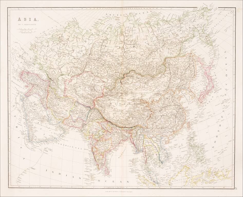
Striking example of Arrowsmith's map of Asia. The map appeared in Arrowsmith's London Atlas, one of the most popular English atlases of the mid-19th Century.
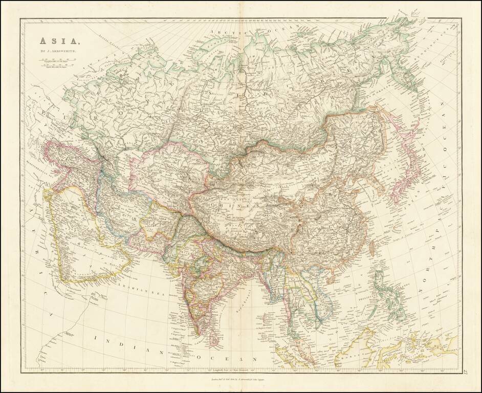
Striking example of Arrowsmith's map of Asia. The map appeared in Arrowsmith's London Atlas, one of the most popular English atlases of the mid-19th Century.
![Asia [with large inset of Australia]](/map/small/67619.jpg)
Detailed map of Asia, including part of Polynesia and a large inset of Australia. Includes color key noting the colonial possessions of Britain, France, Spain, Portugal, Holland and independent islands. Decorative border. An excellent map from the...
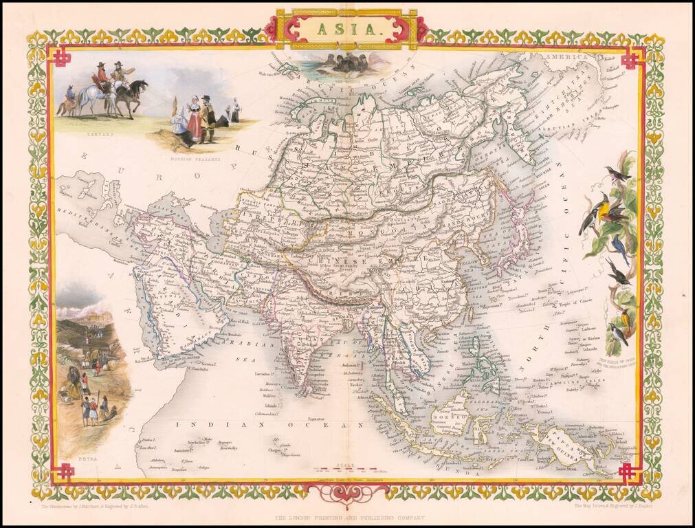
Striking full color example of this marvelous map of the Asian Continent. Decorative vignettes of Tartars, Russian Peasants, Petra and the Sun Birds of India and the Philippines. Engraved for R. Montgomery Martin's Illustrated Atlas. Tallis was one...
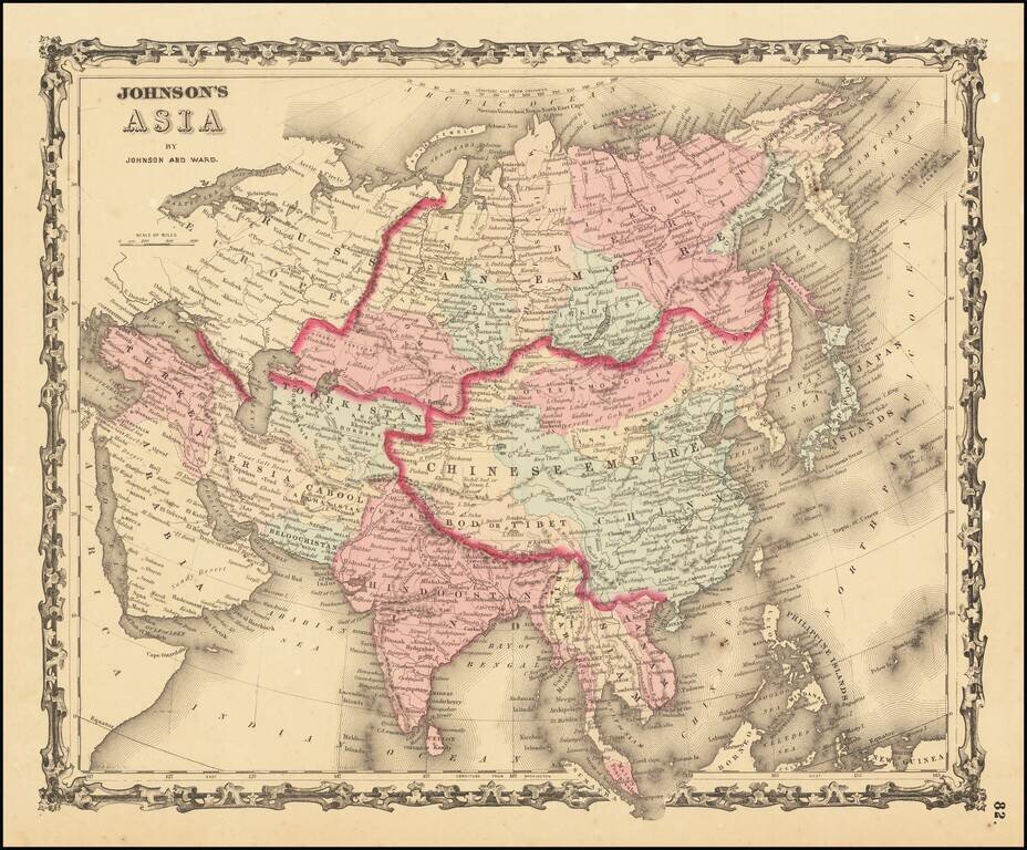
An attractive antique map of the continent of Asia, hand-colored by country and province. The map shows major cities, lakes, rivers, mountains. Includes a decorative border. This map was likely derived from Johnson's earlier wall map. The Russian...
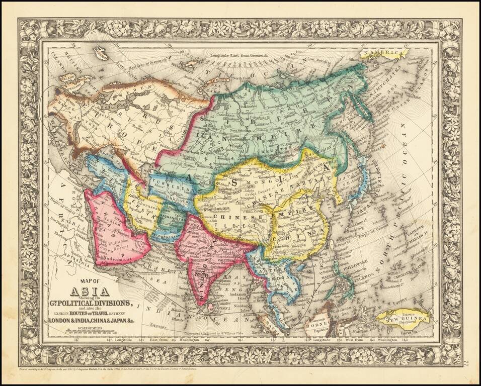
Detailed map of Asia, colored by country. Includes the classical SA Mitchell decorative border of the period.
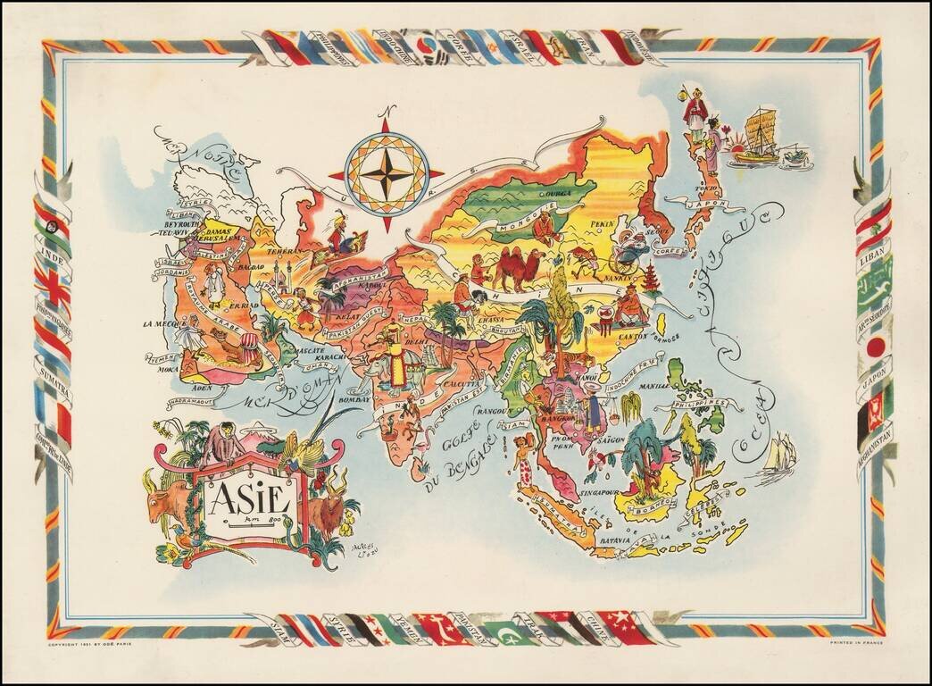
Decorative map of Asia, published by Jacques Lizou. Lizou published a number of maps in this style in 1951, including maps of the French provinces, etc.
![Tabula Asiae VII [Iran, Afghanistan, Turkmenistan, Uzbekistan, Kazakhastan, Pakistan, India]](/map/small/60604.jpg)
Nice example of Munster's Ptolemaic map of the region north and east of the Black Sea and the Persian Gulf, extending to the Imaus Mountains. The map is unchanged from the 1540 first edition of this landmark work. Munster's Geographia was a...
![[Black & Caspian Sea Region] Tabula Asiae III](/map/small/71170.jpg)
Nice example of Munster's Ptolemaic map of the region between the Black Sea and Caspian Sea extending south to include all of Armenia Maior and part of Armenia Minoris. The map is centered on the modern countries of Armenia, Georgia and Azerbaijan....
![Primae Partis Asiae accurata delineatio… [shows Cyprus]](/map/small/57018.jpg)
De Jode's edition of Giacomo Gastaldi's Landmark Map of The Middle East and Asia Minor. Old color example of De Jode's highly desirable map of the region, bounded by the Black Sea and Mediterranean in the West and Afganistan and Central Asia in the...
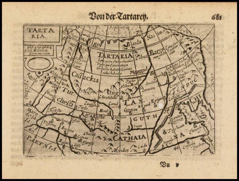
Nice example of this early state of Barent Langenes's map of Tartaria, which first appeared in the 1598 edition of Langenes's Caert-Thresoor, published in Middelburg. Langenes's map was first issued in his Caert-Thresoor and later re-published by...
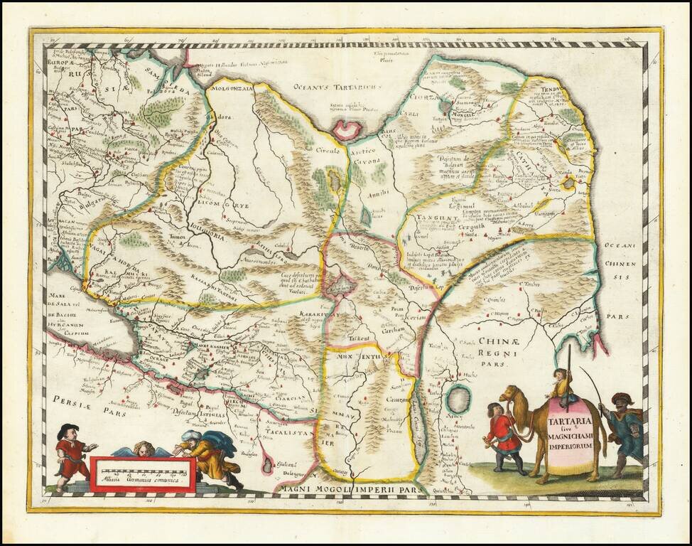
An attractive antique map of China, Tartary, and Central Asia. This map covers a vast area in intriguing detail which reflects European knowledge about the world at the time during which it was made. The detail shown includes many rivers, mountain...
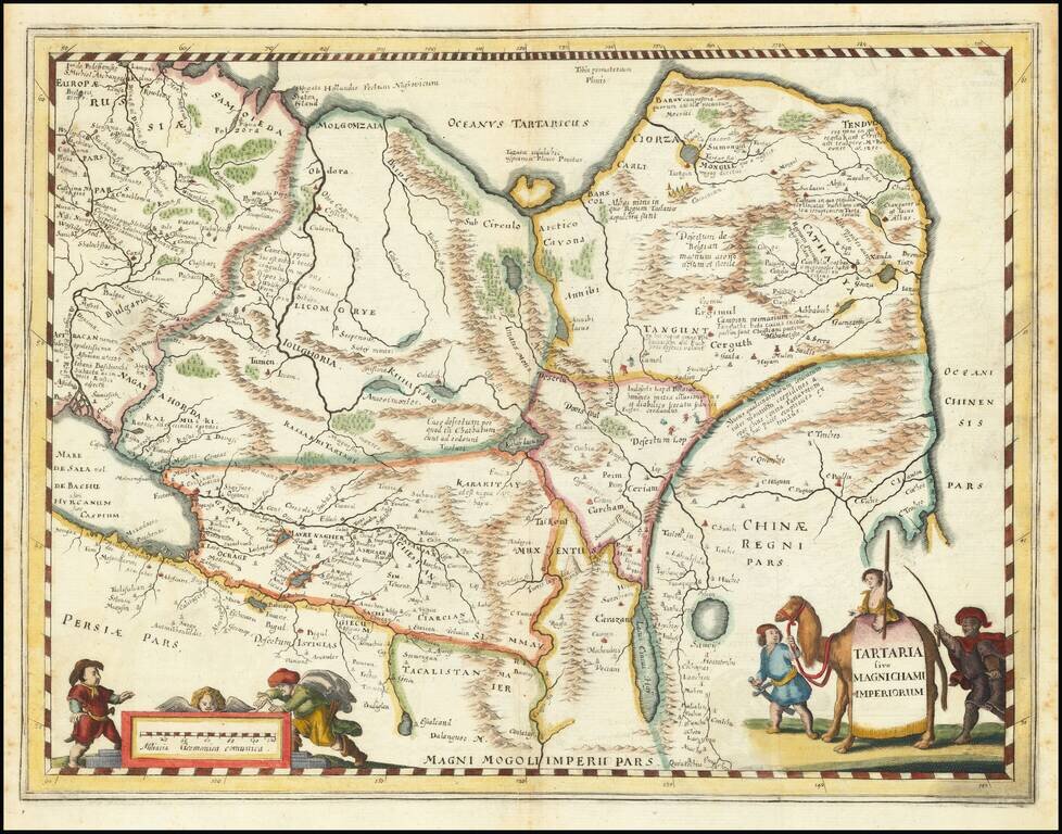
An attractive antique map of China, Tartary, and Central Asia. This map covers a vast area in intriguing detail which reflects European knowledge about the world at the time during which it was made. The detail shown includes many rivers, mountain...
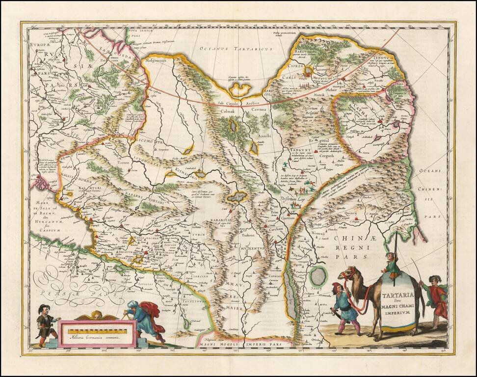
Nice example of Blaeu's map of China, Tartary and Central Asia, extending from Mongolia and Xanadu to the Caspian and the Volga River, and to Tibet and the Upper Ganges River. The Great Wall of China appears prominently.