Map size in jpg-format: 102.682MiB
Click to open in high resolution (open in new tab).
Superb Original Hand-Color Example.
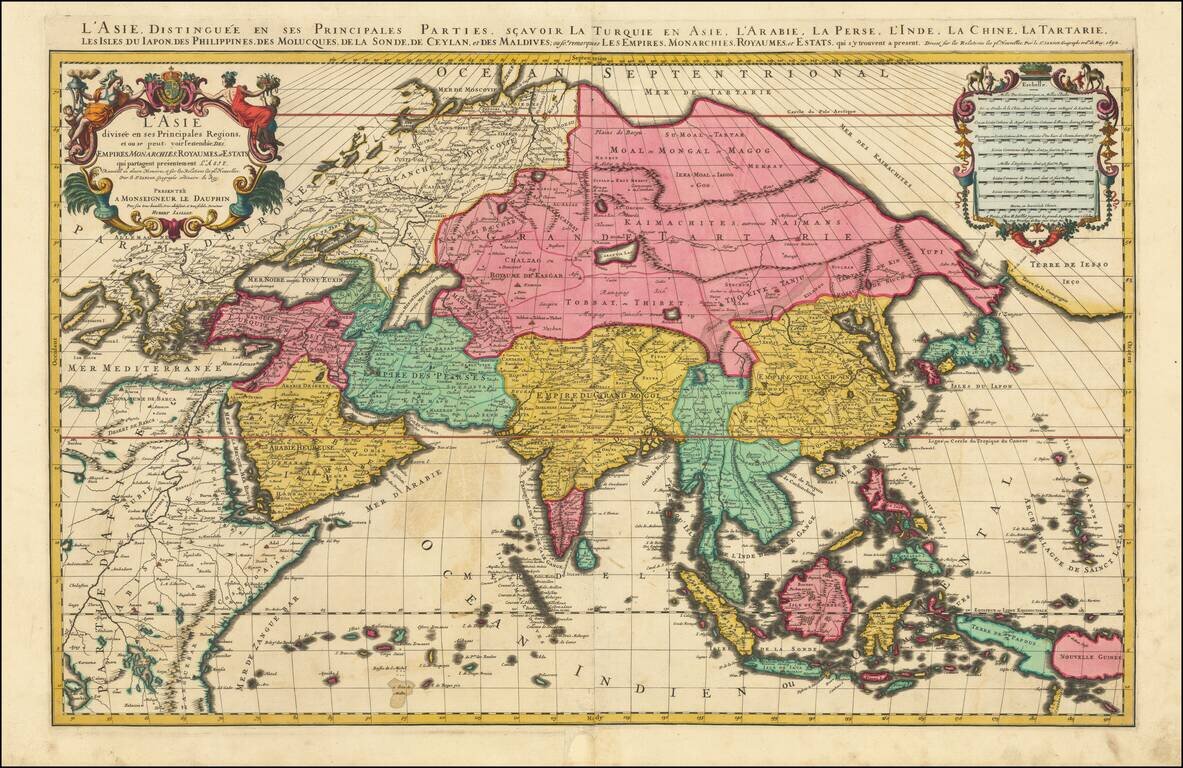
Striking large format map of Asia, by Jaillot. Although the imprint line has not been updated, this example was probably published by Mortier in Amsterdam around 1696.
The map extends as far east as New Guinea and "Terre Iesso" and west to Eastern Europe and the Nile River.
First issued in 1674, this two-sheet map of Asia provides a highly detailed picture of the continent, based upon the geographical compilations and work of Nicolas Sanson which remained unpublished at the time of his death.
Not enough can be said about the original hand-coloring of this example, which is especially careful, fresh, and strong.
Alexis-Hubert Jaillot (ca. 1632-1712) was one of the most important French cartographers of the seventeenth century. Jaillot traveled to Paris with his brother, Simon, in 1657, hoping to take advantage of Louis XIV's call to the artists and scientists of France to settle and work in Paris. Originally a sculptor, he married the daughter of Nicholas Berey, Jeanne Berey, in 1664, and went into partnership with Nicholas Sanson's sons. Beginning in 1669, he re-engraved and often enlarged many of Sanson's maps, filling in the gap left by the destruction of the Blaeu's printing establishment in 1672.
If you are a student, write to us in telegram: @antiquemaps and indicate what material you need and for what work you need a map in high detail. We are ready to provide material on special terms. For students only!

![[Eastern Hemisphere Globe Gores] (Nova et integra universi Orbis descriptio)](/map/small/54480.jpg)