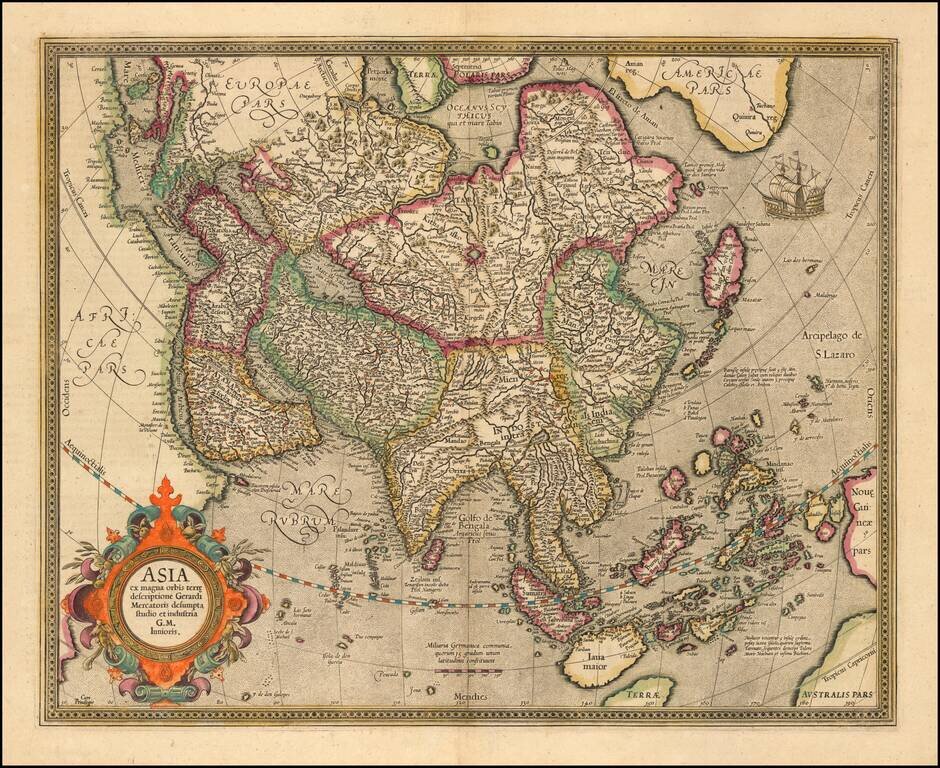
Nice old color example of Mercator's map of Asia. Includes an ornate cartouche and sailing ship. The map was updated and the cartouche etc. changed in 1606. The map is based upon Mercator's World Map of 1569.
Excellent early map of Asia, extending south to include Nova Guinea and Java Major and east to the South Pacific. Includes the NW Coast of America, with a narrow Fretum Anian seperating the continents. and marvelous detail in the NE coast of Asia,...
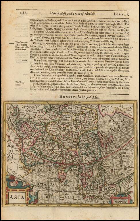
Detailed early map of Asia, from the Mercator-Hondius Atlas Minor. Korea is shown as an island. The Philppines are named and shown in a relatively recognizable shape.
Striking Map of Asia from the Dutch Golden Age of Cartography Fine example of Henricus Hondius’ map of Asia, which appeared in the distinguished Mercator-Hondius atlas. The map encompasses the entirety of the continent, including the Arabian...
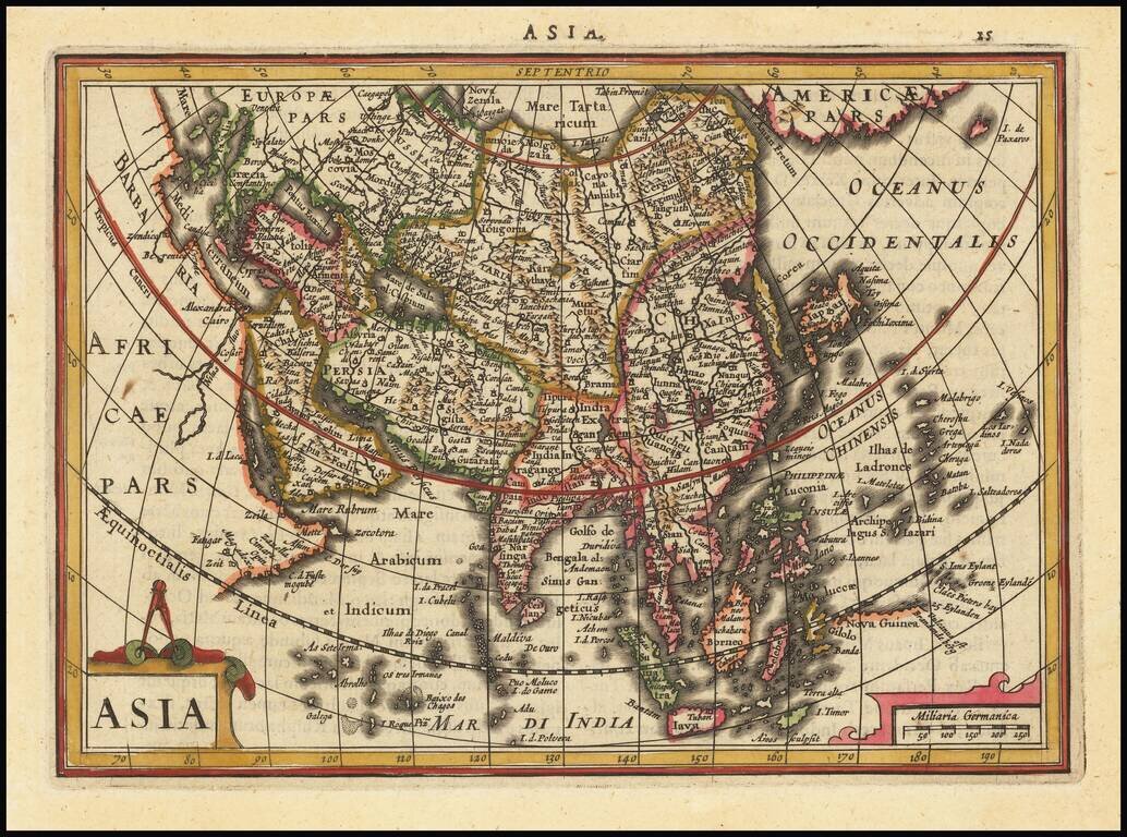
Striking example of this interesting map of Asia, from the Mercator-Hondius Atlas Minor. Includes Corea as an island, early depiction of the Philippines Islands and the land bridge to North America.
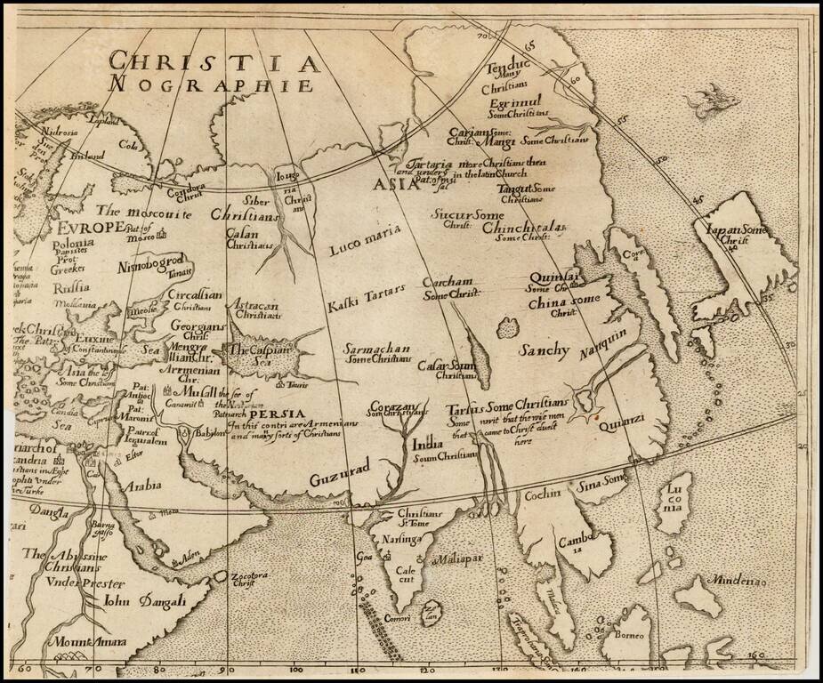
Rare map of Asia, from Ephraim Pagitt's Christianographie, or the Description . . . of the Christian World, not subject to the Pope, first published in London in 1635. The map shows Corea as an Island, and unusual projection for Japan and names Luzon...
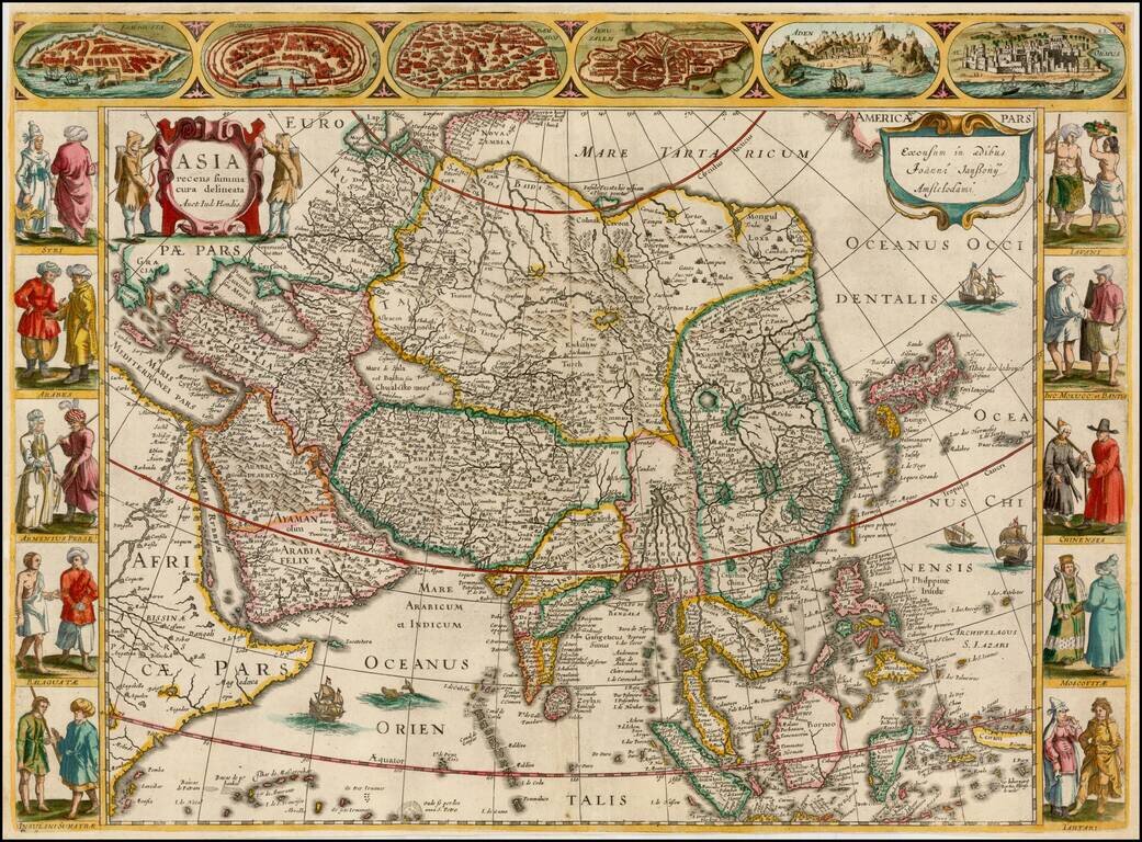
A very fine 'Carte à Figures' map of Asia, by Jan Jansson, after his brother-in-law Jodocus Hondius. This highly attractive map embraces all of Asia. The Middle East is very well formed, although the Caspian Sea has the egg-like form it maintained...
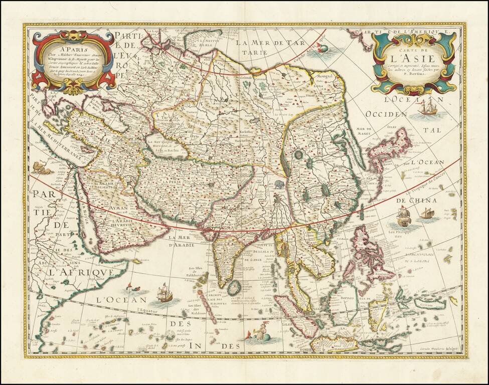
Rare map of Asia, likely drawn from an earlier map by Melchior Tavernier. Extremely detailed throughout. Shows the Great wall, oddly projected Korea, Japan and China and elephant just about the source of the Ganges. Writing about the America map from...
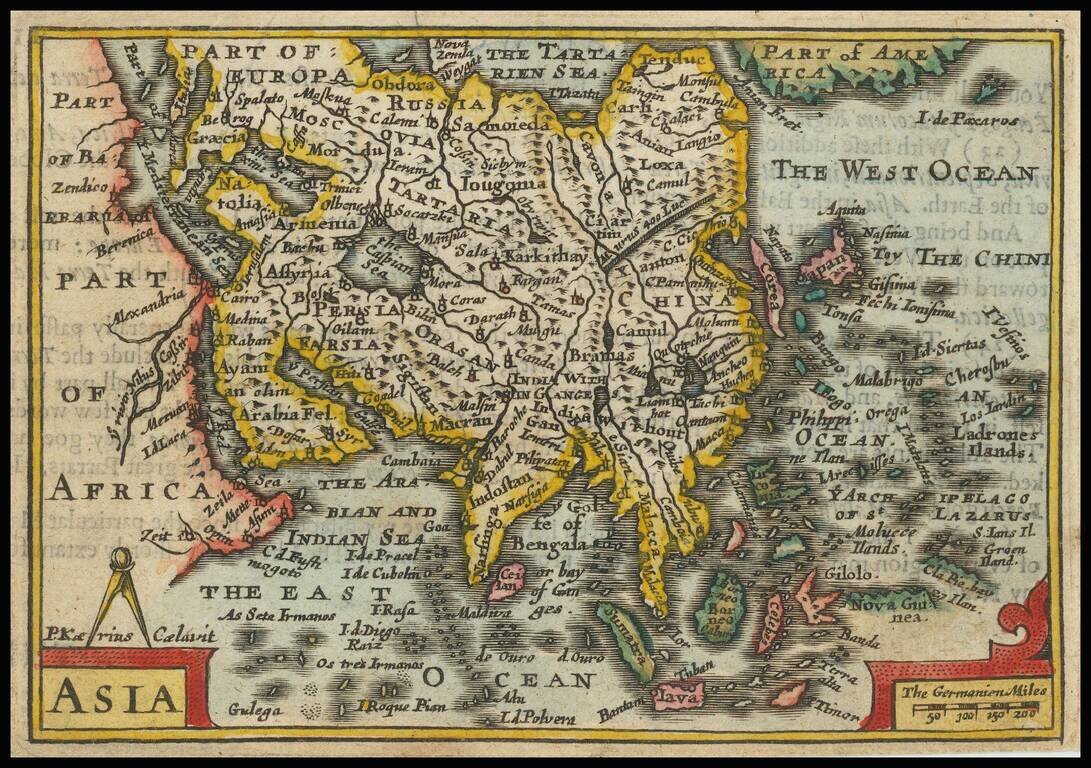
Nice full color example of Speed's rare scarce miniature map of Asia, from Speed's Epitome. The map shows Corea as an Island, a badly misprojected Japan and a small part of the Great Wall of China. Part of America is shown, as is the Straits of Anian....
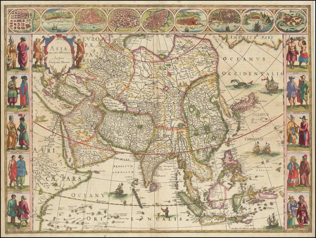
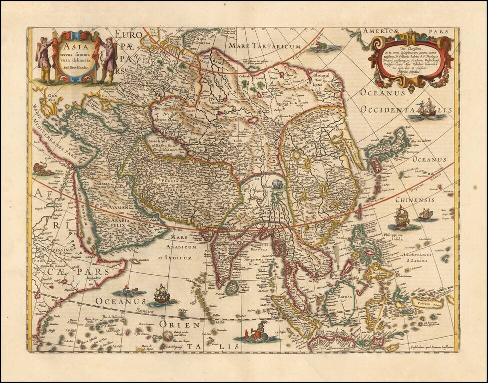
Blaeu’s Iconic Map of the Continent of Asia with Decorative Vignettes Fine example of Blaeu's highly-stylized map of the continent of Asia, one of the most recognizable representations of the continent from the seventeenth century. The map is framed...
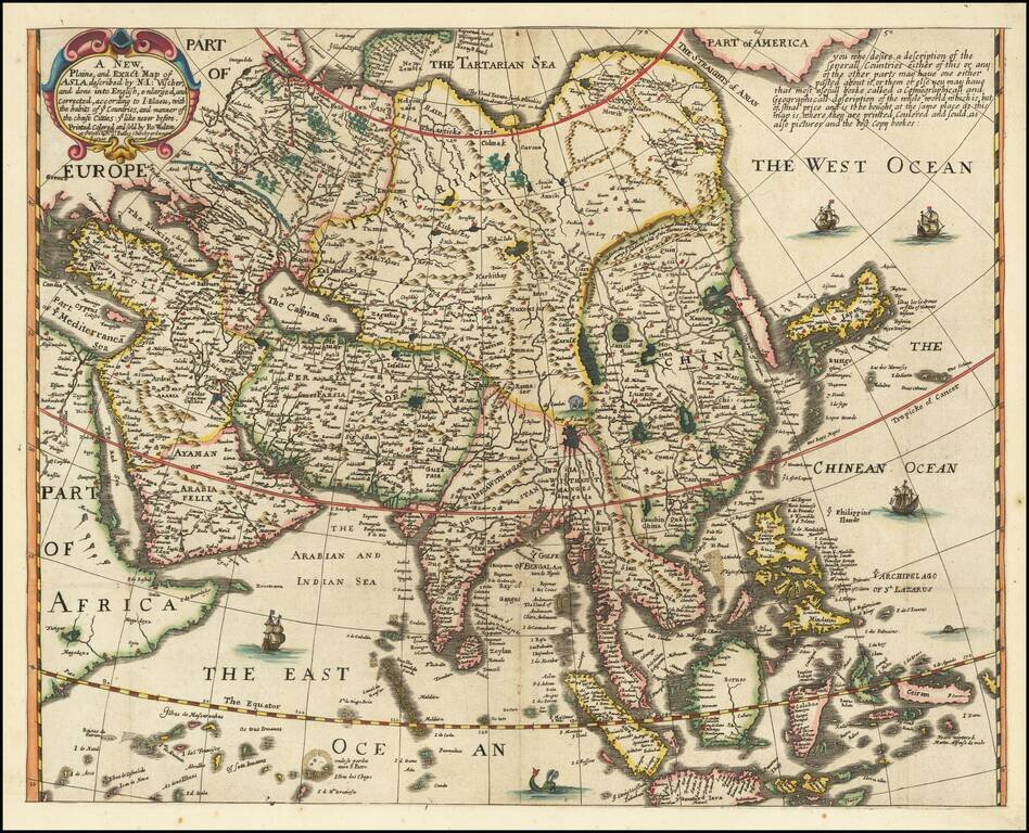
Rare Example Without Panels Rare English map of Asia, engraved by Robert Walton. The map follows the cartography of early maps by Nicholas Visscher the Elder and Joan Blaeu, but has been completely re-engraved, with English nomenclature and...
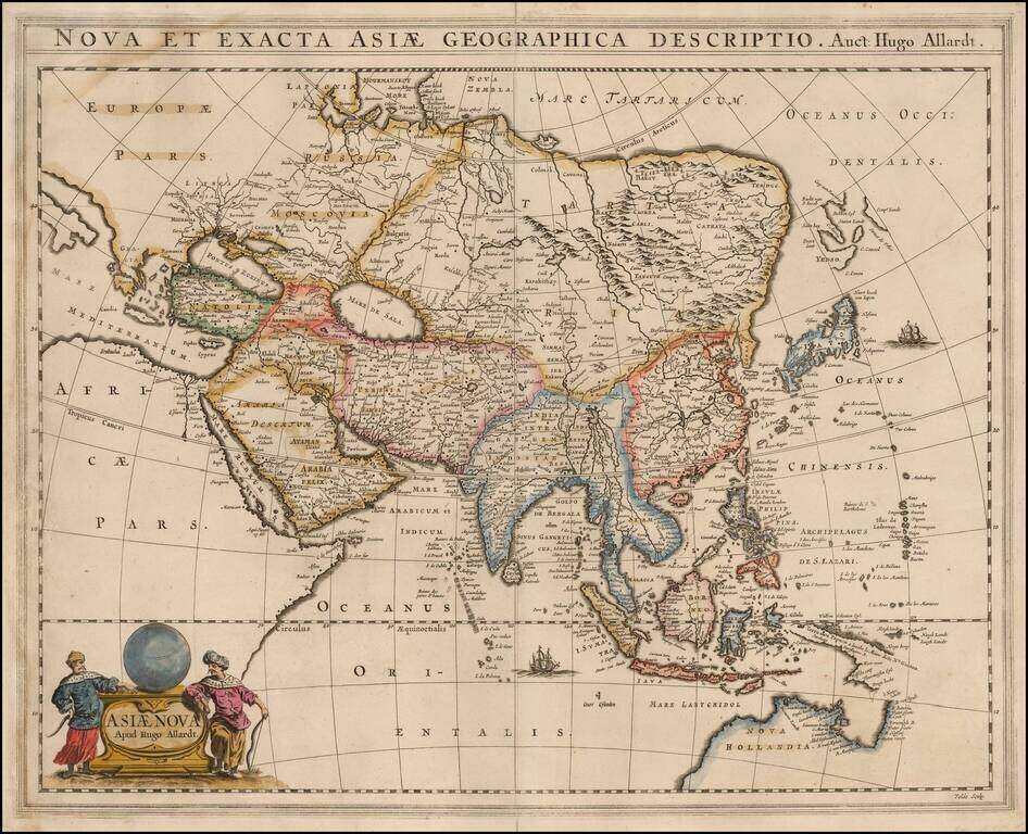
Rare Hugo Allard map of Asia and the north part of Australia. The map includes a nice representation of the Philippines. Korea is shown as a strangely shaped peninsula. China and the Great Wall are located. The depiction of Yedso, Comps. Landt and...
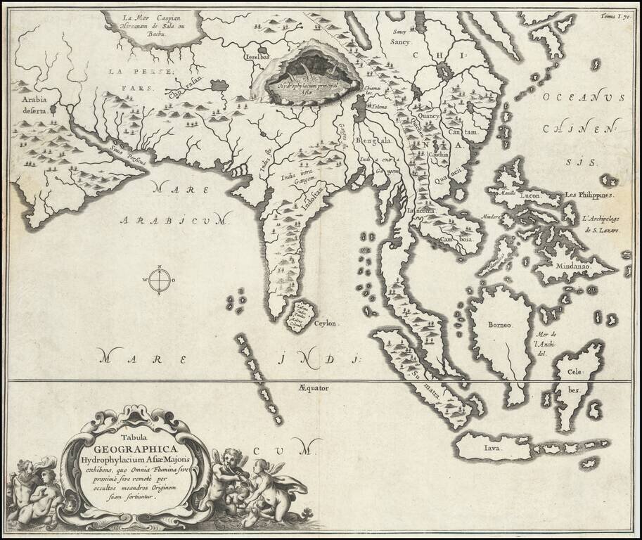
Fine, Distinctive Map of Asia by Polymath Athanasius Kircher Fascinating map of Asia, illustrating the theories of the Jesuit scholar Athanasius Kircher, from his Mundus Subterraneus. It was one of the earliest thematic maps. This very unusual map...
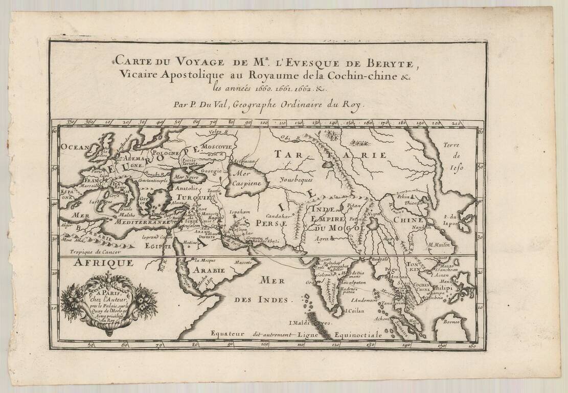
Antique engraved map showing the route of French missionaries to Siam. The map apparently appeared in Bourges's "Relation du voyage de Monseigneur l’évêque de Beryte Vicaire apostolique du royaume de la Cochinchine, Par la Turquie, la Perse, les...
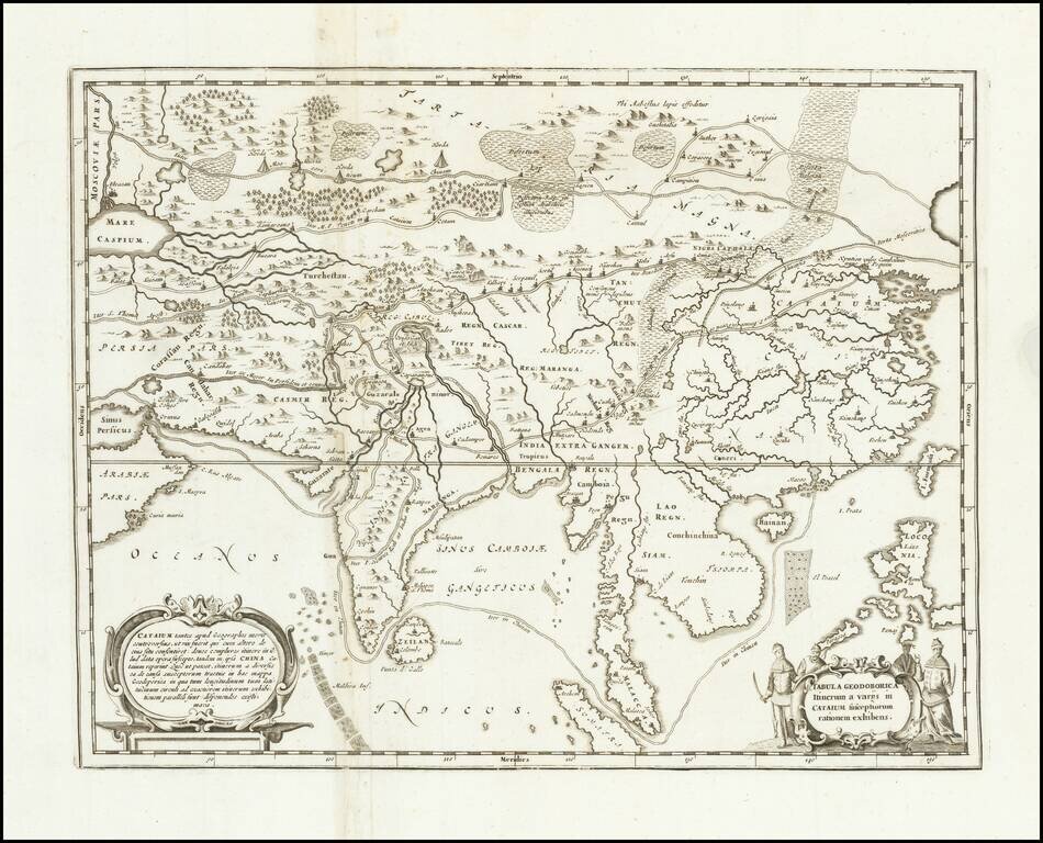
Antique engraved map of Asia, from Persia to China, illustrating various routes of travel across the continent. The map was published in Kircher's China Illustrata in 1667. The sea route from Goa to Macao is depicted. Many overland routes are also...
A striking dark impression of this scarce map of Asia, the earliest folio-size map of Asia to be engraved and printed in England. The map demonstrates the naïve engraving style characteristic of 17th Century English engravers and features an...