Map size in jpg-format: 3208730B
Click to open in high resolution (open in new tab).
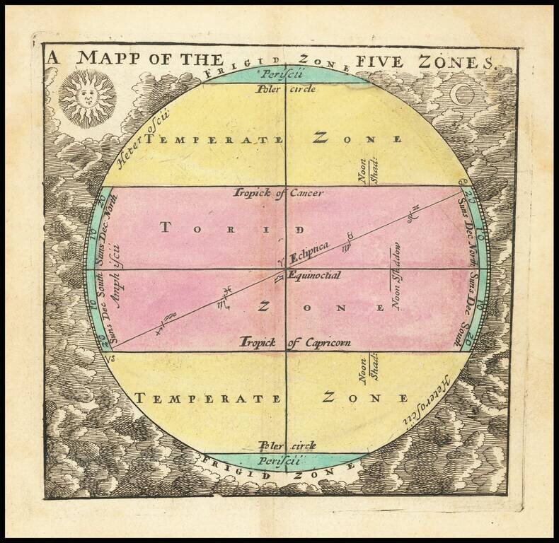
A little gem of map, being John Seller's representation of the ancient concept of zones of the earth, published in his miniature Atlas Terrestris, circa 1700.
The map is a great example of the characteristic Seller engraving style, with the sun and the moon overseeing the globe, which itself is divided into "Poler circle", Temperate Zone, and Torid Zone in both the northern and southern hemispheres.
The concept of geographical zones is most closely associated with Aristotle, though the concept was first promulgated by Parmenides.
If you are a student, write to us in telegram: @antiquemaps and indicate what material you need and for what work you need a map in high detail. We are ready to provide material on special terms. For students only!


