![[Title Page] Atlas Classica; or Select Maps of Ancient Geography, both Sacred and Profane . . . 1829](/map/small/12479.jpg)
Interesting title page from Finley's Classical Atlas.
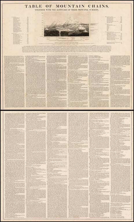
Unusual two sheet table of principal mountains, with an illustration and remarkably detailed list of mountains from all parts of the known world. Includes a list of he tallest Island Mountains, Mountain Passes, Table Lands and Elevated Human...

The Original Mimpriss Chart of the Gospels Finely illustrated map of the Holy Land by Robert Mimpriss. Originally trained as an artist and engraver, Robert Mimpriss would go on to have an important role in shaping Evangelical Christian children's...
![Distribution of Vegatables and Snow Line [with] Comparative Lengths of Rivers](/map/small/63018.jpg)
One of the earliest obtainable comparative charts published in the United States. The image is divided into the Torrid, Temperate and Frigid zones. The graphics are color coded to show North America in Blue, South America in Yellow, Europe in Red,...
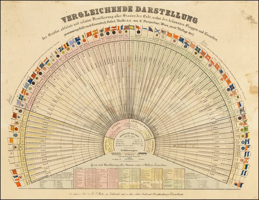
Early Global Statistics Data Visualization Chart. Rare German-language lithographed chart of the population ("Bevölkerung"), area ("Flächeninhalt"), and residents per square mile ("Einw. auft □ M."), along with the flags of many nations of the...
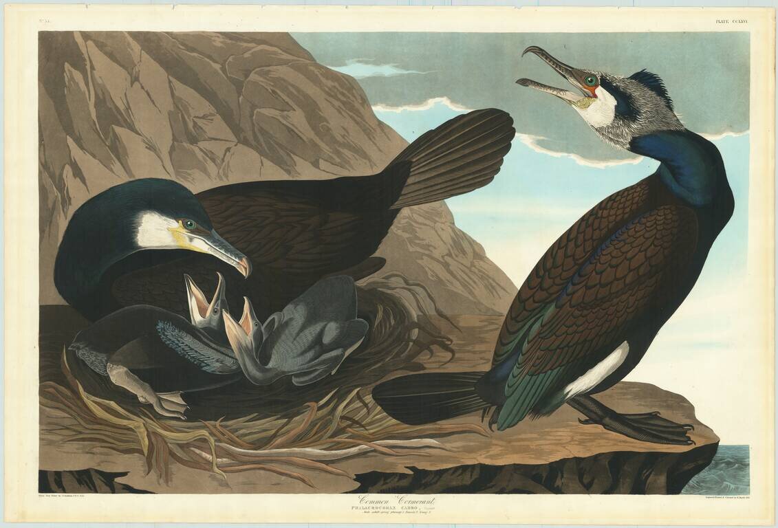
"Look at the birds before you, and mark the affectionate glance of the mother, as she stands beside her beloved younglings!" - John James Audubon, Ornithological Biography, page 458 An exceptional Havell edition John James Audubon aquatinted and...
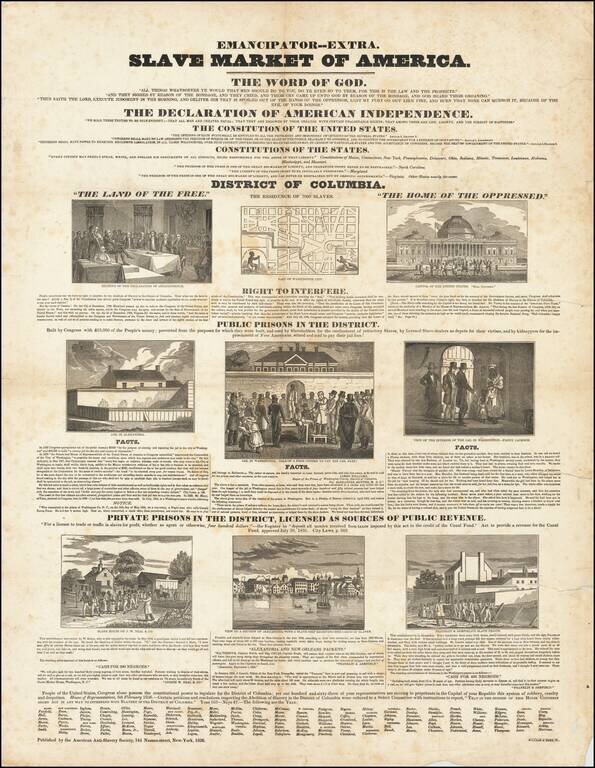
Rare Anti-Slavery broadside protesting the US House of Representatives vote for the so-called "gag bill". Published by the American Anti-Slavery Society, the broadside was a response to legislation passed by the House preventing even the discussion of...
![[Republic of Texas] The Flags of The Principal Nations In the World . . . 1837](/map/small/69791.jpg)
Rare hand-colored flag chart, including the maritime ensign of the Republic of Texas by Hinman and Dutton. The chart includes 98 flags of the world, including national flags, along with merchant, naval and city state flags. Several ensigns of...

Finely colored chart of the World's mountains and rivers, featuring numerous erupting volcanoes. A fine thematic chart illustrating the relative sizes of the world's tallest mountains and longest rivers. The chart also illustrates the relative...
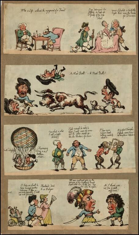
4 interesting cartoon strips, showing whimsical British subjects (although the bull scene might be a Spanish satire).
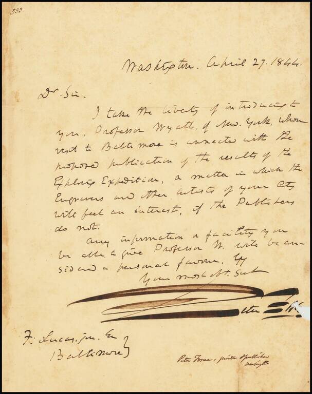
Letter of introduction from Peter Force to Fielding Lucas Jr., concerning the prospective publication of the Reports of the United States Exploring Expedition (Wilkes Expedition). Force had previously published a short summary of Charles Wilkes' 5...

Remarkable image showing Choctaw Indians playing lacrosse, from George Catlin's North American Indian Portfolio. In 1834, George Catlin witnessed Choctaw lacrosse in Indian Territory near present-day Oklahoma, and was captivated by the game. Ball-play...
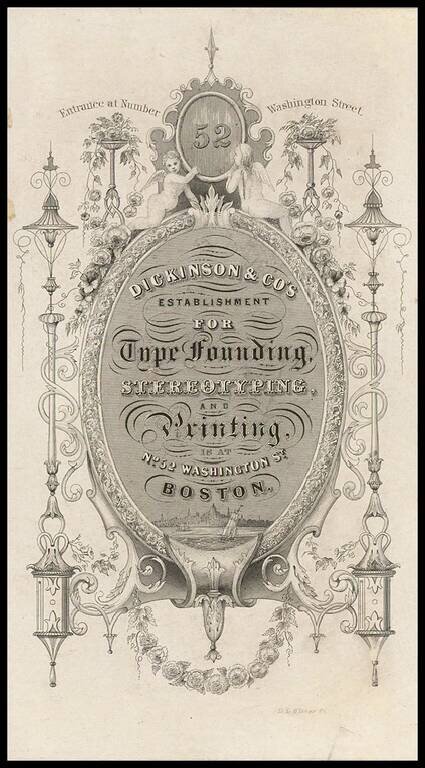
Scarce Boston Trade Card, with a view of the city. The card was created by De Lacy Glover.
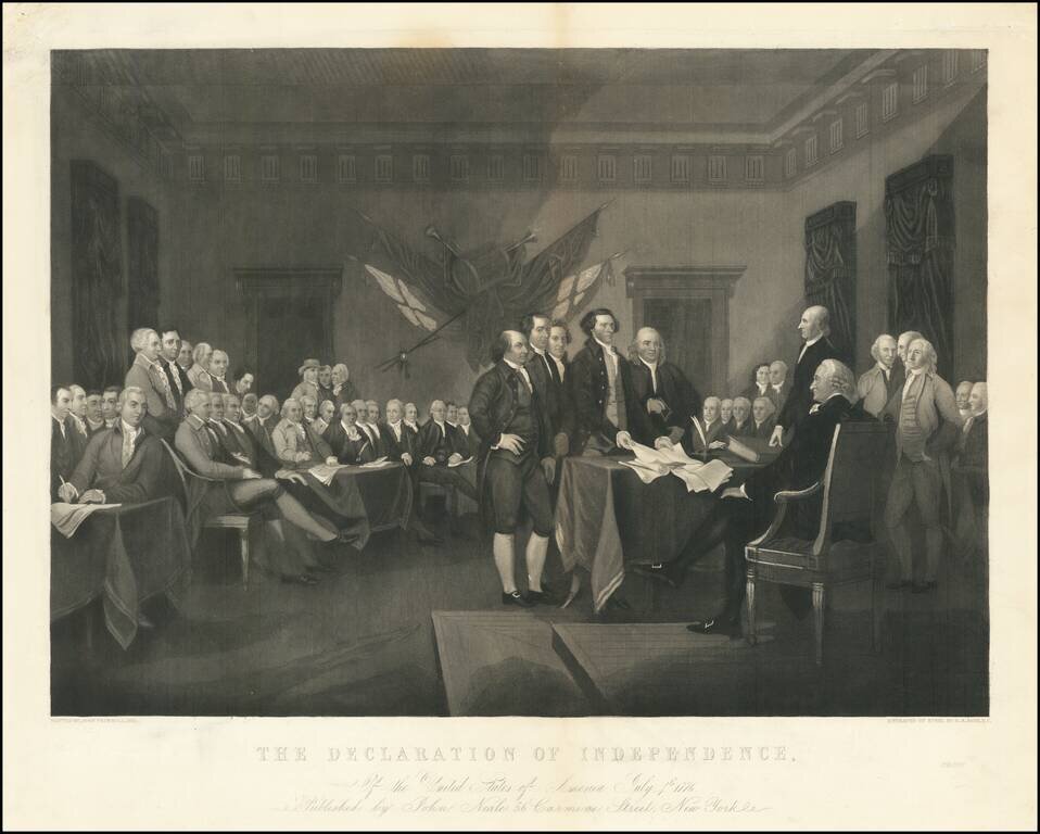
Proof state of John Trumbull's painting of the signing of the Declaration of Independence, "engraved on steel by H.S. Sadd," and published by John Neale A fine mid-19th Century reprise of one of Trumbull's iconic works. The painting shows the...
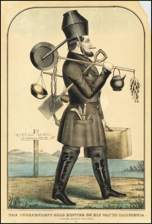
An Iconic Gold Rush Image Rare edition of the class "Gold Hunter" image, published by Kellogg & Comstock. "The 'gold hunter' is a well dressed man, laden with gold mining tools, scales, link sausages, fish and a pot for a hat. In the background a...
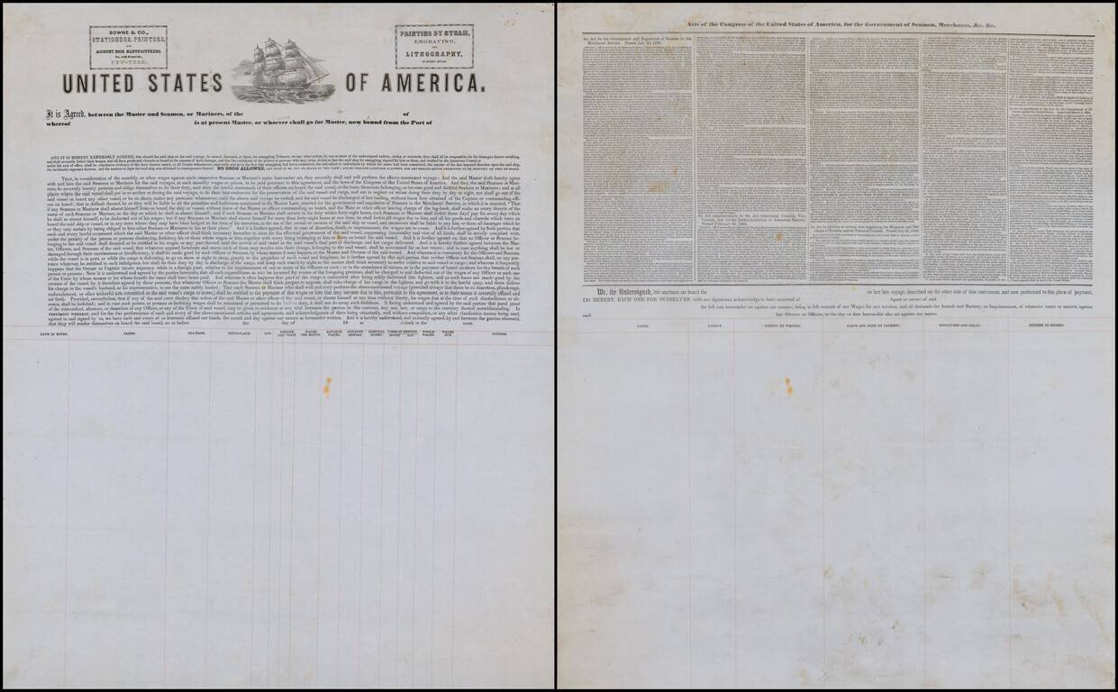
Fine large example of a form contract of the type utilized my American Mariners in the mid-19th Century. The contract includes a detailed recitation of the following "Acts of Congress of the United States of America for the Governance of Seaman'...