Map size in jpg-format: 923411B
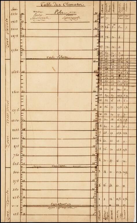
An interesting 18th-century French manuscript climate-parallel chart.
This inteseting piece charts the range of latitudes from the Equator to the Poles, and relates the various parallels to climatic conditions and notes the distances between the meridians of longitude at the various latitudes. It divides the world into the 'Zone Glaciale' (polar zone), the 'Zone Temperee' (temperate zone), and the 'Zone Toride' (tropical zone).
In all, a rare and curious original artifact from the French Enlightenment, a period when scholars sought to quantify the natural world.
If you are a student, write to us in telegram: @antiquemaps and indicate what material you need and for what work you need a map in high detail. We are ready to provide material on special terms. For students only!


