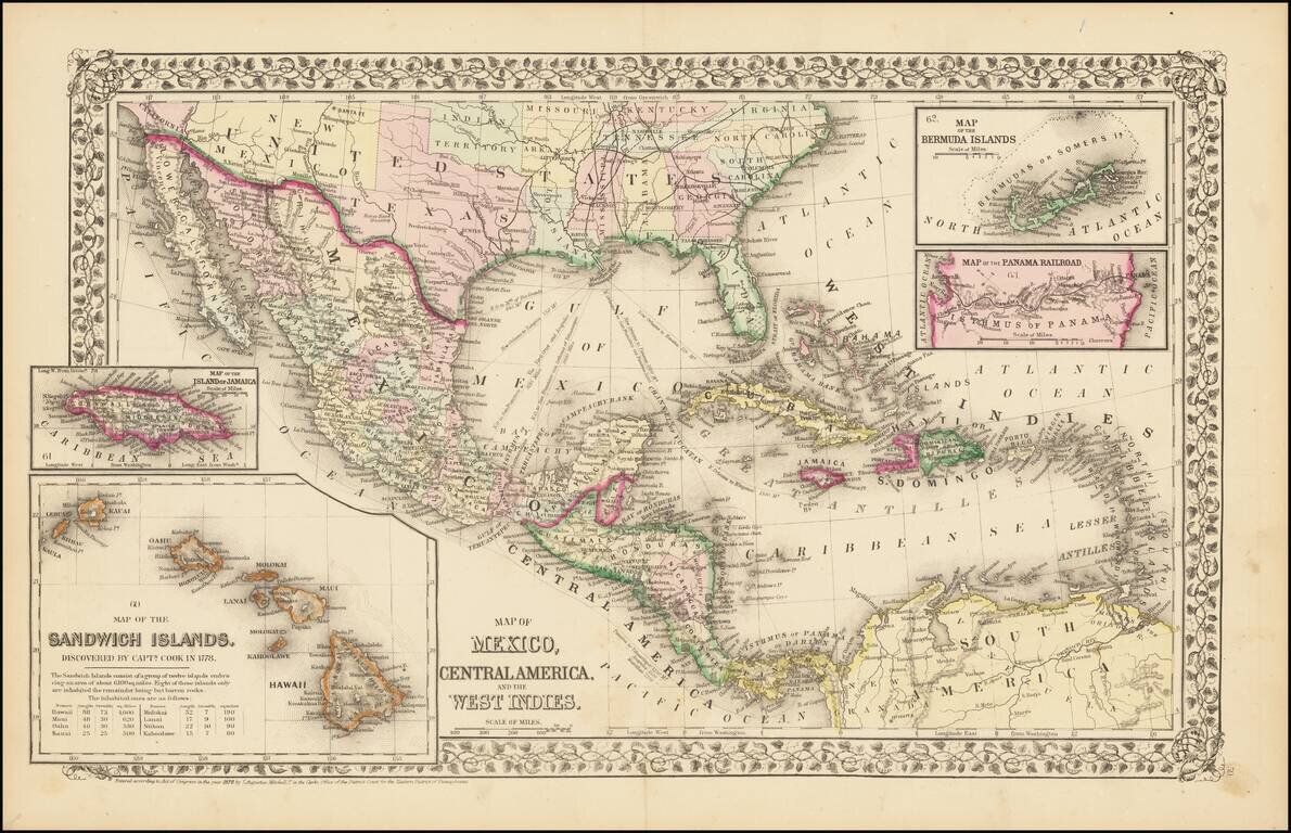
Rare and antique old maps of the North America
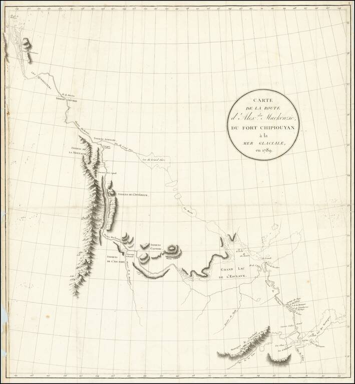
Exploring the River Which Would Bear His Name Nice example of the French edition of Alexander Mackenzie's route map between Lake Athabasca to the Arctic Sea in 1789. Alexander Mackenzie was the first European to cross the North American continent...
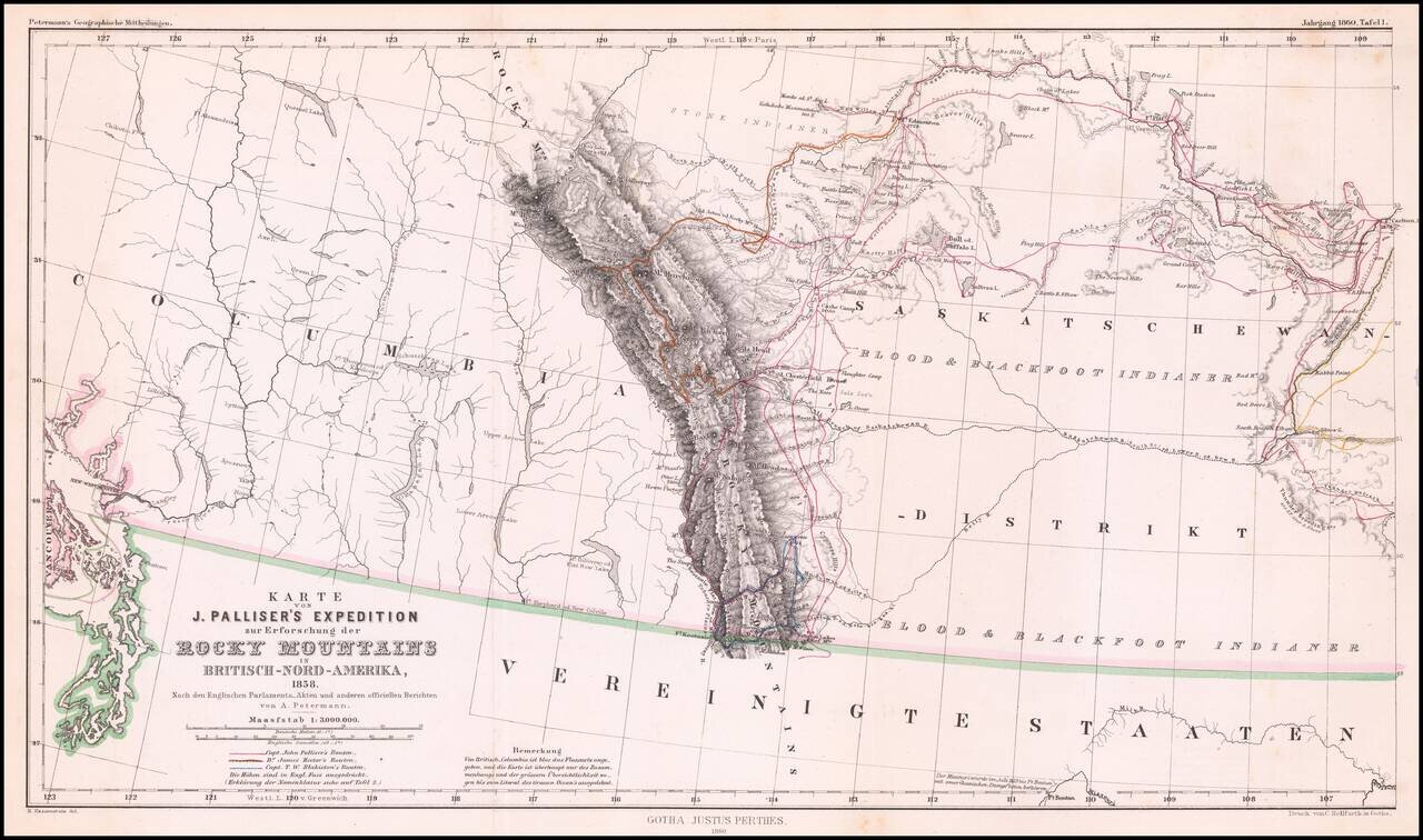
Detailed map of Western Canada illustrating the western part of Captain John Palliser's explorations in Western Canada, based upon Palliser's virtually unobtainable map published about three years earlier. The map shows the disputed boundary claim...
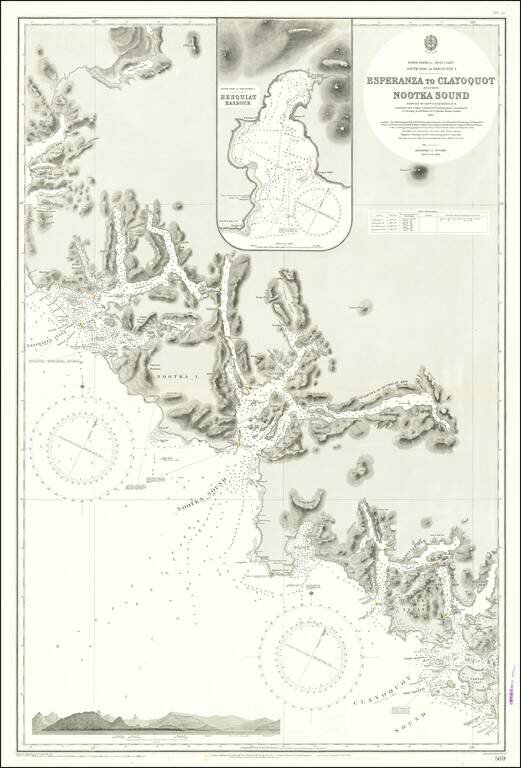
Finely detailed sea chart of a portion of the Western Coast of Vancouver Island, published by the British Admiralty. The chart is centered on Nootka Sound and extends north to Atluck Lake and the Fair Harbor area, and south to Vargas Island and...
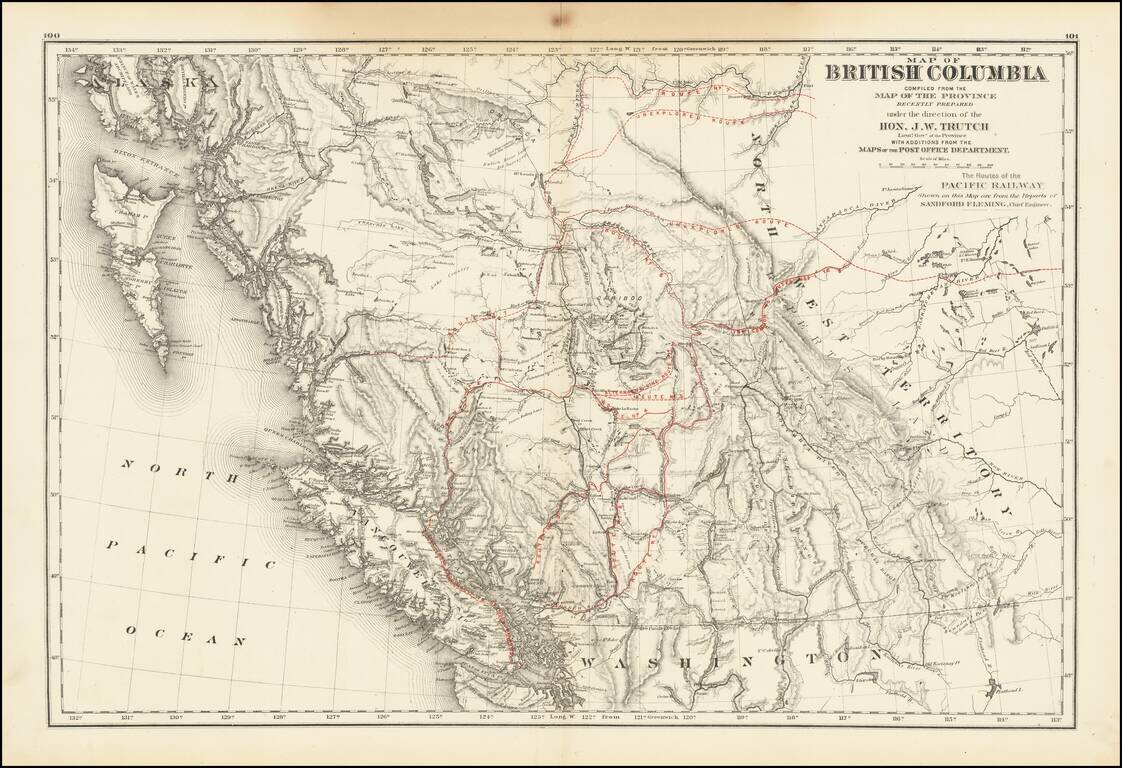
A historically important map of British Columbia after the province entered the Confederation which shows the proposed routes for the Canadian Pacific Railway. Following the establishment of the Canadian Confederation in 1867, Trutch worked to...
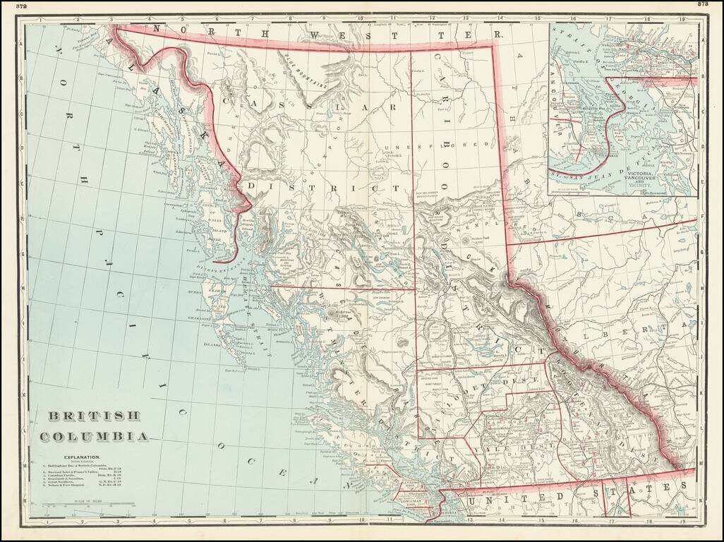
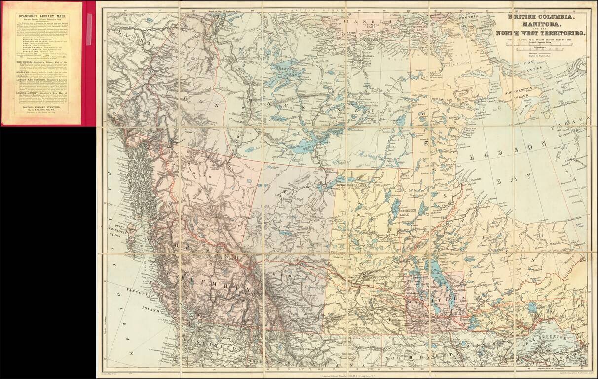
Fine large format map of British Columbia, published in Chicago by George Cram. Includes topographical features, towns, rivers, mountains and early railroads (completed and proposed) The map divides British Columbia into Districts, including...
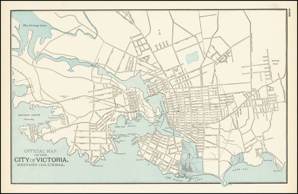
Detailed map of Victoria and environs, published by George Cram in Chicago. The map is centered on Victoria harbor, with a large Indian Reserve on the waterfront. The line of the E & N Railroad extends westward from downtown and a large park in...
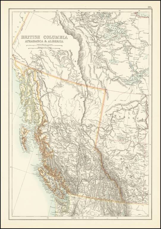
Scarce map of British Columbia and environs, published by A & C Black. The map provides excellent topographical detail for the region, illustrating lakes, rivers, mountains, etc. A number of rivers in the map are illustrated with dashed lines,...
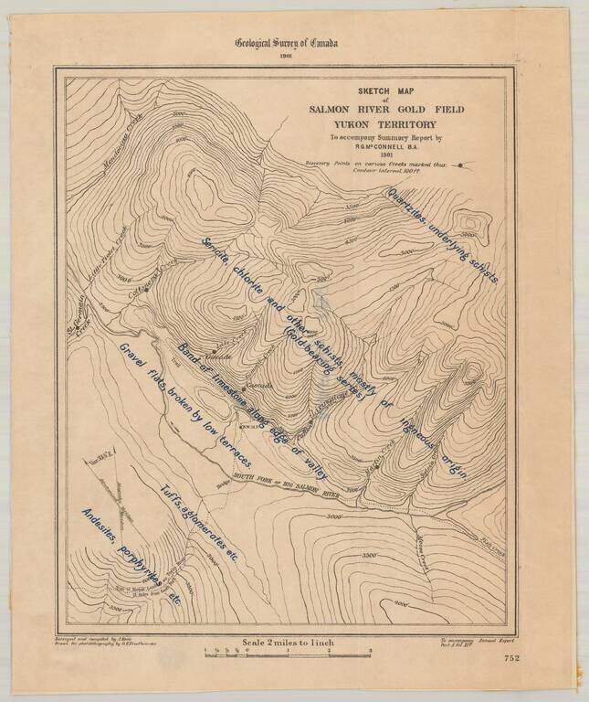
Detailed map of the Salmon River Gold Field, as surveyed by the Geological Survey of Canada. The map provides a highly detailed description, overlaid on a topographical map of the South Fork of Big Salmon River. The 1881 on strike on the Big Salmon...
Includes Early Annotations Detailed map of Canada, illustrating the route of the Grand Trunk Railway and Projected lines. The map illustrates the lines of the railway in red and the projected lines in a broken red line, extending to the Vancouver...
![[Victoria, B.C.] Vancouver Island -- Victoria Harbour Surveyed By Captn. G. H. Richards & The Officers of H.M.S. Plumper. 1859. The Entrance from a Survey by Lieut. B.M. Chambers. R.N. 1895. Amendments by Capt. J.F. Parry, H.M. Surveying Ship Egeria](/map/small/69236.jpg)
Finely executed British Admiralty Sea Chart, illustrating Victoria, British Columbia and environs. The chart shows a well developed waterfront around James Bay and the Harbor, with an outline of the streets shown in great detail in interior. At the...
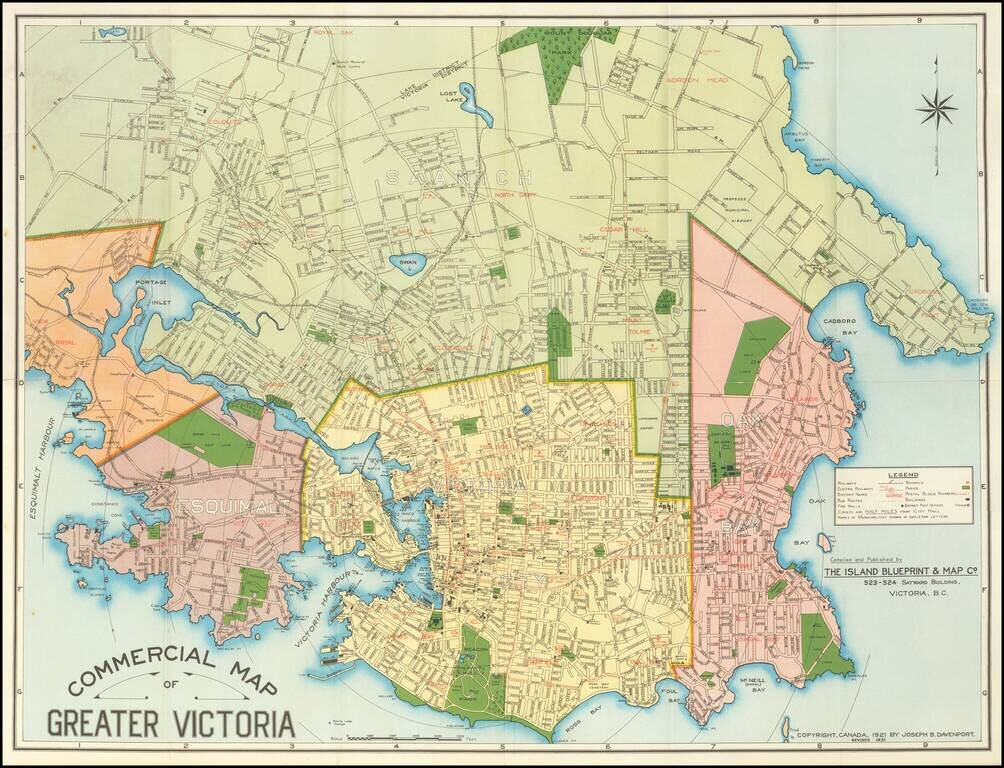
Detailed separately published map of Victoria, British Columbia, published by the Island Blueprint & Map Company. Shows railways, streetcar and bus lines, schools, fire halls, post offices and selected holdings. This is the second edition of the...
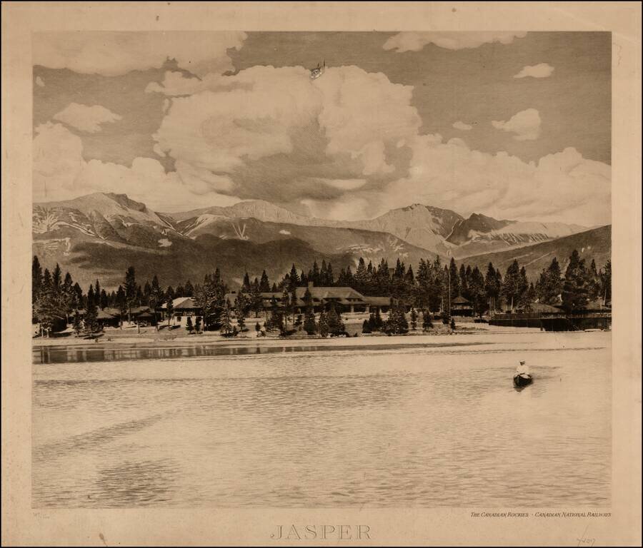
Striking engraving of the Jasper Park Lodge, celebrating its construction in 1921-22, with lake in the foreground, issued by the Canadian National Railroad. In 1813, a fur trade outpost named Jasper House was established by the North West Company at...
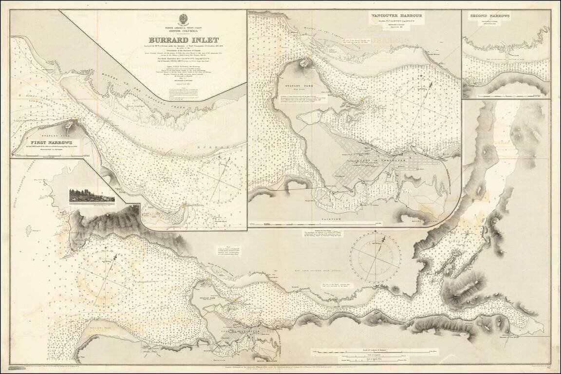
Attractive Chart Showing a Nascent City of Vancouver This is a navigational chart of the area around the Burrard Inlet on the Salish sea. The map, comprised of several detailed inlays, extends inland to Harrison Lake. Navigational detail on the map is...
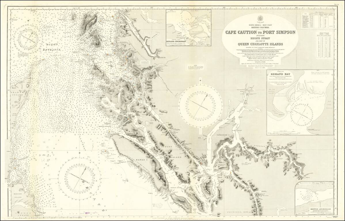
Detailed Coastal Chart of a section of British Columbia, published by the British Admiralty. The chart includes the southern part of Queen Charlotte Island in the west and extends from Bramham Island and Allison Harbor area in the south to the area...
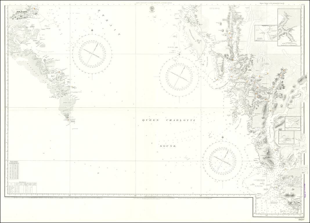
Large engraved chart of the Pacific coast of British Columbia just below the border with Alaska. The map covers the area known as the Hecate Strait between Graham Island and the archipelago to the east. There are extensive soundings and some...
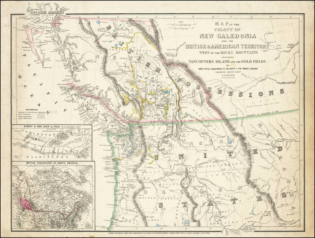
First State of this Exceptional Fraser Canyon Gold Rush Rarity One of the great early mappings of the Pacific Northwest, covering Oregon Territory, Washington Territory, and British Columbia (which was then still "New Caledonia") with information...