Map size in jpg-format: 33.2368MiB
Click to open in high resolution (open in new tab).
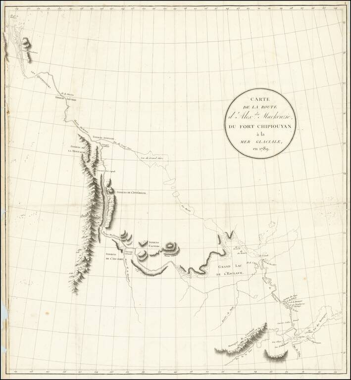
Exploring the River Which Would Bear His Name
Nice example of the French edition of Alexander Mackenzie's route map between Lake Athabasca to the Arctic Sea in 1789.
Alexander Mackenzie was the first European to cross the North American continent north of Mexico, thereby ending the hope of finding a Northwest Passage between the Pacific Ocean and Hudson Bay. His exploration was a milestone in the cartographic history of North America.
The map appeared in Voyages dans l'intérieur de l'Amérique septentrionale, faits en 1789, 1792 et 1793. Précédés d'un Tableau historique et politique sur le commerce des Pelleteries, dans le Canada.
Alexander Mackenzie: 1788-1789
On behalf of the North West Company, Mackenzie traveled to Lake Athabasca to replace Peter Pond. Upon his arrival in 1788, he was one of the founders of Fort Chipewyan.
Sent to replace Peter Pond, one of the partners in the North West Company, he learned from Pond that the First Nations people understood that the local rivers flowed to the northwest. Thinking that it would lead to Cook Inlet in Alaska, he set out by canoe on the river known to the local Dene First Nations people as the Dehcho, which would become known as the Mackenzie River. After a journey of 12 days, he reached the Arctic Ocean on July 14, 1789, establishing for the first time that there was no watercourse from the Hudson to the Pacific Ocean.
If you are a student, write to us in telegram: @antiquemaps and indicate what material you need and for what work you need a map in high detail. We are ready to provide material on special terms. For students only!

![Amer. Sep. No. 33. Partie De La Nouvelle Bretagne (Upper Missouri River, Lake Winnepeg, Lake of the Woods and Saskatehawan River]](/map/small/41687.jpg)
