Map size in jpg-format: 47.5469MiB
Click to open in high resolution (open in new tab).
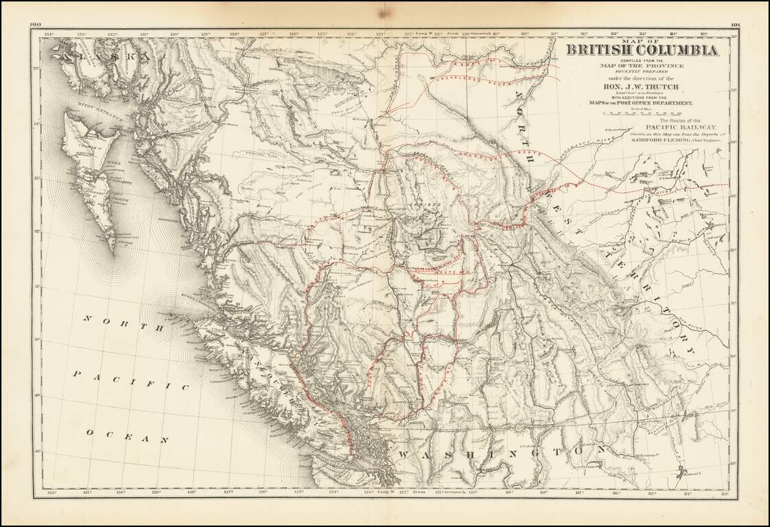
A historically important map of British Columbia after the province entered the Confederation which shows the proposed routes for the Canadian Pacific Railway.
Following the establishment of the Canadian Confederation in 1867, Trutch worked to negotiate British Columbia's entry, which occurred in 1871 after he secured a promise for the construction of the Canadian Pacific Railway (CPR). Trutch was the first Lieutenant Governor of British Columbia following Confederation, a position he retained from 1871-1876. Following his tenure as lieutenant governor, Trutch was appointed a "Dominion agent for British Columbia", and helped to oversee the construction of the CPR in the province.
The map locates the potential routes of the Canadian Pacific Railway (CPR).
On July 20, 1871, British Columbia became the sixth province to join Canada. In return for entering the Confederation, Canada absorbed B.C.'s massive debt and promised to build a railway from Montreal to the Pacific Coast within 10 years, ending a period in which the residents also debated joining the United States or remaining a British Colony. The last spike of the Canadian Pacific Railway was driven in Craigellachie in 1886. The completion of the CPR brought about a period of explosive growth in British Columbia that soon saw the province become Canada's third-most-populous province.
Rarity
Twice previously we have had examples of this map in which the potential route of the CPR is printed in black, like the rest of the map. In that variant, there are far fewer potential routes illustrated than in the present map.
See the other map here: www.raremaps.com/gallery/detail/40641
If you are a student, write to us in telegram: @antiquemaps and indicate what material you need and for what work you need a map in high detail. We are ready to provide material on special terms. For students only!

![Amer. Sep. No. 33. Partie De La Nouvelle Bretagne (Upper Missouri River, Lake Winnepeg, Lake of the Woods and Saskatehawan River]](/map/small/41687.jpg)
