logo

1901. Sketch Map of Salmon River Gold Field Yukon Territory To accompany Summary Report by R.G. McConnell B.A. 1901

  • Sketch Map of Salmon River Gold Field Yukon Territory To accompany Summary Report by R.G. McConnell B.A. 1901

Sketch Map of Salmon River Gold Field Yukon Territory To accompany Summary Report by R.G. McConnell B.A. 1901 information:

Year of creation: 
Resolution size (pixels): 
 2159x2569 px
Disk Size: 
 1195090B
Number of pages: 
 1
Place: 
 n.p.

Print information. Print size (Width x height in inches):
Printing at 72 dpi 
  29.99 х 35.68
Printing at 150 dpi 
 14.39 х 17.13
Printing at 300 dpi 
 7.2 х 8.56

An example of detailing the file of this map of in a printable high-resolution:

Click to open in high resolution (open in new tab).
Attention! this is just the central piece (central area 960x960 px) of the map file!
This is an example, so that you can see and study the level of detail of a given map. The entire Map will be fully available after payment!

Sketch Map of Salmon River Gold Field Yukon Territory To accompany Summary Report by R.G. McConnell B.A. 1901

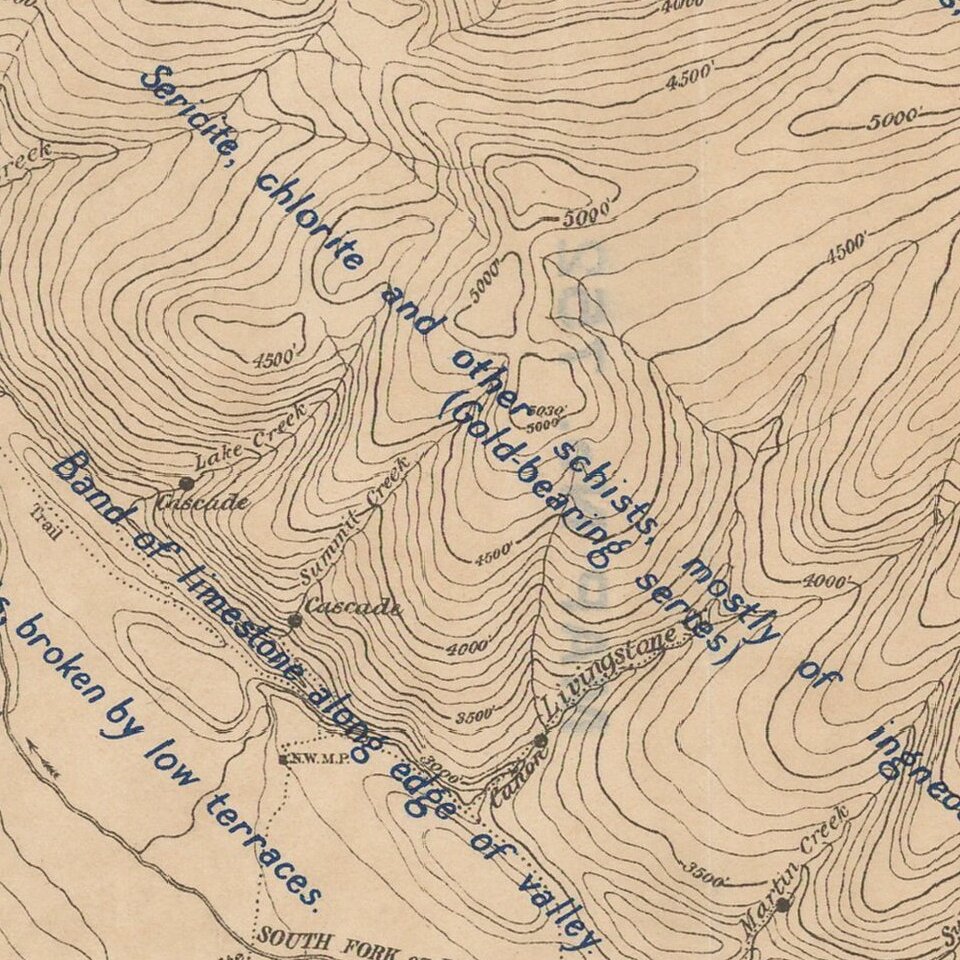
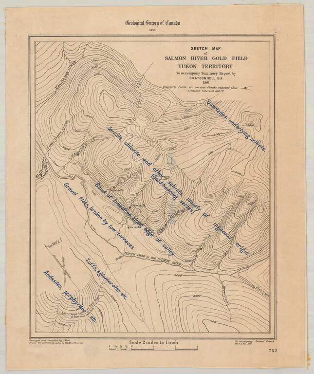
Detailed map of the Salmon River Gold Field, as surveyed by the Geological Survey of Canada.

The map provides a highly detailed description, overlaid on a topographical map of the South Fork of Big Salmon River.

The 1881 on strike on the Big Salmon River was the first payable quantity of placer gold discovered in the Yukon.


Special conditions for students!

If you are a student, write to us in telegram: @antiquemaps and indicate what material you need and for what work you need a map in high detail. We are ready to provide material on special terms. For students only!

Item information:

Year of creation:
Size:
2159x2569 px
Disk:
1195090B
Number of pages:
1
Place:
n.p.
Author:
Geological Survey of Canada.
$14.99

Related item