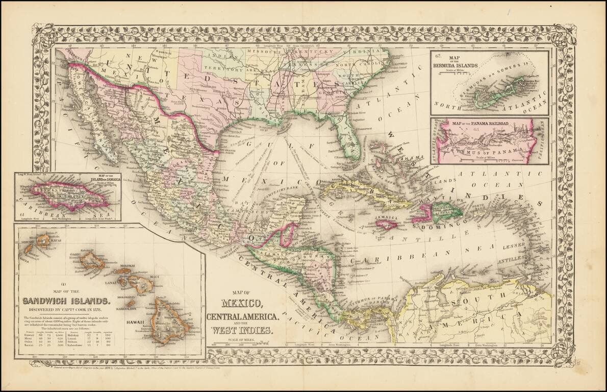
Rare and antique old maps of the North America
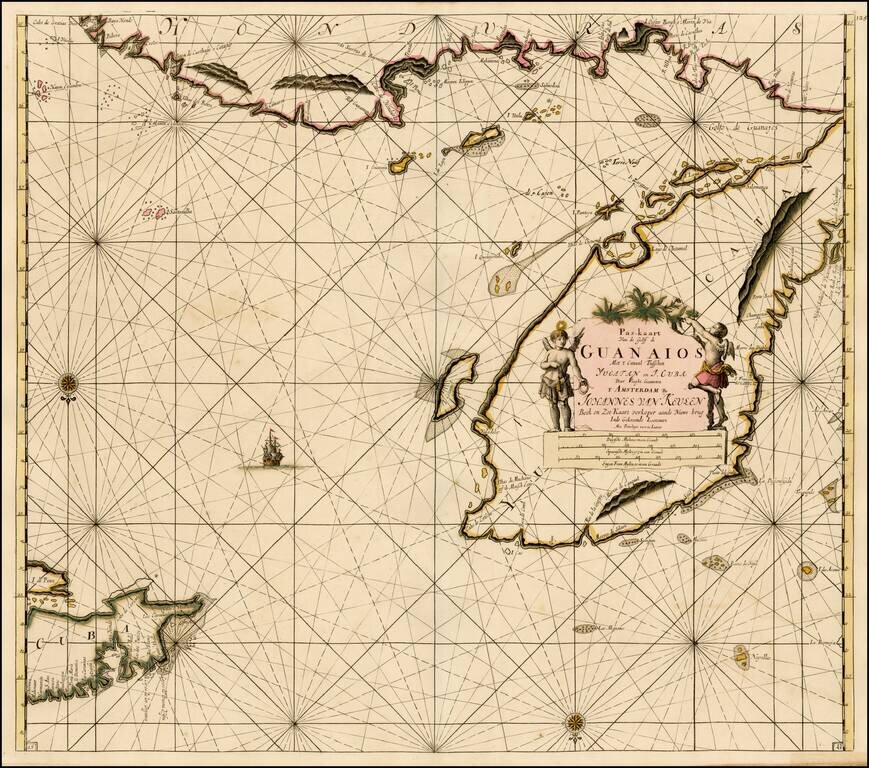
Fine old color example of Van Keulen's sea chart of the Yucatan and Vicinity, including Cozumel, and parts of the Coast of Belize, Nicaragua, Honduras and the western part of Cuba, from De Nieuwe Groote Lichtende Zee-Fakkel . . . . A very attractive...
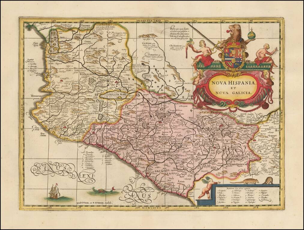
Fine example of the scarce Valk & Schenk map of Mexico . Gorgeous map of Mexico extending from just north of Mazatlan to Acapulco and from Tehuacan to the Sierra Madres, showing Mexico City, Puebla (Angelorum Civitas), Colima, Campostella,...
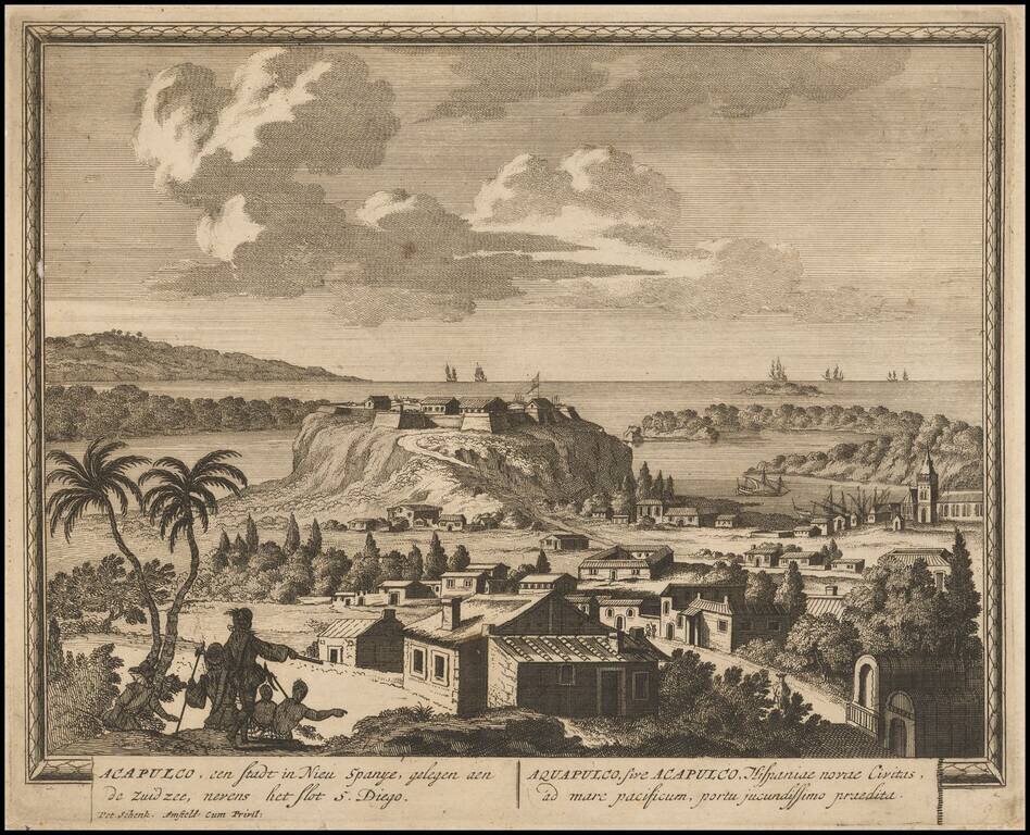
Rare early view of Acapulco, engraved by Schenk.
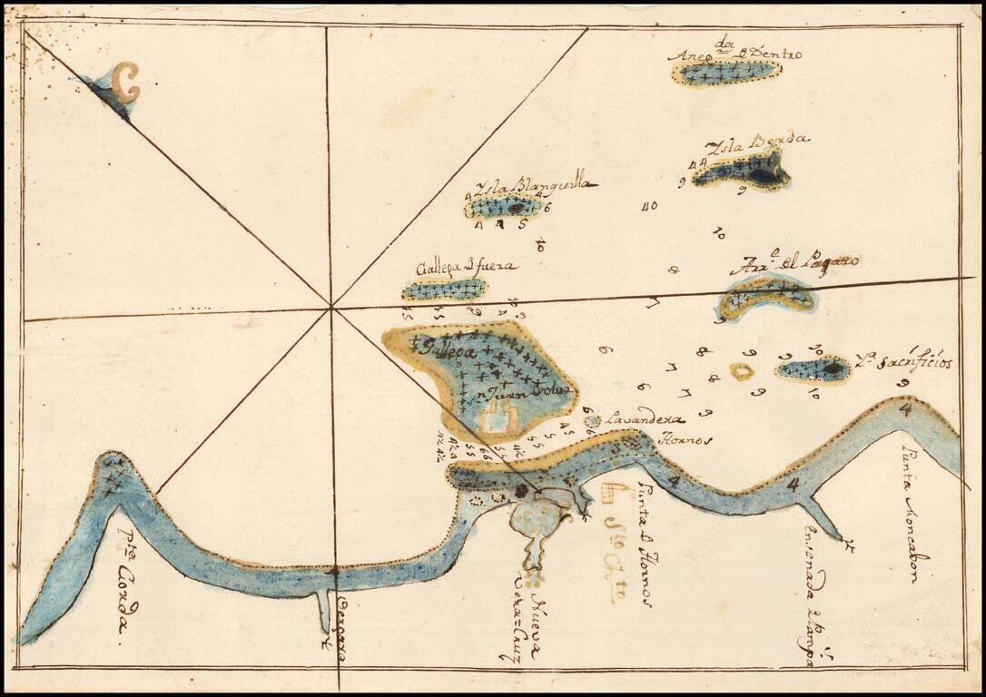
Fine Manuscript Chart of the Waters Around Veracruz, Mexico, including the Fortress of San Juan de Ulúa Nice manuscript chart of the waters surrounding the important port of Veracruz, Mexico. This chart was found laid in loosely in a Spanish edition...
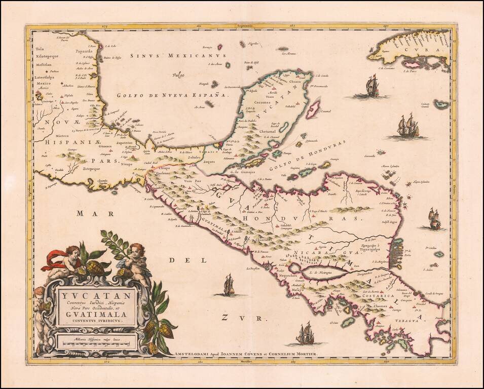
Rare example of Covens & Mortier's map of the Yucatan Peninsula. First issued by Joannes Blaeu, this edition is very rare on the market. This is one of the earliest Dutch maps to focus on the region centered on the Yucatan Peninsula. Includes...
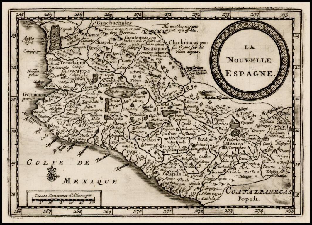
Rare map of central and western Mexico, published by Vander Aa. Mexico City is located on the banks of a large lake, and numerous gold and silver mines are scattered across the map. This map is from a revised copper plate originally engraved by Pieter...
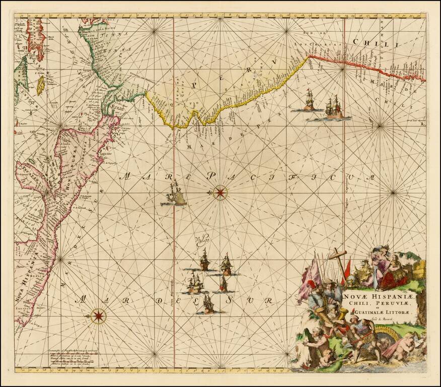
Nice example of this sea chart of the western coastlines of South and Central America, published by Louis Renard. The map covers the Pacific Coast from Xalisco, Mexico, to Puerta Bairres and Rio Cachapool in Chile, covering over two thirds of the...
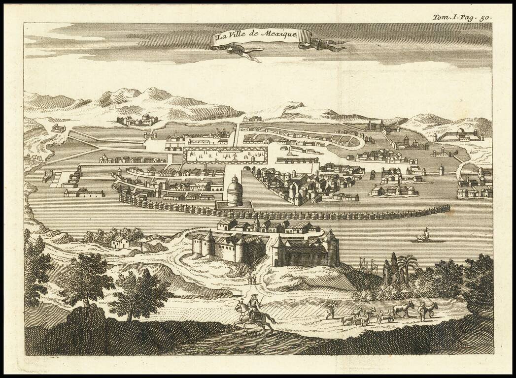
Engraved view of Mexico City, from an unidentified edition of Thomas Gage's voyages in New Spain, probably published circa 1720. This edition of the view has the binding note "Tom. I Pag. 50" in the upper-right corner. The city appears much as it did...
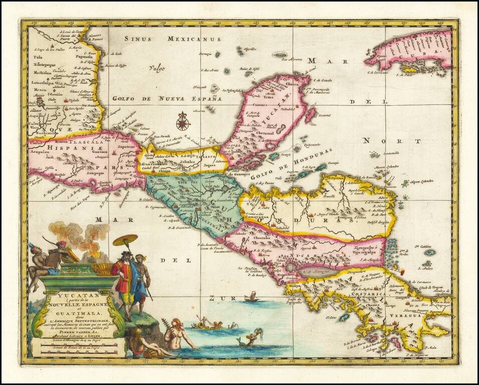
Rare early map of Central America and the Caribbean, published by Vander Aa in Amsterdam. Decorative map of the region from Mexico City to Panama City, extending to include part of Cuba, and is based on Blaeu's map of the Yucatan peninsula. Cozumel...
![Plan De Guadalaira Place Forte appartenant aux Espagnols dans la Nouvelle Espagne F. A. Wattenwyl fecit. 1730 [Manuscript Plan of Guadalajara, Mexico]](/map/small/32660.jpg)
A Proposal for Vauban Style Fortifications In Guadalajara, Mexico Fine early plan of the town and proposed fortifications of Guadalajara, Mexico, drawn by Watenwyll, who appears to be a trained engineer of Swiss or Austrian descent who was familiar...
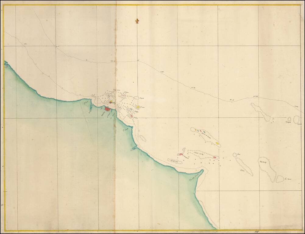
Fine Manuscript Chart of the Waters around Veracruz, Mexico Nice manuscript chart of the waters surrounding the important port of Veracruz, on Mexico's eastern coast. The simple yet aesthetically pleasing chart was meant to aid in navigation to and...
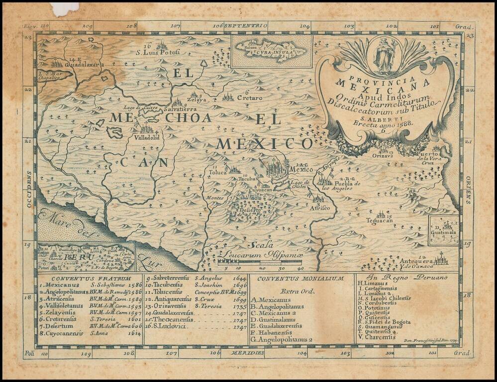
Rare Second State of Carmelite Province of Mexico in Blue Ink This is a very rare map of the central area of Mexico, illustrating the Discalced Carmelite convents of both friars and nuns and engraved by Domenico Franceschini. This is a rare second...
![[Manuscript Map, Michoacan, Mexico]](/map/small/65663ba.jpg)
18th Century Mexican Manuscript Map Describing A Dispute Over Water and Land Ownership Rights This manuscript describes the location of a disputed dam or weir near the stream of Chichipican de San Juan, which may be near Tzintzuntzan in Michoacán...
![[Untitled Map of Baja California & West Coast of Mexico]](/map/small/65439.jpg)
First Printing of Domingo del Castillo's 1541 Map of Baja and the West Coast of Mexico Fine example of Domingo del Castillo's map of Mexico, which appeared in Lorenzana's Historia de Nueva-España, escrita por su esclarecido conquistador Hernan...
![[Volcanos] The Bay of Honduras. By Thos. Jefferys Geographer to His Majesty](/map/small/70861.jpg)
With Volcanos in El Salvador and Guatemala shown Nice example of Thomas Jefferys chart of the coastline from Salamanca de Bacalar to Brewer's Lagoon and the Moskito Coast, centered on the Gulf of Honduras and the Rio Balize. Extends to the Port of...
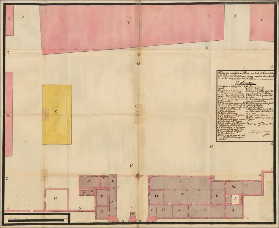
Manuscript Plan of Veracruz's Plaza Contaduria, the Accounting Place of Empire This is a plan of one of Veracruz's plazas. This particular plaza, Contaduria, was used to monitor commerce, as Veracruz was the most important port in New Spain. The plan...