Map size in jpg-format: 79.4498MiB
Click to open in high resolution (open in new tab).
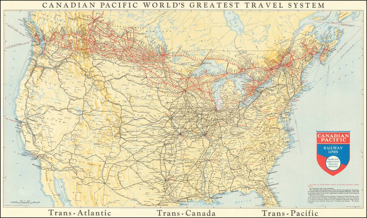
This is a map showing the railway lines of Canada and the US, with the lines operated by the Canadian Pacific Railway highlighted in red. Many different routes crisscross the map, and cities, towns rivers, and more are all named. The verso advertises several trips and itineraries offered by the railway company for tourists.
The Canadian Pacific Railway Company built and operated Canada's first transcontinental railroad, completed in 1885. Over the next few decades, additional lines were added throughout southern Canada and the northern US. The Railway expanded its operations to include steamship, aviation, and motorcar services. While the Company always focused on freight, it sought also sought to create its own market. Several tactics were introduced to draw more immigrant settlers into the plains (advertising Manitoba as the "Climate the Healthiest in the World"), with cheap and even free farms available in the least populated areas. The Company also sought to position itself as a leading tourism operator.
At the time this map was created, the Canadian Pacific Railway was operating lines throughout Canada and Vancouver Island, and down to Seattle, Spokane, Minneapolis, Chicago, Detroit, and Boston. The Railway also operated steamship services to Europe, Australia, and East Asia.
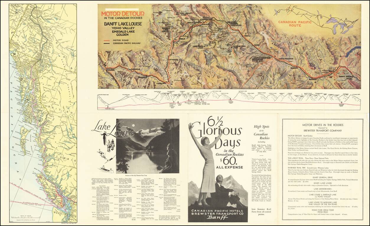
The itineraries on the verso are fascinating. For only sixty dollars, tourists could take a weeklong motorcar journey (covering 124 miles) throughout the Canadian Rockies, stopping both for scenery and for luxurious resorts. The brochure specifically advertises to those who "reside south of the 49th parallel" who get the additional experience of international travel. Accompanying maps depict this voyage and an inside passage route. The low costs of all these voyages would have been targeted at a Depression-era audience, wary of spending much money. These small charges would have been barely enough to cover company costs but allowed for the tourism industry to survive.
We are unable to locate other copies of this map.
If you are a student, write to us in telegram: @antiquemaps and indicate what material you need and for what work you need a map in high detail. We are ready to provide material on special terms. For students only!
![[The First Maps in a la poupée Printed Color] Cartes en Couleur des Lieux Sujets aux tremblements de Terre Dans toutes les parties du Monde Selon le Sisteme de l’impulsion Solaire](/map/small/52293op.jpg)

