Map size in jpg-format: 401.406MiB
Click to open in high resolution (open in new tab).
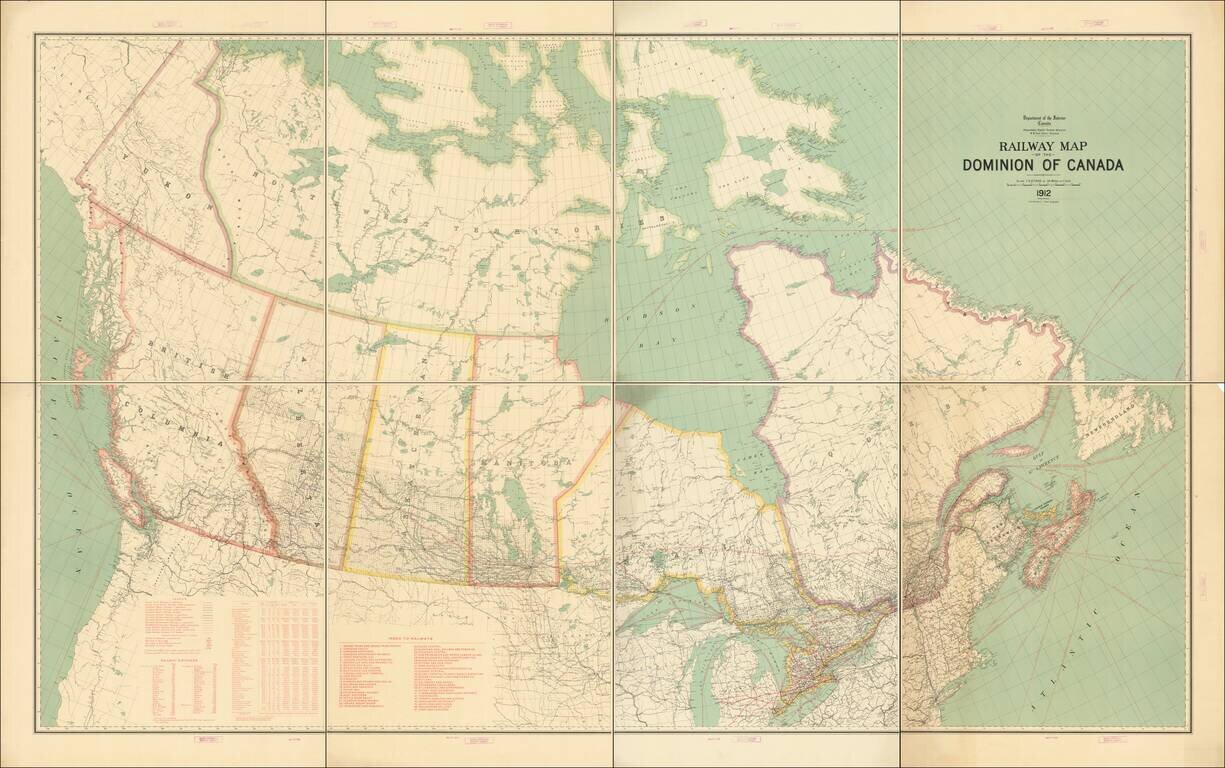
Fine example of this exceptional map of Canada, published by the Department of the Interior.
The map focuses on the Railway system in Canada and related statistical information.
Tables include:
Additional details on shipping distances from Vancouver, Quebec, and other East Coast Cities is also given, along with primary shipping routes in the Great Lakes.
Rarity
The map is scarce on the market. We locate only 1 example of the 1910 edition on the market in the past 10 years and no examples of the 1912.
If you are a student, write to us in telegram: @antiquemaps and indicate what material you need and for what work you need a map in high detail. We are ready to provide material on special terms. For students only!
![[The First Maps in a la poupée Printed Color] Cartes en Couleur des Lieux Sujets aux tremblements de Terre Dans toutes les parties du Monde Selon le Sisteme de l’impulsion Solaire](/map/small/52293op.jpg)

