Map size in jpg-format: 19.3123MiB
Click to open in high resolution (open in new tab).
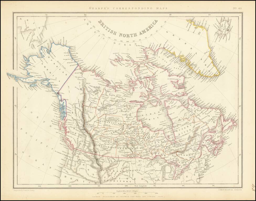
Scarce map of the British North America and Russian America (Alaska) published in London in 1848.
The far western portion of Canada is labeled simply "Columbia and extends from the US to Russian America, dominated by a speculative "Cook River."
A number of Hudson Bay Trading Company forts are shown.
If you are a student, write to us in telegram: @antiquemaps and indicate what material you need and for what work you need a map in high detail. We are ready to provide material on special terms. For students only!
![[The First Maps in a la poupée Printed Color] Cartes en Couleur des Lieux Sujets aux tremblements de Terre Dans toutes les parties du Monde Selon le Sisteme de l’impulsion Solaire](/map/small/52293op.jpg)

