Map size in jpg-format: 1.45114MiB
Click to open in high resolution (open in new tab).

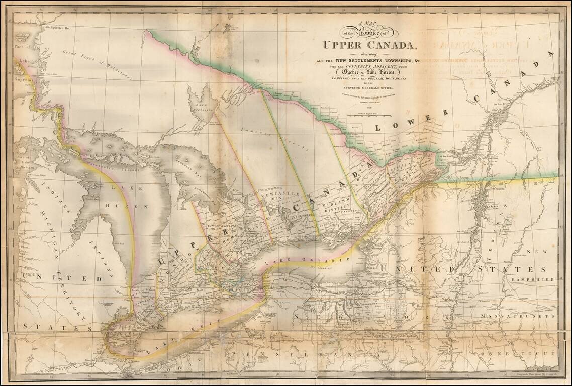
Highly detailed map of the Province of Upper Canada, originally published by David William Smyth and periodically revised over time.
Fine map of Upper Canada, showing detailed information on the counties, districts, townships, transportation systems, place-names and northern Ontario ('Great Tract of Wilderness') &c. It also includes portions of Quebec, Michigan Territory, New York, Pennsylvania. The 1838 issue includes additional rivers, lakes, place-names, roads and a railway from London to Hamilton.
First issued in 1800, with credits to David William Smyth, this is one of the most enduring maps of Canada. Smyth was the first Surveyor General of Canada and in 1799 wrote "A Short Topographical Description of His Majesty's Province of Upper Canada, In North America" which was sold with the map.
This map is the 1838 edition of the "Smyth Series" which went through 13 separate editions to 1858. Smyth's name was dropped from all editions after 1835. Faden published the map until 1818; Wyld published it after 1831. Longest publishing history of any map of the region (Farrell).
If you are a student, write to us in telegram: @antiquemaps and indicate what material you need and for what work you need a map in high detail. We are ready to provide material on special terms. For students only!
![[The First Maps in a la poupée Printed Color] Cartes en Couleur des Lieux Sujets aux tremblements de Terre Dans toutes les parties du Monde Selon le Sisteme de l’impulsion Solaire](/map/small/52293op.jpg)

