
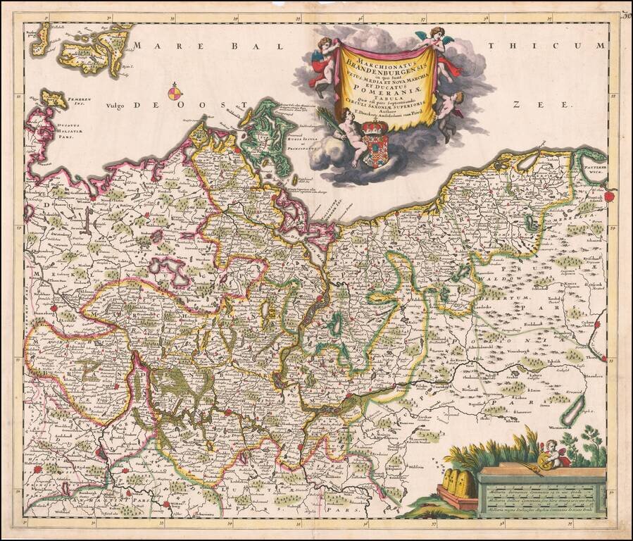
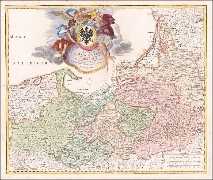
Fine old color example of Theodore Danckerts rare map the Brandenburg and Pomerania regions, published in Amsterdam. Extends east to Dantzig (Gdansk) and Chelm in Poland, to Donneberg and Magdeburg in the west. Cartouches depict coat of arms...
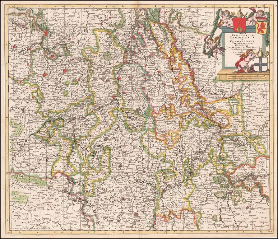
Fine old color example of Theodore Danckert's rare map of the area of the Lower Rhine and Maas Rivers. Major towns on the map include Cologne, Aachen, Bonn, Brussels, Antwerp, Liege, Ghent, Louven, Mechelen, Maastricht, Roermonde, Trier, Coblentz,...
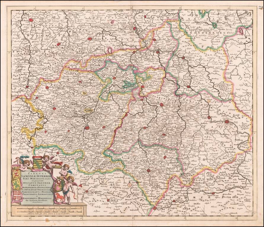
Fine old color map of parts of northcentral and eastern Germany, published by Justus Danckerts. Large cities on the map include: Erfurt Hall Leipzig Dresden Mansfeld Wittenburg Halberstat Magdeburg Mulhausen
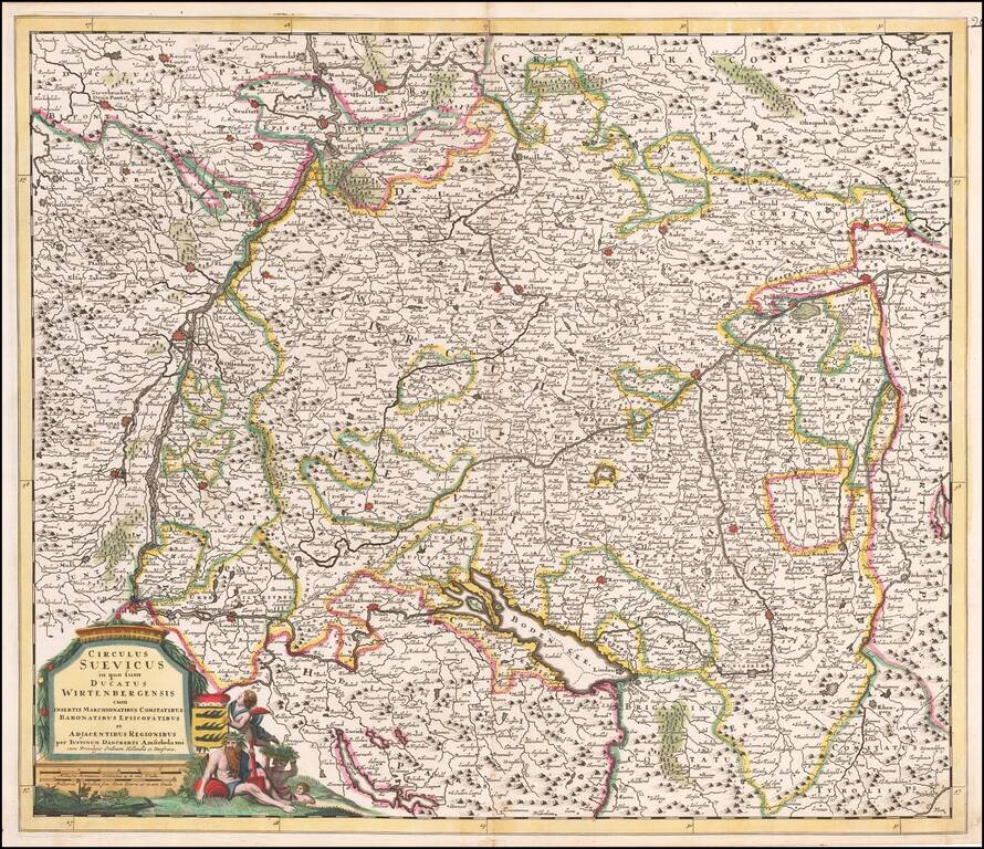
Antique Map of Souabia and Environs Detailed early map of Souabia.
![Hanc Ger[maniae et P]oloniae de[s ... ]em Serenissim [P]otentissimi Poloniae Regi August offert et inscribit Petrus Schenck](/map/small/64898.jpg)
With Portrait of the King of Poland and Lithuania Large engraved antique map of Poland, Lithuania and the Holy Roman Empire, by one of Amsterdam's most important mapmakers, Peter Schenk. The map includes a portrait of King Augustus II the Strong,...
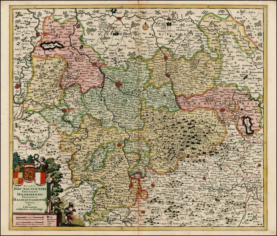
Detailed regional map of Germany, centered on Hanover, Holdesheim, Wolfenbuttel and Gottingen, and extending from Minden to Halberstadt. Includes a decorative cartouche with the coats of arms of Brunswick, Hildesheim, and Halberstadt.
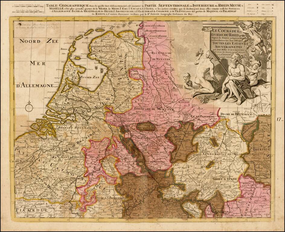
Detailed map the the Low Countries and Germany focusing on the course of the Rhine River.
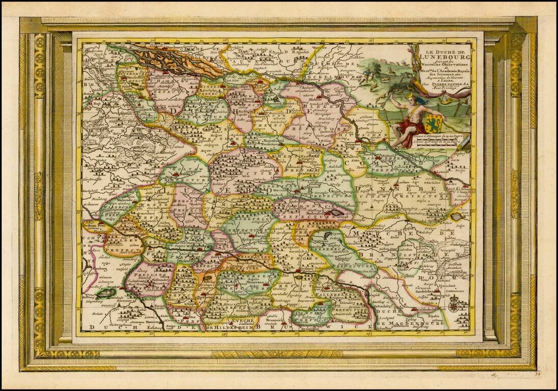
Decorative example of Vander Aa's map of the Duchy of Lunebourg. Nice example, with the picture frame border, which appeared in Vander Aa's Nouvelle Theatre Du Monde, published in 1713.
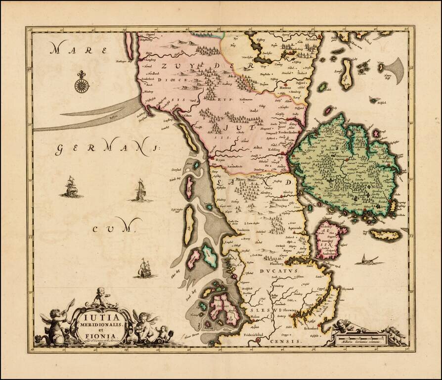
Rare map of the southern part of Jutland and the island of Fionia, published by Covens & Mortier. The map was originally issued by Hugo Allard, circa 1690. All editions are very rare on the market.
Detailed map the course of the Rhine River, from the Wesel area in the Duche of Cleves to Coblentz. Major towns in the region shown include Rheinberg, Duisberg, Dusseldorf, Leverkeusen, Cologne, and Bonn. Fine old color and 2 decorative cartouches.

Highly detailed map of the region including a striking old colored cartouche. Cities shown on the map include Frankfurt, Maintz, Coblentz, Nassau, Waldek, Cassel, Eysenach, Erfurt, Hirschfelt, Fuld, Schwinfurt, Bamberg, Wurtzburg, Wertheim. The map...
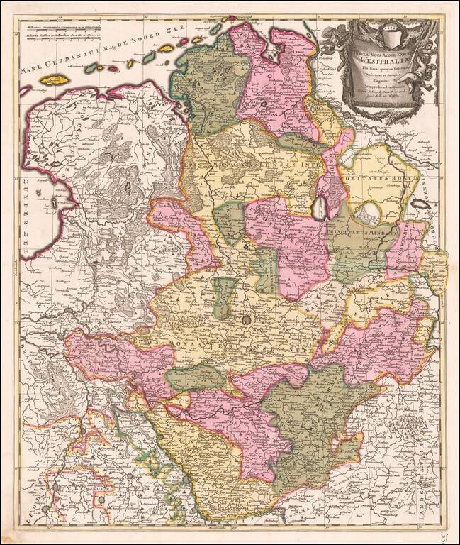
Fine old color example of Schenk's map of the northwestern part of Germany. The map is centered on Munster and extends south to the area arould Cologne, east to the Bishoprick of Paterborn and north to the North Sea.
Detailed map of the region centered on Erfurt. Also includes Gotha, Weimar, Schwartzburg, Halle, Jena, Mulhausen, etc.
Fine map of Bohemia, celebrating the inauguration of Fredrick I as King of Prussia on January 1, 1713. Gorgeous map of the Baltic region, from Memel to Pomerania, extending south to Poland. Centered on Dantzig, Konigsberg, Heilsperg, etc. Magnificent...
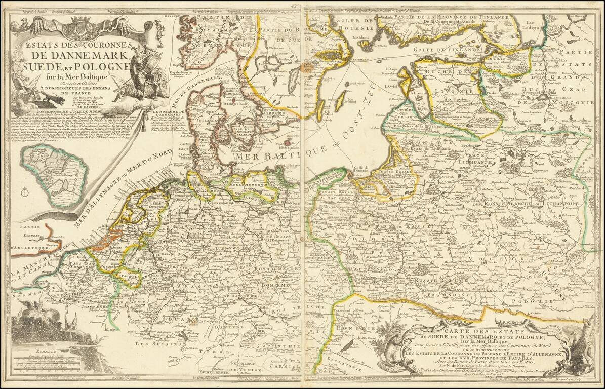
Scarce two sheet map of the Poland, the Baltic Sea and contiguous regions. The map includes a number of sea routes throughout the North Sea, Danish Sea and Baltic, ultimately connecting Finland and Latvia with Rotterdam, Friedrichstadt, Dantzig,...
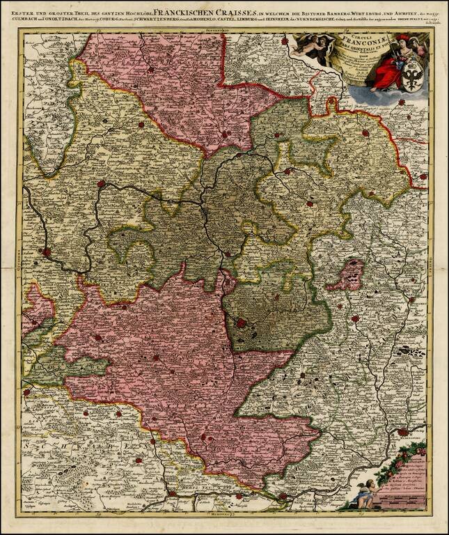
Striking regional map centered on Nuremberg and Bamberg. Extends from the Donau in the South (showing Regensberg, Ingolstatt and Nordlingen) to Eger, Hoff and Amberg in the East and Wurtzberg in the west. Large decorative cartouche w/coat of arms. A...