
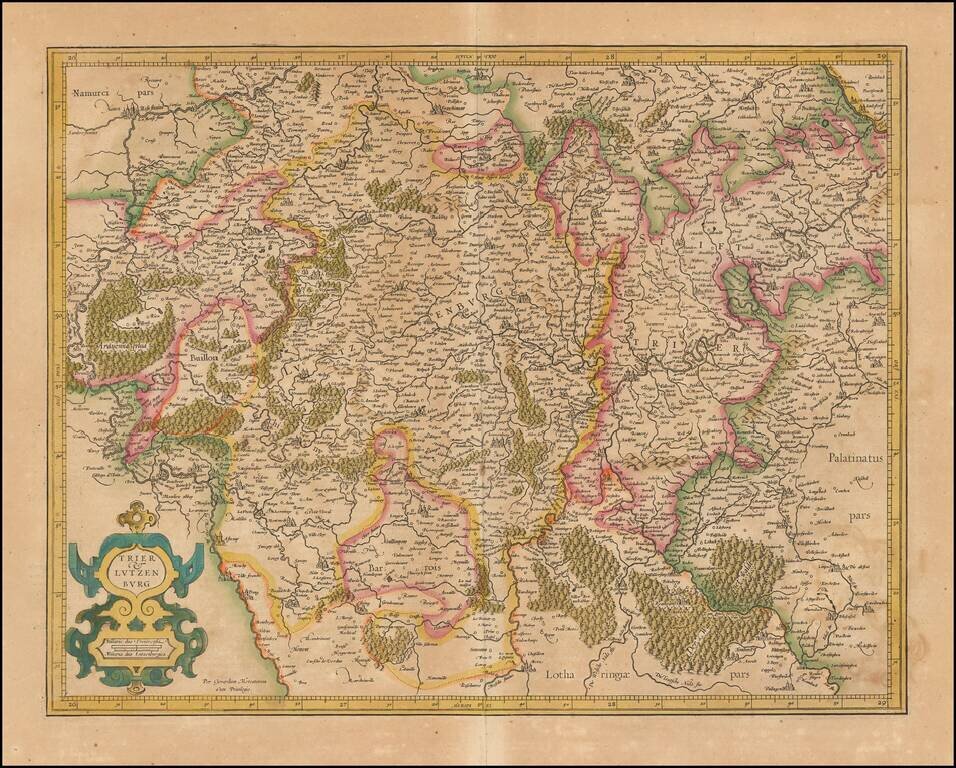
Nice old color example of Mercator's detailed map of Trier and Luxembourg.
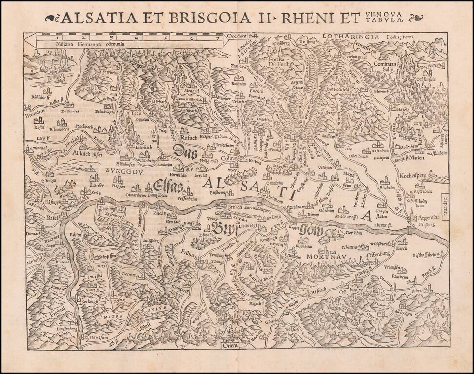
One of the earliest Modern Maps of the Rhine River Valley Detailed map of the Rhine River Valley, from Strasbourg and Argentina to Basel and Laufenberg, centered on Brisach and Kappel and showing Colmar. West is at the top of the map. The map is...
![[Swiss Cities] Decem Et Tria Loca Confoederatorum Helvetia](/map/small/54682mp2.jpg)
Braun & Hogenberg's set of 13 views of Swiss towns, first issued in 1572. The towns illustrated are Schwyz, Unterwalden, Zug, Glarus, Basel, Zurich, Bern, Lucerne, Uri, Fribourg, Solothurn, Schaffhausen, and Appenzell. Between 1291 and 1512, the...
![Gallia Narbonensis Ora Marittima Recenter descripta [and] Sabaudiae Et Burgundiae Comitatus descriptio . . .](/map/small/57206.jpg)
The regions include a detailed area map of the Avignon region on the upper Rhodanus River (and coastline from Narbone to Marseille) and the area around Lake Geneva, extending west to Lyon, and showing Grenoble, Geneva, San Moritz, and Torino (Italy)....
![Gallia Narbonens [on sheet with] Savaudiae Ducat. [on sheet with] Venuxini Comitatus Descr.](/map/small/61542.jpg)
Fine old color example. The regions include a detailed area map of the Avignon region on the upper Rhodanus River (and coastline from Narbone to Marseille) and the area around Lake Geneva, extending west to Lyon, and showing Grenoble, Geneva, San...
Fine example of Jan Baptiste Vrients' map of the Lake Geneva region, which first appeared in the 1608 edition of Ortelius' Theatrum Orbis Terrarum. A number of islands shown off the coast. Includes 3 sailing ships, a sea monster and 3 large...

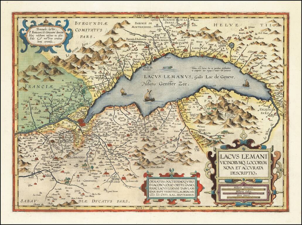
Striking regional map, centered on Lake Geneva, based upon a map from Abraham Ortelius's Epitome. The map is oriented with East at the top and extends to Basel and Strasbourg in the North, Turin and Grenoble in the south, and Dijon and Lyon in the...

Fine old color example of Theodore Danckerts rare map of the Upper Rhine Region, published in Amsterdam. Cartouche surrounded by cherubs.

An exceptional old color example of this scarce map of the Savoye region, topped by Lake Geneva. The color in this example is truly extraordinary. The map is adorned with a title cartouche decorated with a globe crowned with fleurs de lys and two...
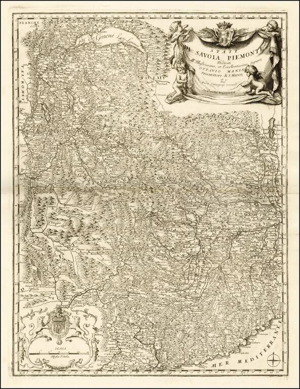
Fine example this striking map of Piemonte and Savoye, from Vincenzo Maria Coronelli's Corso Geographico, published in Venice. The map provides a fantastic image of the topography of the region, naming mountains, rivers, lakes, towns, castles, etc....
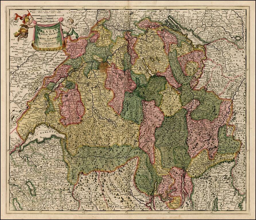
Decorative map of Switzerland, the Lake Geneva area and the areas around Lago Magiore, Lugano and Lago di Como and Bergamo. Includes a decorative title cartouche.
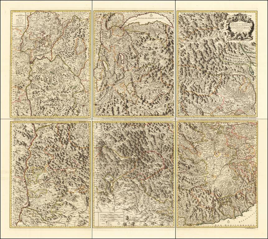
Rare 6-sheet map of the Savoy and Piemonte region, published by Pierre Mortier in Amsterdam. The map provide a highly detailed treatment of the topography of the region. Lake Geneva at the top center, with Monaco and the Italian Riviera at the bottom...

De L'Isle's map of the Rhine River and neighboring regions, from Strassbourg in the north to the Swiss Alps.
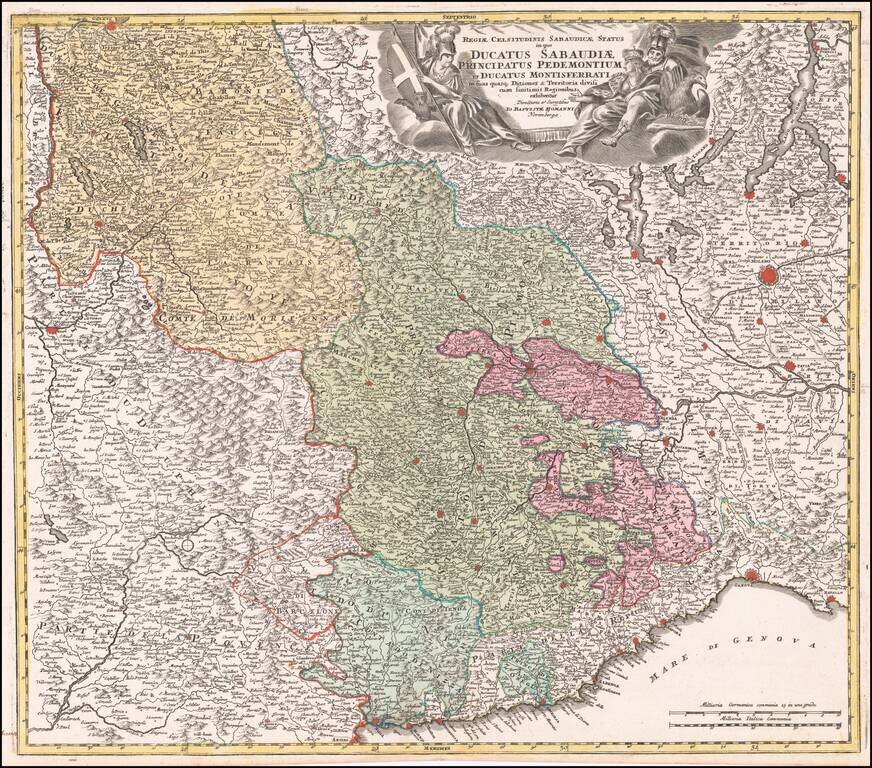
Striking example of Homann's decorative map of the Savoy and Piedmont regions, centered on Torino. The map coverage extends from Grenoble, Geneva, Die and Romans, to Genoa and Milan. Highly detailed, with excellent graphical representation of the...
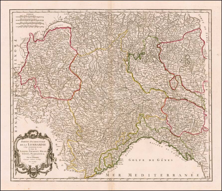
Highly detailed map of Northern Italy, Nice region and part of Switzerland, from DeVaugondy's Atlas Universel. Includes towns, mountains, rivers, lakes and a host of other details. Decorative cartouche. De Vaugondy's atlas was one of the most...
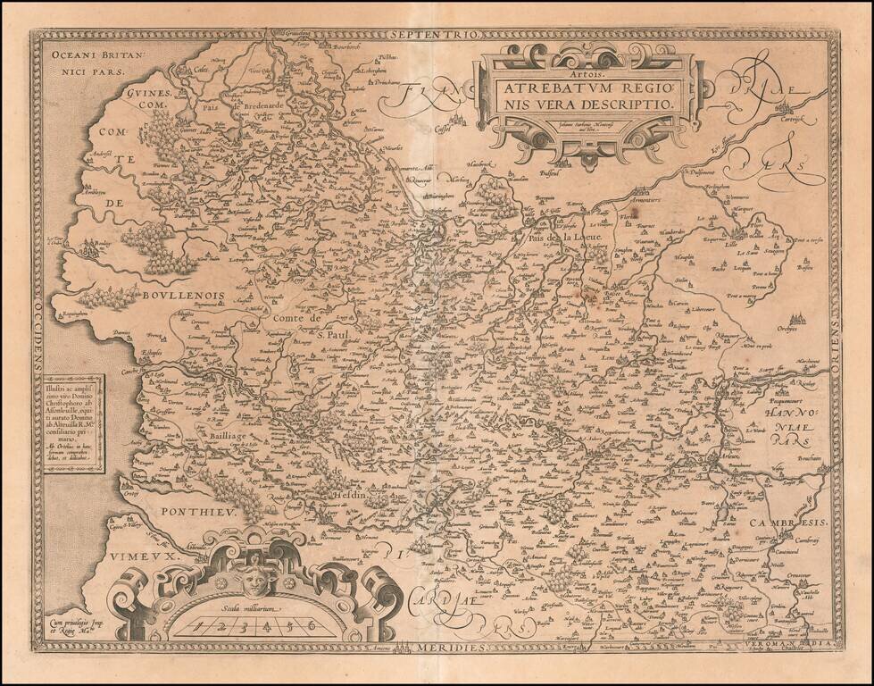
Detailed regional French map, extending from Abbeville Auxy and Cambray to Lille and Cales. Detail and cartouches consistent with Ortelius's usual cartographic skills.