Map size in jpg-format: 19.4143MiB
Click to open in high resolution (open in new tab).
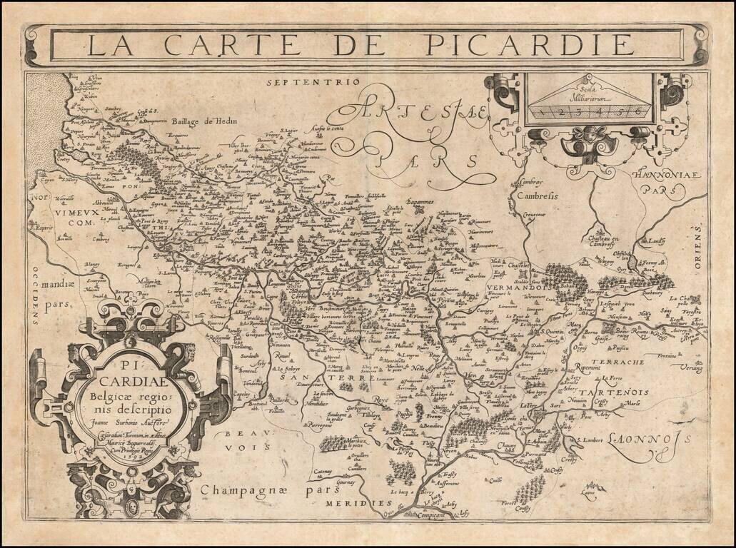
An Important Early Map of Picardy
Rare example of Francois Bougereau's map of Picardy region of France, published in Tours, from his Le Theater Francoys.
The map is centered on the Somme River, extending from its source near Vermandois to the sea.
The map was engraved by Gabriel Tavernier, with his initials (GT) in the lower center of the cartouche.
Picardy part of Hauts-de-France, is an historical region of northern France, stretching north from the suburbs of Paris and vineyards of Champagne to the beaches of the Bay of Somme on the English Channel. The regional capital is Amiens.
If you are a student, write to us in telegram: @antiquemaps and indicate what material you need and for what work you need a map in high detail. We are ready to provide material on special terms. For students only!
![Carte d'Etude [Study Map]](/map/small/66795.jpg)
![Orange [Vauban Style Fortress]](/map/small/62043.jpg)
