Map size in jpg-format: 41.0843MiB
Click to open in high resolution (open in new tab).
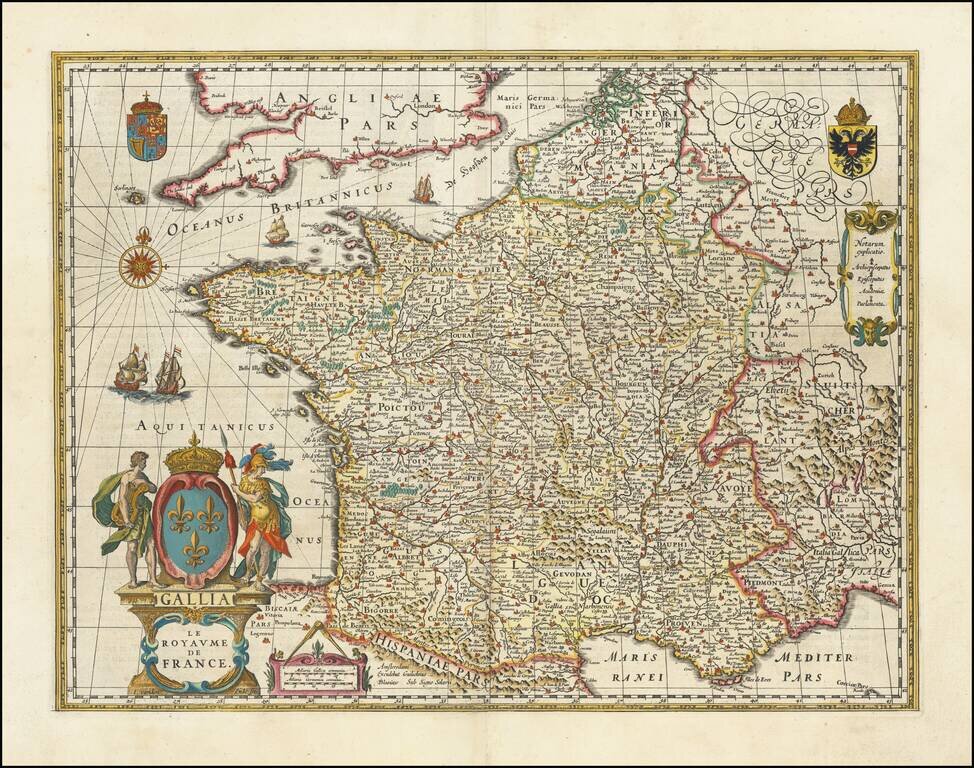
Rare edition of Blaeu's 1607 map of France, modified by Blaeu for publication in his 1631 Atlas Appendix, prior to completion of his updated map of France which appeared thereafter.
The map was first published with border figures in 1607. When Blaeu needed a folio size map of France for his first atlas in 1631, he cut off the borders and a new narrow ornamental frame was engraved along both sides and the upper edge of the map. The map content was extended further to the north and numeral indicating degrees of latitude were added.
The map is the work of the master engraver Josua van den Ende. The map is enhanced by the inclusion of a large title cartouche in the lower left corner, sailing ships, a compass rose and the English royal coat-of-arms above it, plus the German royal coat-of-arms and a small explanation table to the right margin.
Willem Janszoon Blaeu (1571-1638) was a prominent Dutch geographer and publisher. Born the son of a herring merchant, Blaeu chose not fish but mathematics and astronomy for his focus. He studied with the famous Danish astronomer Tycho Brahe, with whom he honed his instrument and globe making skills. Blaeu set up shop in Amsterdam, where he sold instruments and globes, published maps, and edited the works of intellectuals like Descartes and Hugo Grotius. In 1635, he released his atlas, Theatrum Orbis Terrarum, sive, Atlas novus.
Willem died in 1638. He had two sons, Cornelis (1610-1648) and Joan (1596-1673). Joan trained as a lawyer, but joined his father’s business rather than practice. After his father’s death, the brothers took over their father’s shop and Joan took on his work as hydrographer to the Dutch East India Company. Later in life, Joan would modify and greatly expand his father’s Atlas novus, eventually releasing his masterpiece, the Atlas maior, between 1662 and 1672.
If you are a student, write to us in telegram: @antiquemaps and indicate what material you need and for what work you need a map in high detail. We are ready to provide material on special terms. For students only!
![Carte d'Etude [Study Map]](/map/small/66795.jpg)
![Orange [Vauban Style Fortress]](/map/small/62043.jpg)
