Map size in jpg-format: 35.5633MiB
Click to open in high resolution (open in new tab).
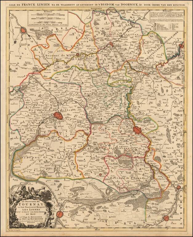
A fine example of Jaillot's map of the border area between France and Belgium with the towns of Tournai, Lille, Ipres, Douay, Condé and others.
The map also locates smaller towns, churches, religious schools, residential areas, castles, cabarets, windmills, bridges, water ways, and roads.
Includes a decorative title cartouche with cherubs.
Alexis-Hubert Jaillot (ca. 1632-1712) was one of the most important French cartographers of the seventeenth century. Jaillot traveled to Paris with his brother, Simon, in 1657, hoping to take advantage of Louis XIV's call to the artists and scientists of France to settle and work in Paris. Originally a sculptor, he married the daughter of Nicholas Berey, Jeanne Berey, in 1664, and went into partnership with Nicholas Sanson's sons. Beginning in 1669, he re-engraved and often enlarged many of Sanson's maps, filling in the gap left by the destruction of the Blaeu's printing establishment in 1672.
If you are a student, write to us in telegram: @antiquemaps and indicate what material you need and for what work you need a map in high detail. We are ready to provide material on special terms. For students only!
![Carte d'Etude [Study Map]](/map/small/66795.jpg)
![Orange [Vauban Style Fortress]](/map/small/62043.jpg)
