Map size in jpg-format: 53.0054MiB
Click to open in high resolution (open in new tab).

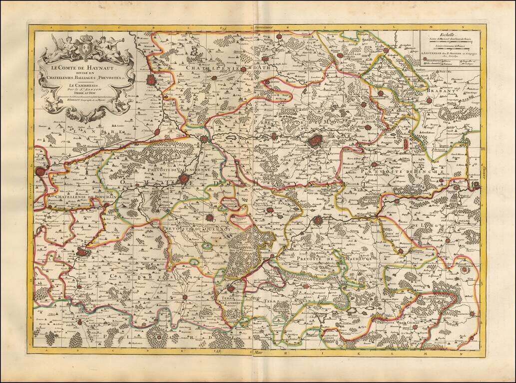
Detailed map of the French Hainaut region, published in Amsterdam.
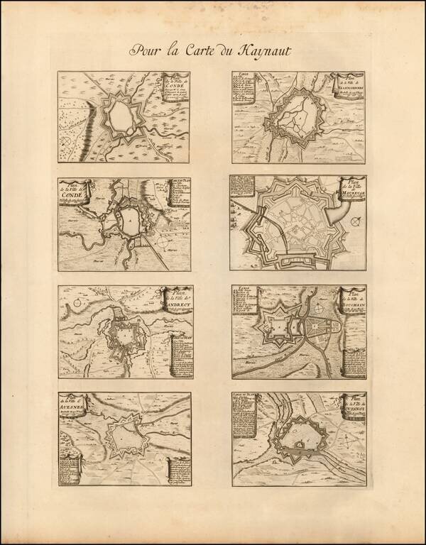
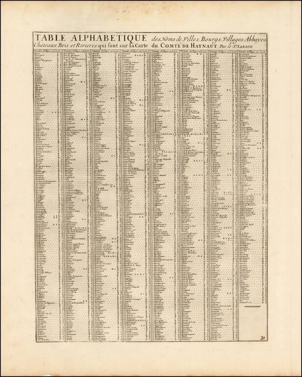
The map includes a second sheet, illustrating 8 fortified towns (2 of Conde, Valenciennes, Maubeuge, Landrecy, Bouchain, Auesnes and Quesnoi) and an Index page.
The map shows the region shortly after the 1679 Treaties of Nijmegen divided up the County of Hainaut.
French Hainaut is one of two areas in France that form the département du Nord, the easterly area. It corresponds roughly with the Arrondissement of Avesnes-sur-Helpe (east), Arrondissement of Cambrai (south-west) and Arrondissement of Valenciennes (north-west).
Until the 17th century it was an integral part of the County of Hainaut, ruled by the Burgundians and later the Habsburgs. In a series of wars between France and Spain, this southern part of Hainaut was conquered by France, together with the adjacent smaller Cambresis or the Bishopric of Cambrai to the south-west, loosely associated with it, and the similar area to these two combined in the west, southern Flanders, which borders on the English Channel (French: la Manche). Together these formed the French province of Flandre immediately before the French Revolution, which became the current Nord département.
The 1659 Treaty of the Pyrenees and the 1679 Treaties of Nijmegen cut the County of Hainaut in two parts. The southern area, around the towns of Valenciennes, Le Quesnoy and Avesnes, was ceded to France under King Louis XIV (see French Hainaut). The northern area, around Mons, remained under Spanish Habsburgs, and was then part of the Austrian Netherlands after the 1713 Treaty of Utrecht. The Habsburg Emperors ruled it until 1794, when it was absorbed into the French First Republic.
Pierre, or Pieter, Mortier (1661-1711) was a Dutch engraver, son of a French refugee. He was born in Leiden. In 1690 he was granted a privilege to publish French maps in Dutch lands. In 1693 he released the first and accompanying volume of the Neptune Francois. The third followed in 1700. His son, Cornelis (1699-1783), would partner with Johannes Covens I, creating one of the most important map publishing companies of the eighteenth century.
If you are a student, write to us in telegram: @antiquemaps and indicate what material you need and for what work you need a map in high detail. We are ready to provide material on special terms. For students only!
![Carte d'Etude [Study Map]](/map/small/66795.jpg)
![Orange [Vauban Style Fortress]](/map/small/62043.jpg)
