Map size in jpg-format: 7.83119MiB
Click to open in high resolution (open in new tab).

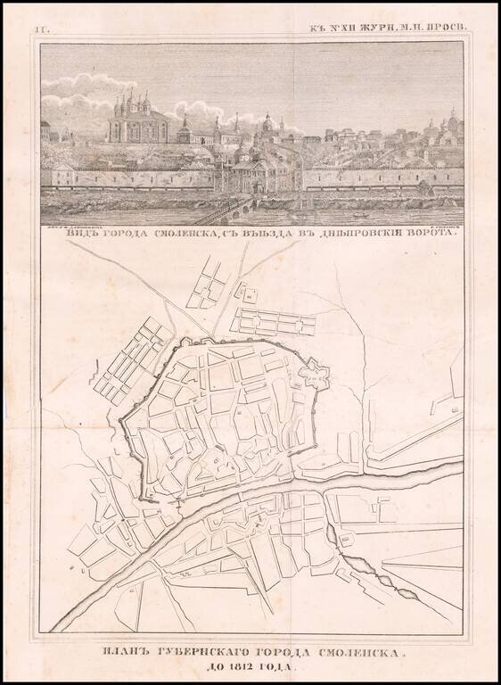
Rare engraved map of Smolensk on the Russian border with Belarus, published in 1812.
Above the map is a view of the city titled "Видъ города смоленска, съ въезда въ днепровския ворота." (View of the City of Smolensk from the entrance to the Dnieper gate.)
The map was almost certainly created in relation to Napoleon's invasion of Russia and the 1812 Battle of Smolensk.
If you are a student, write to us in telegram: @antiquemaps and indicate what material you need and for what work you need a map in high detail. We are ready to provide material on special terms. For students only!
![[Signed Political Satire Artwork] Vietnam ... Vietnam ... Vietnam ...](/map/small/68726.jpg)

