
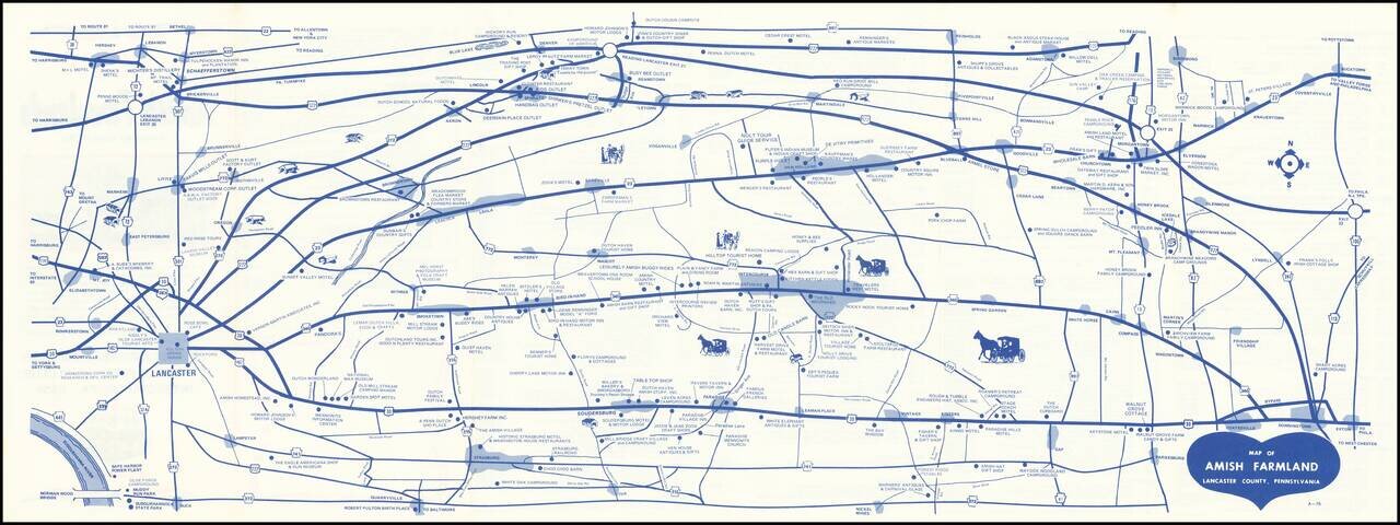
Early edition of this promotional map of the Amish Country. Interesting schematic style road map of the Amish Country, published to promote local businesses by the 340-23 Club. The verso notes that the Free Map of Amish Farmlands, Lancaster County,...
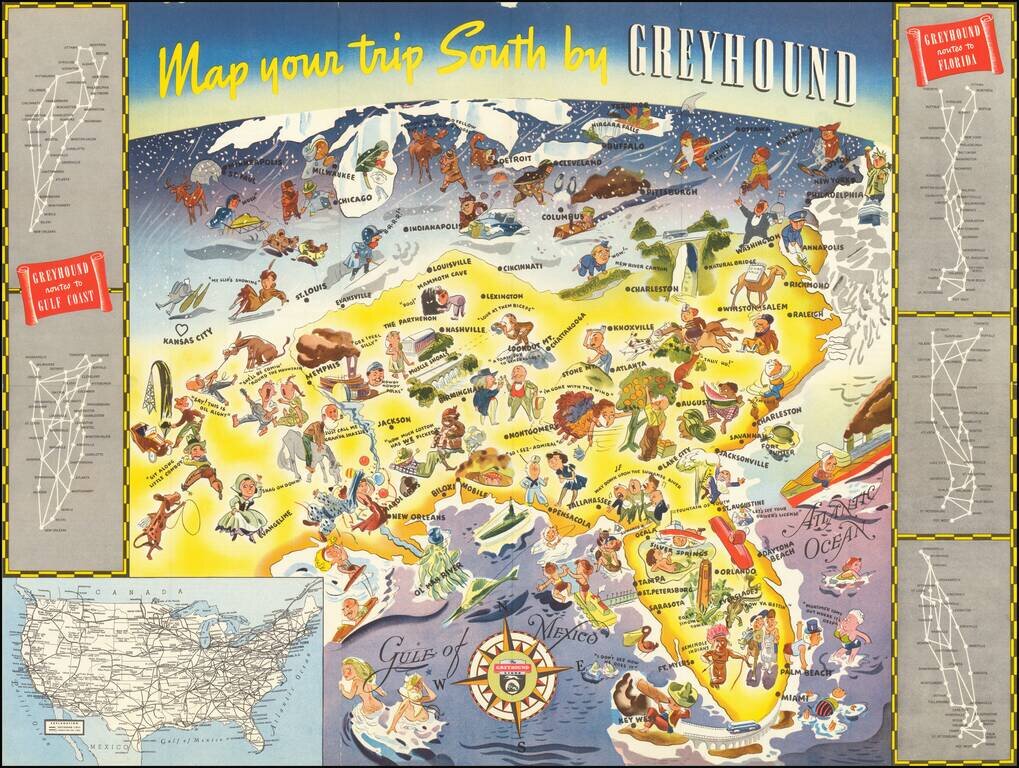
Whimsical map of the American South, promoting Greyhound's routes to Florida and the Gulf Coast in 1938. The image is dominated images of Florida tourist attractions, as well as other southern sites. Further north, the residents of the Midwest,...
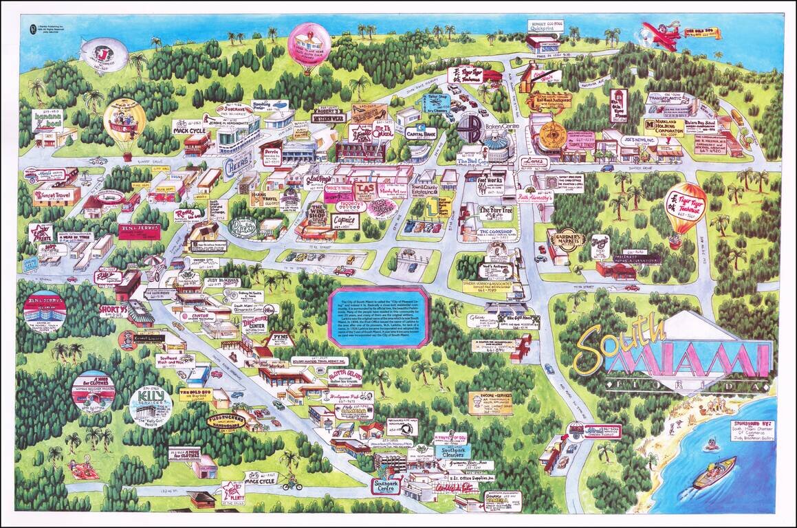
Fine pictorial map of South Miami, showing the neighborhood immediately south of the University of Miami. A fine whimsical mid-1980s image, filled with local advertising. The map shows what must have been one of the earliest Ben & Jerry's Ice...
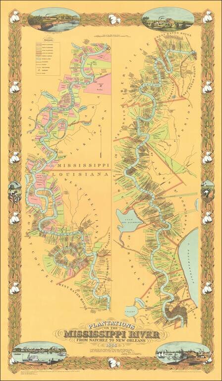
Fine limited edition copy of Norman's Chart of the Mississippi River from Natchez to New Orleans, also known as the Persac map. The map shows the divisions of land with owners’ names, vignettes of New Orleans, Baton Rouge and plantations, the...
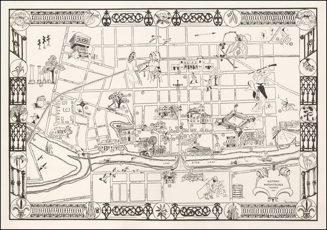
Decorative pictorial map of Natchitoches, Louisiana, by Thelma Z Kyser. Thelma Kyser was a life resident of Natchitoches, Louisiana, who seems to have been very active in Women's Physical Education and Health issues. We can find no information about...
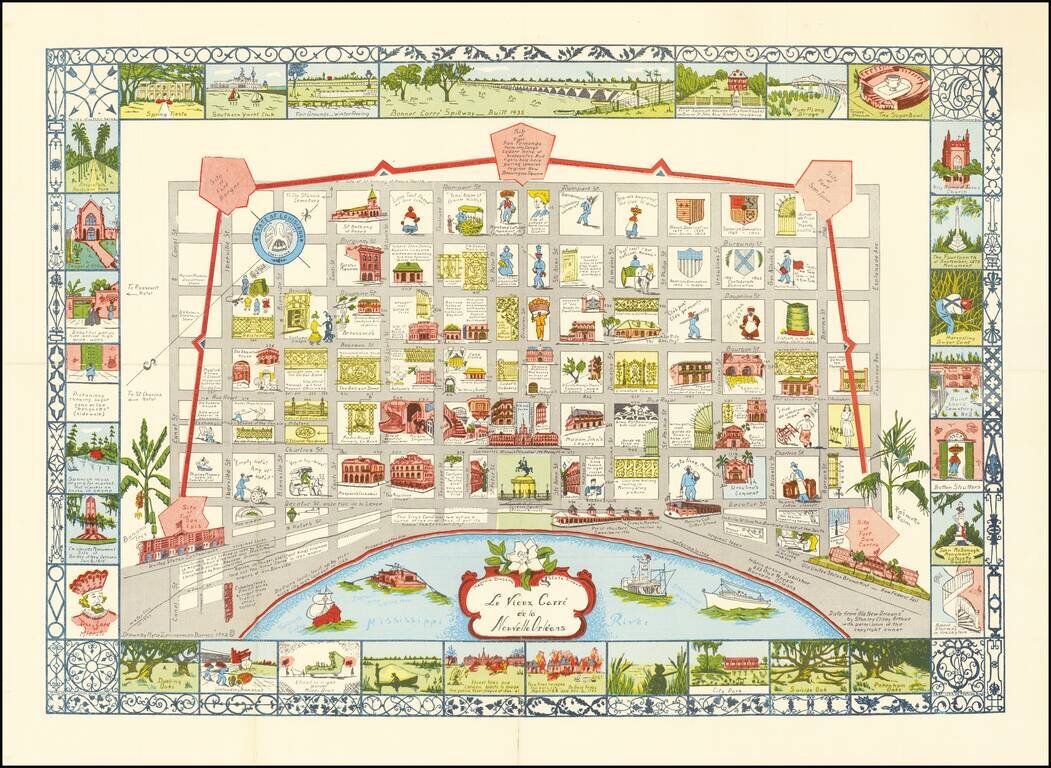
Scarce map of New Orleans, drawn by Myro Zimmerman Barnes in New Orleans in 1942. Includes a fabulous whimsical look at the city, with block by block vignettes of history, costumes and other clever caricatures.
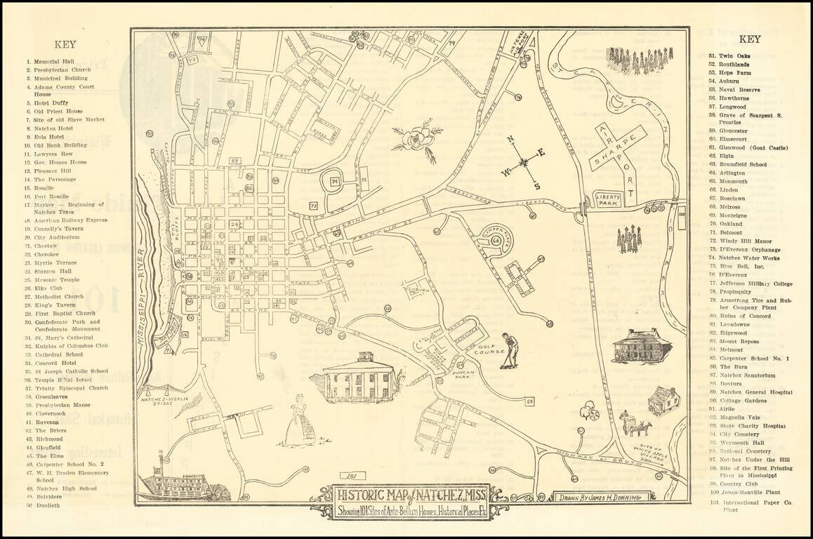
Scarce Pictorial map of the Natchez, Mississippi area, illustrating historical sites, extending frrom the Mississippi River to Sharpe Airport. On the verso, a key with points illustrating on the map is given.
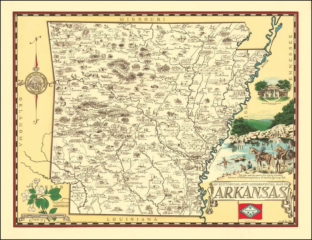
Rare pictorial map of Arkansas, drawn by Karl Smith. The map shows historic sites, locations of significant events, cities and towns, Indian settlements, agricultural products, industry, parks, historical trails, rivers, and recreational activities....

Scarce vintage pictorial map of Kentucky, celebrating the state's agricultural industries, produced by Karl Smith, one of the 1930s' prominent makers of state pictorial maps. The map features an exhaustive list of Kentucky's 120 counties at the time,...
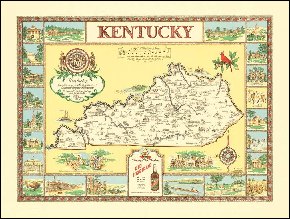
"The Dark and Bloody Ground" Rare pictorial map of the Kentucky, one of a number of different pictorial maps of Kentucky by the prolific illustrator Karl Smith. The map illustraes landmarks and historical events in the decorative panels which make up...
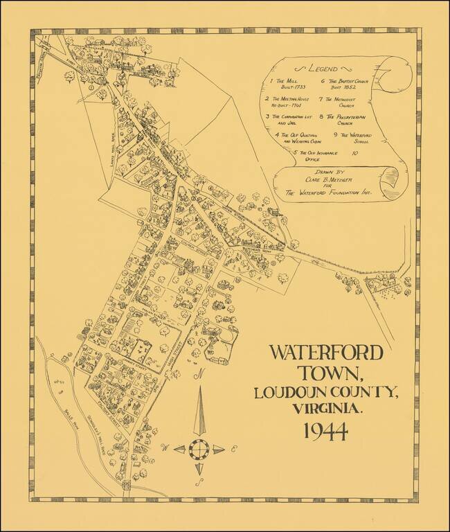
Interesting pictorial map of Waterford Town, Virginia, drawn by Clare B. Metzger for The Waterford Foundation. The present map is based the official map of the town, commissioned in 1875. The Acts of 1875 provided that the Waterford council should...

Lively pictorial map of Williamsburg, illustrating the town following its restoration "through the generosity of . . . John D. Rockefeller, Jr. and members of his family." The main map provides a fine overview of the town, with buildings named.
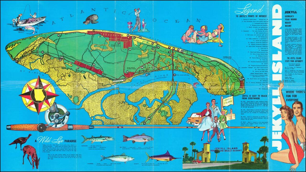
Pictorial map of Jekyll Island, Georgia, illustrating the island and its recreational activities. The map highlights the island's fishing, wildlife and golf activities, with photos on the verso.
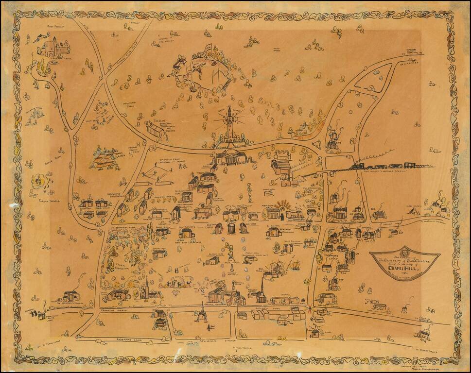
Impressive manuscript pictorial map of the University of North Carolina at Chapel Hill, drawn by Mary C. Dirnberger in 1933. The view is oriented with south at the top, at the bottom of the map it is bounded by Rosemary Street, at the top (south) of...
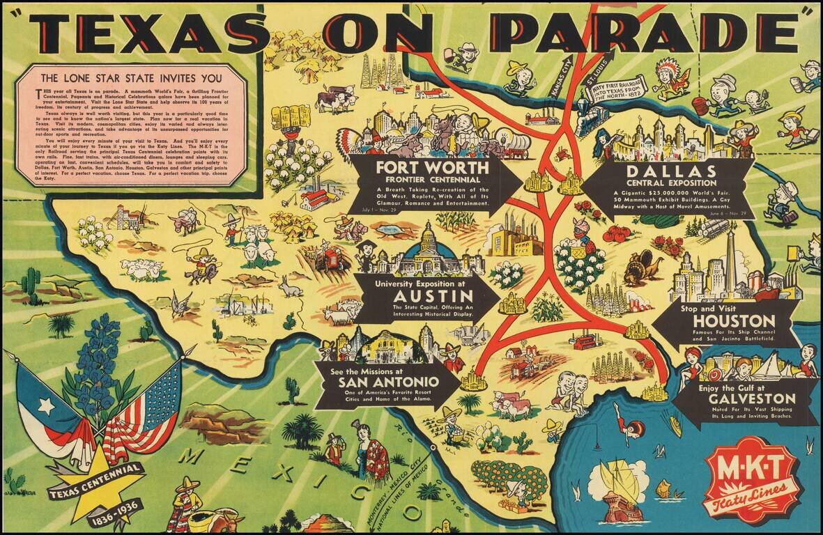
Rare Texas Centennial Pictorial Map, published by the MKT Katy Lines. The map highlights six destinations, Dallas, Houston, Austin, Galveston, San Antonio, and Fort Worth. The lively pictorial maps shows regional vignettes featuring the commerce and...
![[Original Texas Pictorial Map Artwork]](/map/small/65261.jpg)
Pictorial Artwork by Texas Artist Dick Spencer Lively hand drawn pictorial map of Texas, drawn by Dick Spencer. The map is drawn in an birdseye view style and is centered on Houston, Austin and San Antonio, with the Randolf (Army) Field at the...