
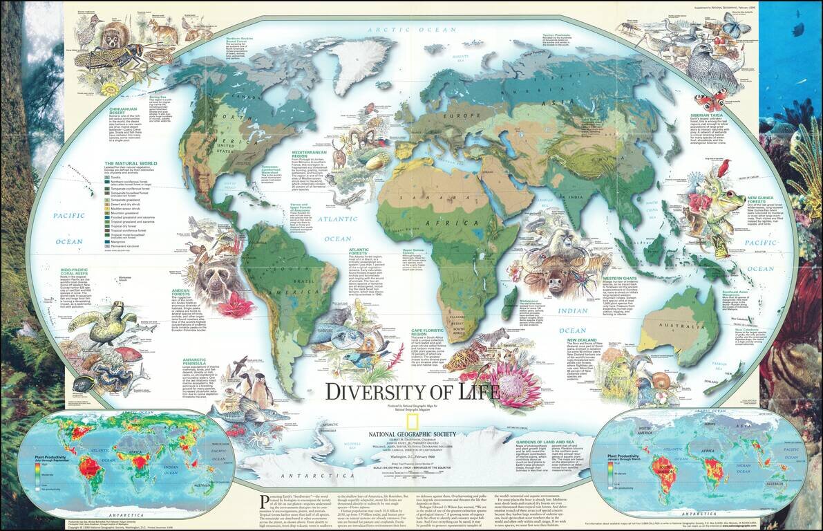
Fascinating pictorial map that portrays the many unique aspects of life on earth. Map itself portrays the world divided into biomes. Insets detail the differences in summer and winter primary productivity between the hemispheres. Includes drawings of...

Excellent "NavWar" pictorial map of the North Atlantic and Western European Theaters during World War II. The map is a very effective persuasive piece, which sweeping arcs depicting Allied naval power in the Atlantic combined with its air power over...
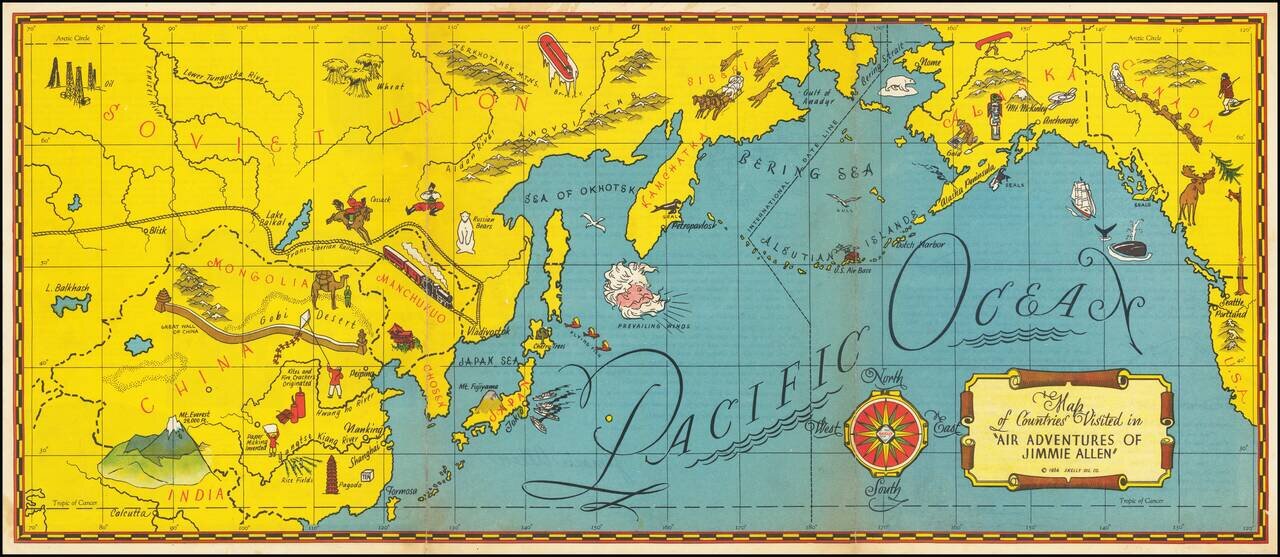
The Gold Age of Radio Theater -- The Air Adventures of 16 Year Old Crime Solving Pilot Jimmie Allen Rare pictorial map of the Pacific printed as a promotional premium for the Air Adventures of Jimmie Allen, theatrical radio production that aired from...
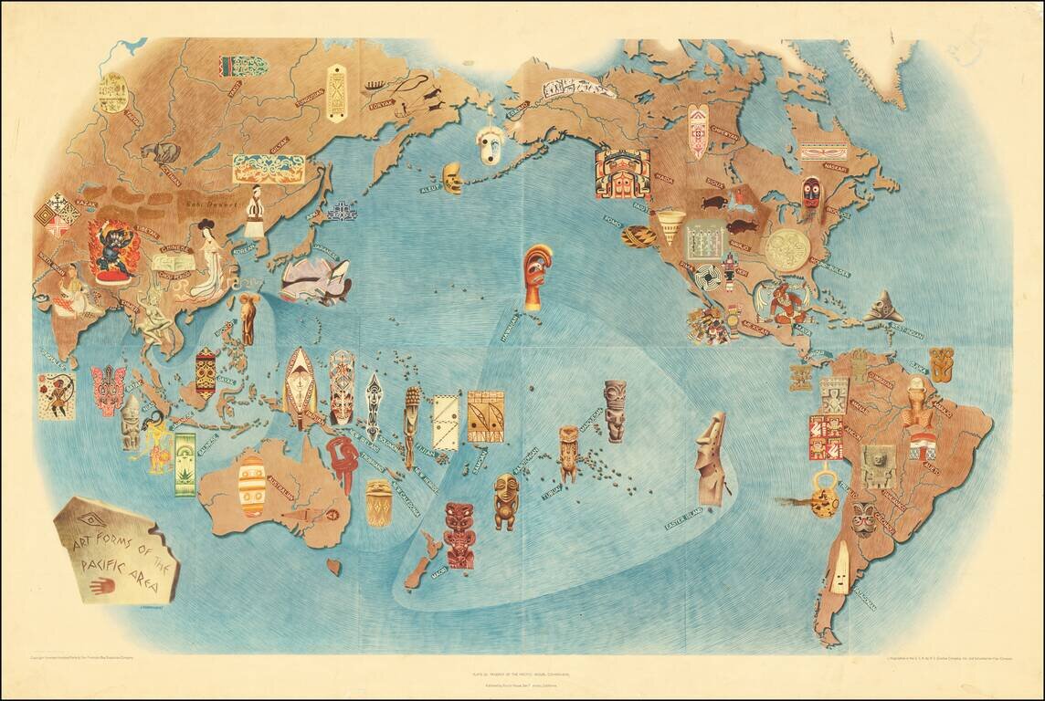
An attractive lithograph showing the art forms of the Pacific, after the eponymous mural by the talented Mexican intellectual Miguel Covarrubias. Many examples of traditional art forms are shown overlaid on a map that includes all of the Americas,...
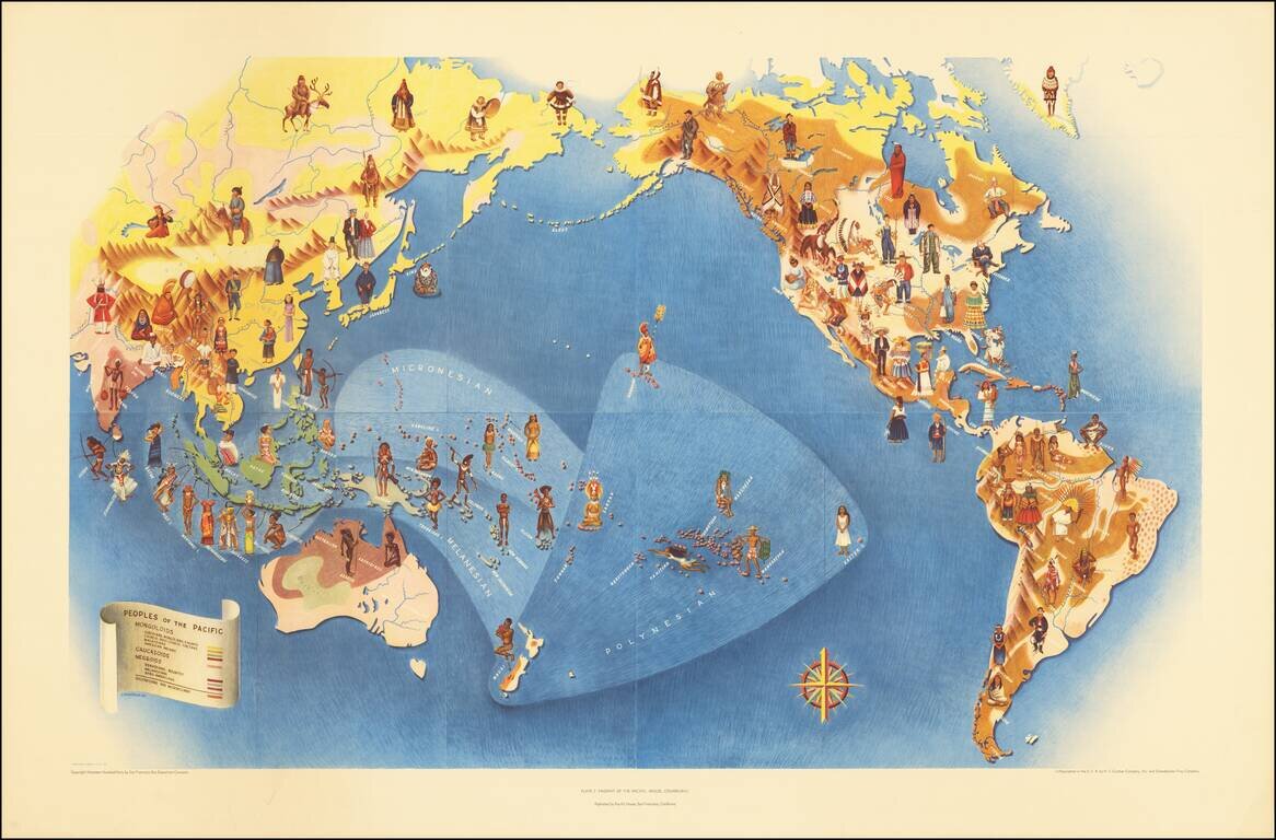
An attractive lithograph from 1940 showing the peoples of the Pacific, after the eponymous mural by the talented Mexican intellectual Miguel Covarrubias. The map shows the Pacific in its entirety and extends to all of the Americas, Oceania, and most of...
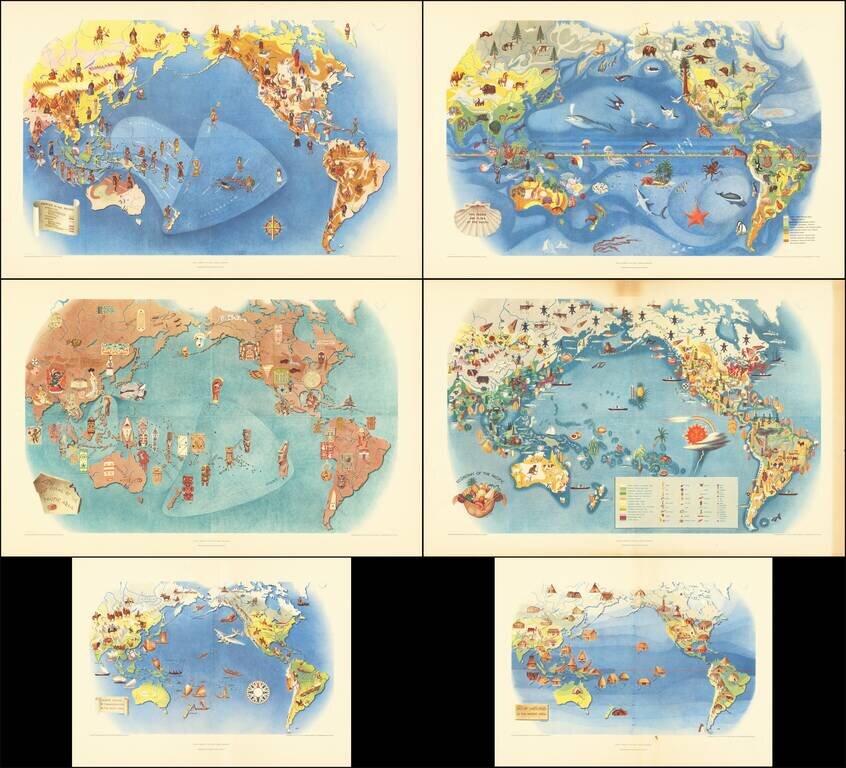
This is a series of six works, lithographed after Covarrubias's mural the Pageant of the Pacific, which was first displayed at the 1939 San Francisco Golden Gate International Exposition. Covarrubias was commissioned to create this mural that would be...
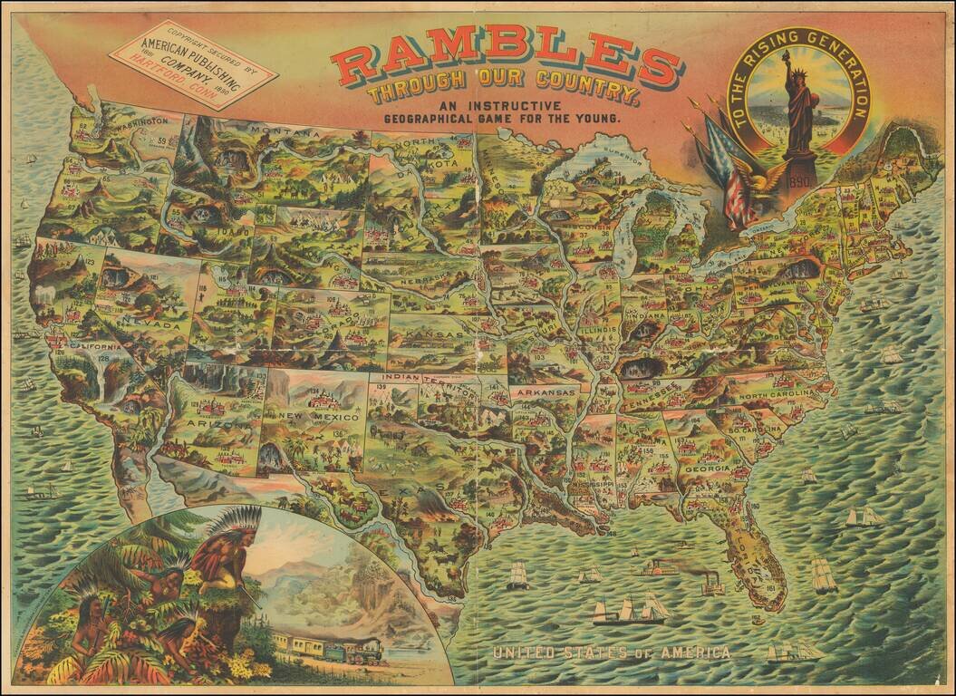
A bright, whimsical chromolithographed map of the United States, designed for a children's game, but wonderful in its own right. The principal cities of the US are depicted, as are natural resources or landmarks. Texas is shown with Indians chasing a...
![[United States] Across the Continent](/map/small/63859.jpg)
Fine example of this early example of Parker Brothers game board, "Across the Continent." This is one of a few color lithographic game boards produced in the 1880s and early 1890s. Includes several railroad routes illustrating the major railroad...
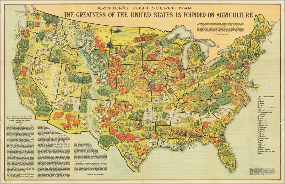
Scarce promotional map published by Armour & Company, displaying and illustrating the agricultural regions of the United States. Includes a marvelous quote from L. Ogden Armour describing the importance of livestock in American Agricultural...

This is an attractive pictorial map of the United States published by the Ford Motor Company as an advertisement for air routes that were supplied in part by their Ford Trimotor aircraft. The map is fascinating, showing domestic and international air...
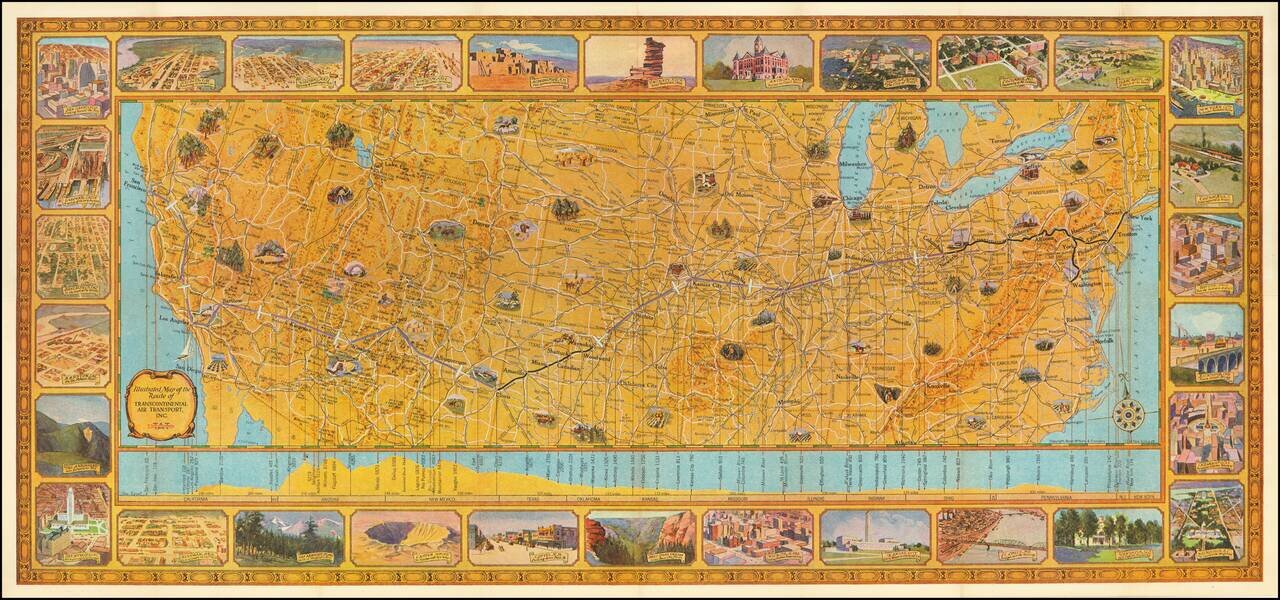
Rare Early Flight Planning Map Finely executed pictorial map of the United States showing the route of Transcontinental Air Transport, embellished by 30 decorative vignettes showing major American cities and points of interest. On the verso is flight...
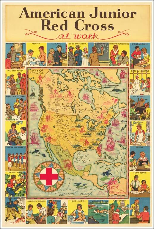
Attractive vintage pictorial map of North America, published by the American Junior Red Cross and with art by H.M. Leslie Rundle. The central map of North America shows early European Settlements (in blue) and Discoveries (in pink) including "Norsemen...

Striking large pictorial map of the United States, produced for the Chicago World's Fair of 1933. The map was executed by Louis Delton Fancher, a well regarded graphic artist for the Great Atlantic & Pacific Tea Company (A & P), as a...
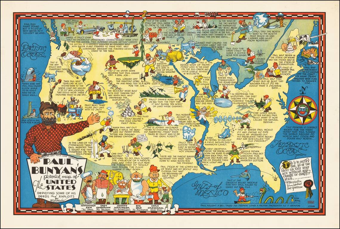
Rare pictorial map of the United States, celebrating the legend of Paul Bunyan. As noted by David Rumsey: Humorous pictorial map by R. D. Handy showing the adventures [of Paul Bunyan] across the United States, with illustrations and descriptive...
![[Come To Dallas] Easy To Reach -- Hard To Leave](/map/small/63387.jpg)
Pictorial map of the United States, focusing on Dallas as the center of the country. The map shows distances from Dallas to many other major cities in the United States. The map was published as part of the centennial of the Republic of Texas...
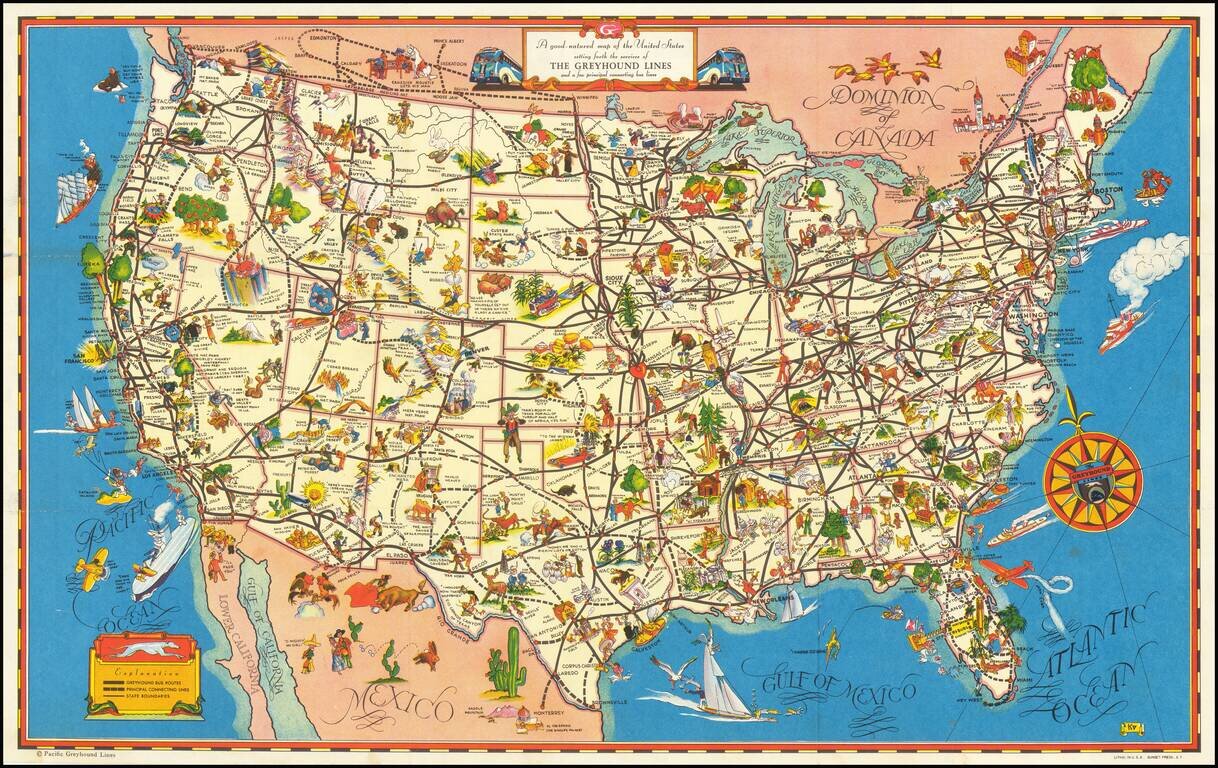
A fine example of this decorative pictorial map of the United States, promoting Greyhound bus lines. The caricatures of the various regions run from charming to very politically incorrect and provide a marvelous look at American's ethnic and regional...