
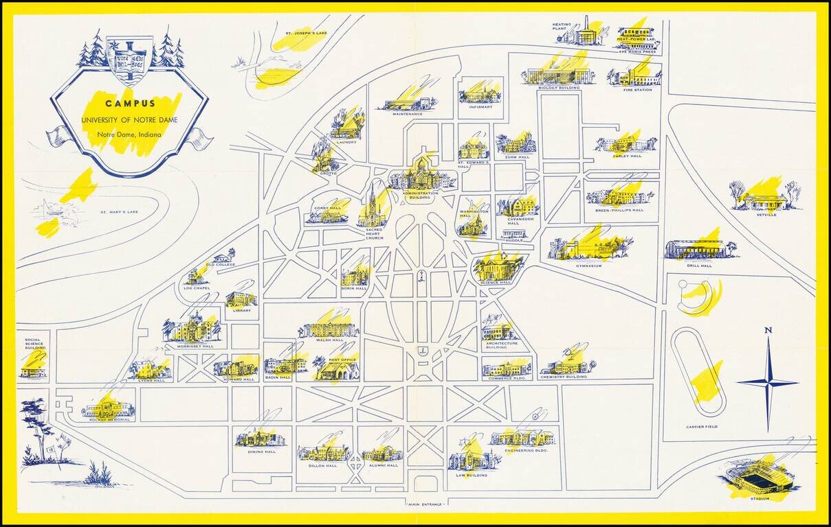
Scarce pictorial map the University of Notre Dame campus in South Bend, Indiana. The recto shows the campus with important buildings, including Notre Dame Stadium (opened in 1930), scattered around the grid of pathways and roads. On the verso, the...
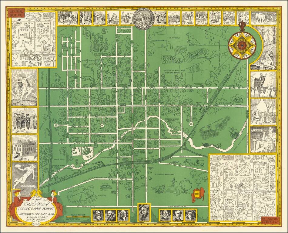
Rare vintage pictorial map of Oberlin College and the town of Oberlin, Ohio. The map was made by Walter Knapp in 1929, during the Golden Age of Pictorial Mapmaking, and it relies on many of the themes embodied in that movement. The map includes...
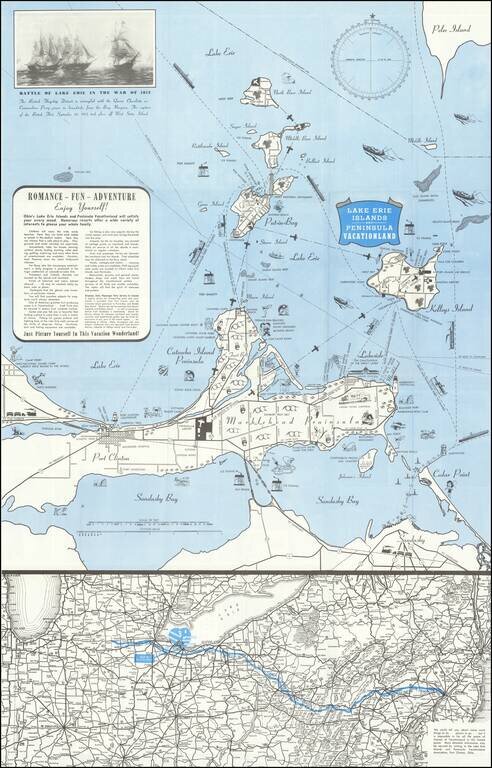
Lively pictorial map of the Lake Erie and Peninsula Vacationland, near Port Clinton Ohio, between Toledo and Cleveland on Lake Erie. The main map focuses on recreational opportunities on Marblehead and Catawba Island Peninsulas, with Port Clinton....
![[Kensington Metropolitan Park / Kent Lake] Scouting To Adventure Gold Rush of '48 Detroit Area Council Boy Scouts of America . . . 1948](/map/small/63032.jpg)
A Gold Rush Themed Scouting Retreat in 1948 Pictorial map of the Kensington Metropark area of Kent Lake, prepared in conjunction with the Detroit area Boy Scouts of America regional council, June 25, 26 and 27, 1948. The map provides a lively image...
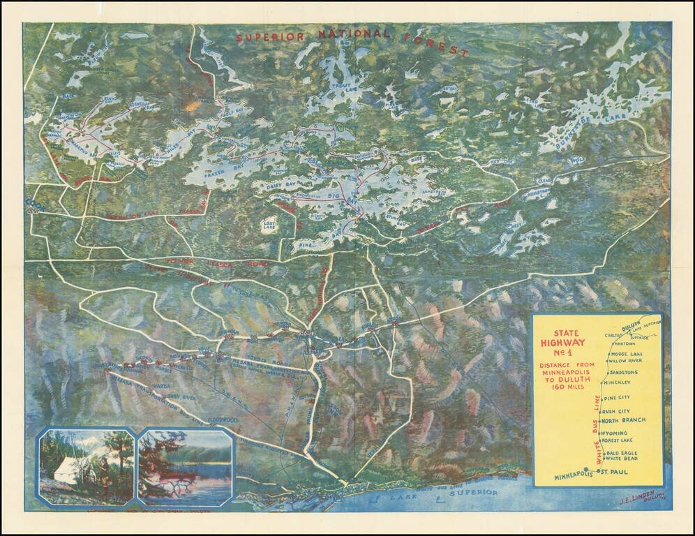
Rare color bird's-eye view of northern Minnesota, produced in Duluth by J.E. Linden. The map was produced to entice vacationers from the Twin Cities to travel to Lake Vermilion in the summer. Lake Superior and Duluth occupy the bottom of the map, and...
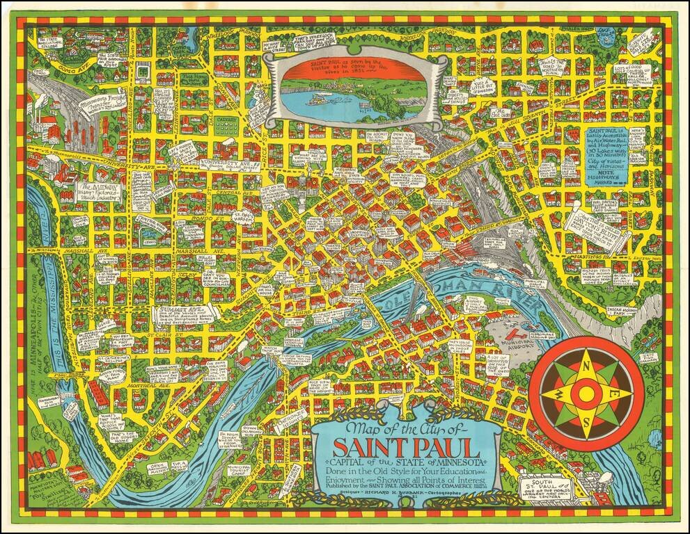
Scarce pictorial map of St. Paul, Minnesota, drawn by Richard Burbank for the Saint Paul Association of Commerce. Includes "Dramatic Moments in Saint Paul's Yesterday" on the verso, along with tourist and promotional text and a fine small birdseye...
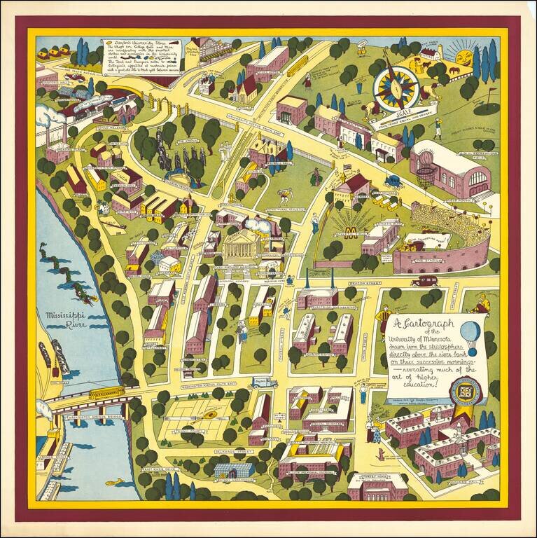
Nadine Semans's 1935 Map of the University of Minnesota. The Biggest of Her University of Minnesota Pictorial Maps. Excellent pictorial map covering the University of Minnesota's original "East Bank" campus. Published by the Dayton Company to promote...
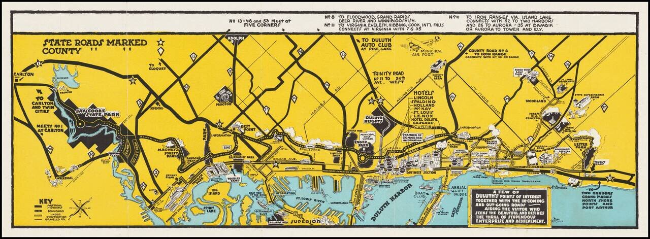
Aiding The Visitor Who Seeks The Beautiful and Desires The Thrill of Stupendous Enterprise and Achievement. Pictorial map of the area around Duluth, Minnesota, promoting local tourism and business, drawn by Nelson A. Long for the Duluth Chamber of...
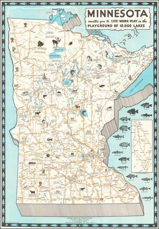
Attractive Vintage Pictorial Map of Minnesota, Featuring the State's Local Fish, Livestock, and Agriculture. The map illustrates fourteen species of fish and across the state the local produce and livestock species are illustrated pictorially. The...
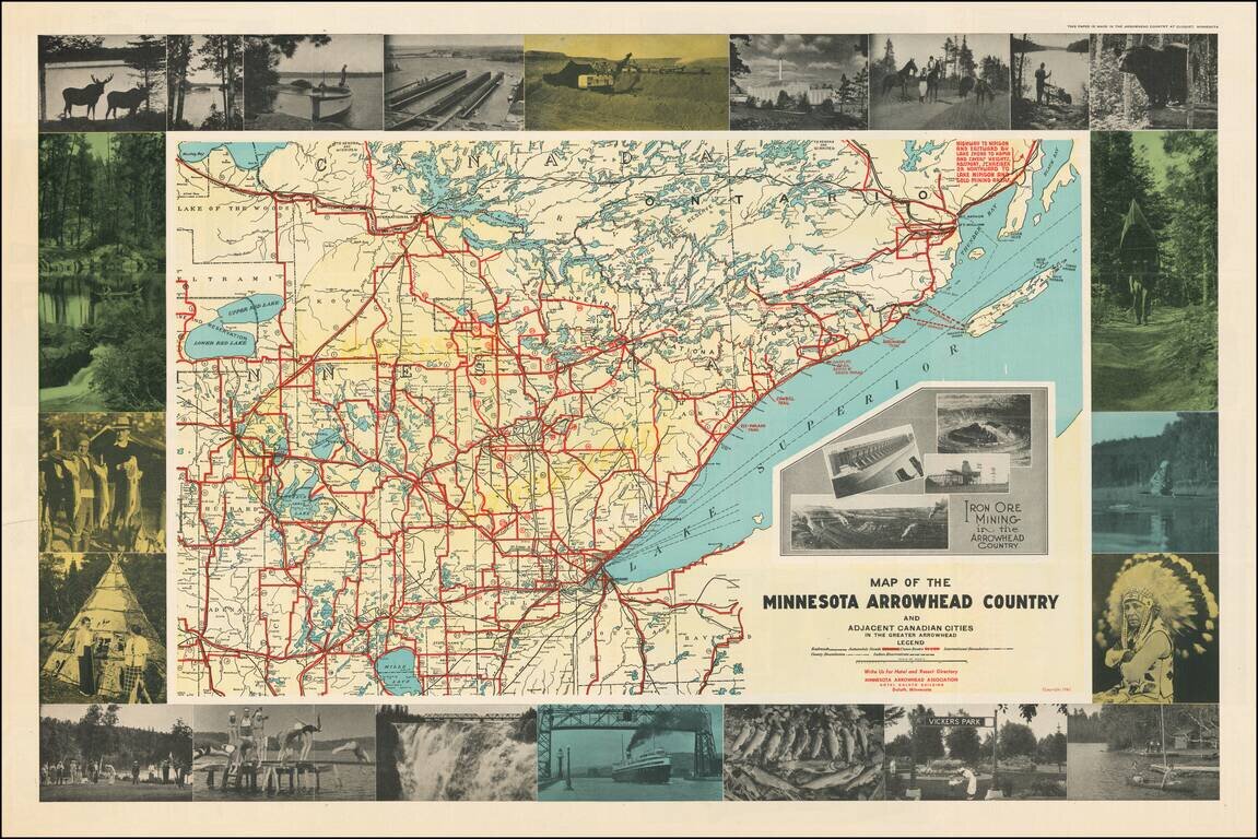
Attractive pictorial map of Minnesota's Arrowhead Region with numerous carte-a-figure photographs of local tourist attractions, wildlife, Native Americans, etc. The map includes inset photos of Iron Ore mining operations in northeast Minnesota. The...
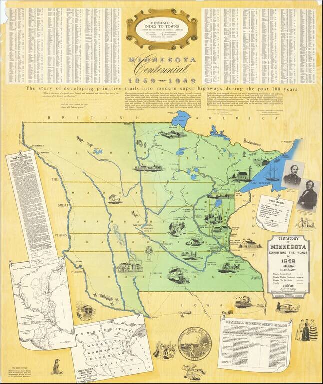
Large Minnesota Historical Society pictorial map depicting the Territory of Minnesota in 1849. The main map focuses on the roads in the Territory in 1849, an inset map shows the original counties, and another shows the roads in eastern Minnesota in...
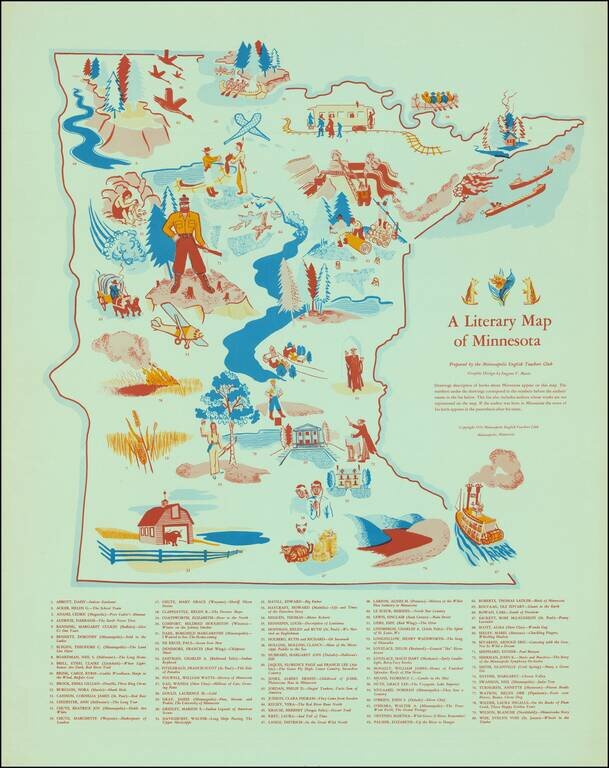
Scarce vintage pictorial of Minnesota, focusing on the state's literary heritage. The map was published by the Minneapolis English Teachers Club in 1954. "Drawings descriptive of books about Minnesota appear on this map. The numbers under the drawings...
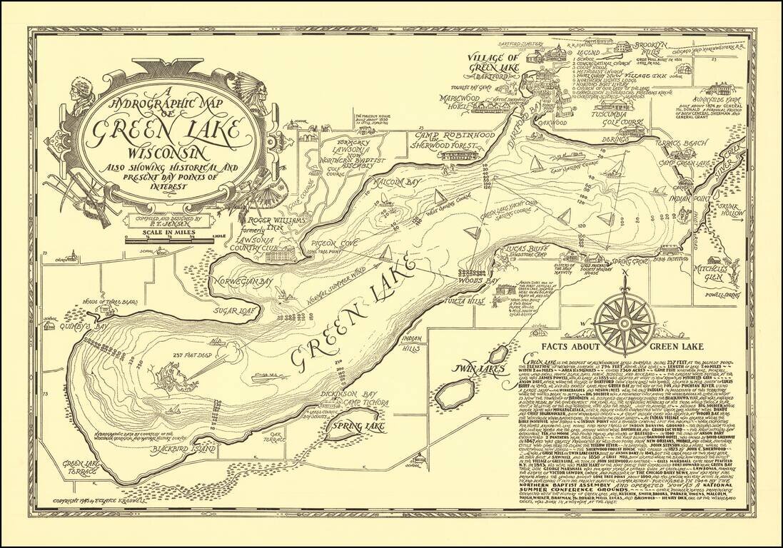
Scarce vintage pictorial map of Green Lake, Wisconsin, compiled and designed by P.T. Jensen and published by F. Clayce Kradwell in 1945. Green Lake is a large lake between Oshkosh and Wisconsin Dells. The Wisconsin Historical Society has a colored...
![[Ashland Wisconin]](/map/small/60288.jpg)
Lake Trout Trolling on Lake Superior! Detailed pictorial map of the area around Ashland, Wisconsin, published by the Ashland Chamber of Commerce. The focal point of the map is recreational activities, including hunting, fishing, skiing, boating,...
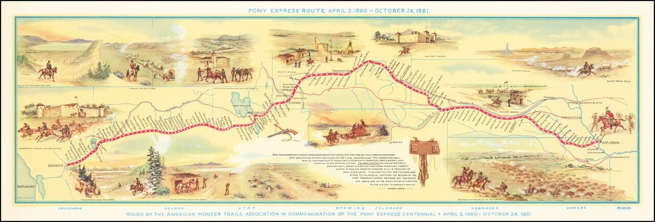
Fine pictorial map of the Pony Express Route, issued by the American Pioneer Trails Assocation in to commemorate the Centennial of the Pony Express. As noted by David Rumsey: Shows route of Pony Express with names and location of relay stations....
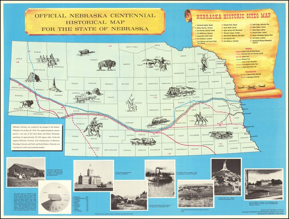
Interesting historical map of Nebraska, published to celebrate the 100 year anniversary of its Statehood in 1867. The map includes about 15 vignettes in the map and a key locating 21 points of interest, 7 important historical trails across Nebraska...