
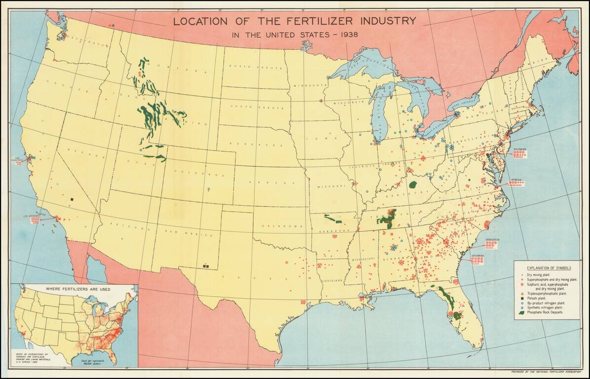
Mapping America's Fertilizer Production and Use During World War II Large map of the United States, illustrating the places and means of production of Fertilizer in the United States. The key locates 8 different important locations of different types...
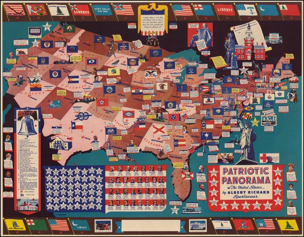
The Albert Richmond Patriotic Panorama Map Detailed patriotic map of the United States drawn by F. E. Cheeseman, published for Albert Richard. The map was issued by Albert Richard, a manufacturer of mens and boys coats. The posters were promotional...
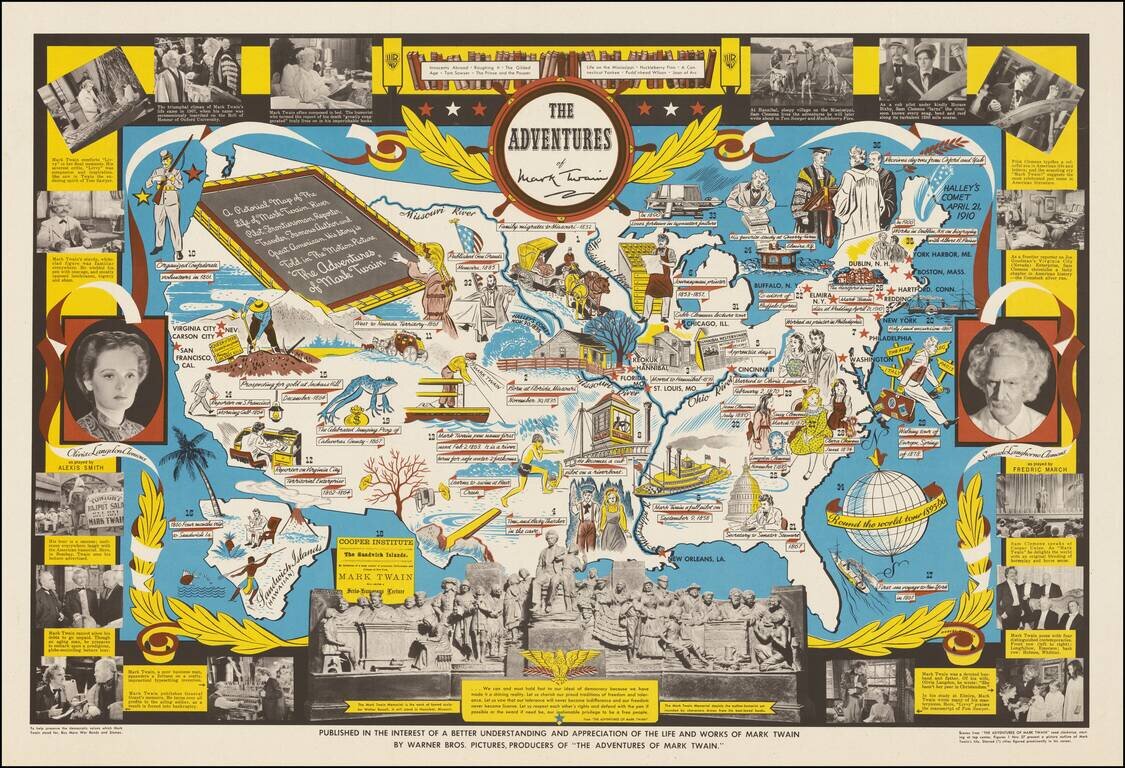
Decorative pictorial map telling the story of Mark Twain, published by Warner Brothers, in conjunction with its release of the movie of the same title. "The Adventures of Mark Twain" was a 1944 biographical film produced by Warner Brothers. The text...

Rare vintage pictorial map of the United States, by Edward McCandish, published by Hagstrom Company under the Bill Whiffletree trademark. An earlier edition of the map was published in 1926; this edition, easily differentiated by the inclusion of the...
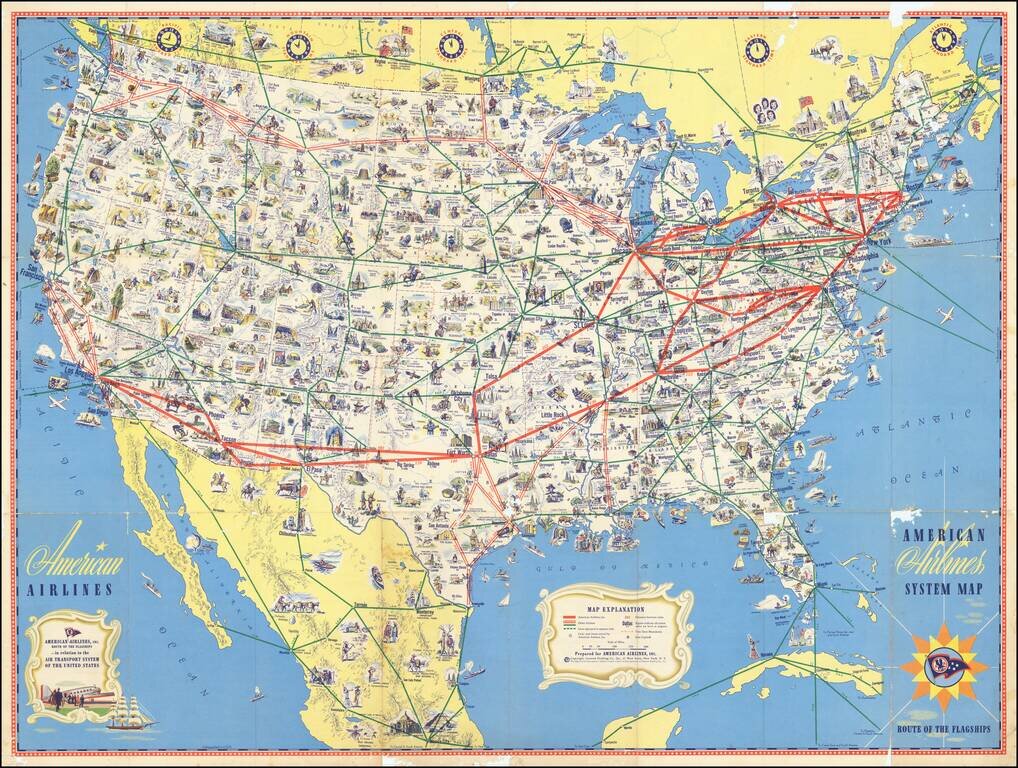
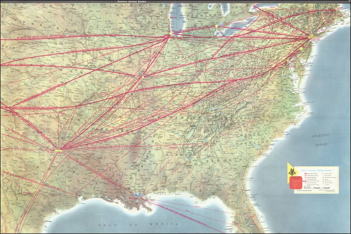
Richly illustrate pictorial map highlighting the flagship routes of American Airlines. The American Airlines system is shown "in relation to the Air Transport System of the United States", with other airlines marked in green, but identified. The map...
![Trails: [1595-1945]: Land, Sea, and Air of The American Adventure Series](/map/small/70672.jpg)
Attractive vintage pictorial map of the United States, featuring a quintessentially Mid-Century outlook on the country's history. The map focuses on "Trails in American Adventure" (Oregon, California, Santa Fe, Chisholm, Wilderness Road, Pony Express,...

Striking pictorial map of the United States, by W.P.A. artist Paul Sample. The map provides a fine look at agricultural America, paying tribute to America's farming and ranching traditions from coast to coast. The map was one of three lithographic...
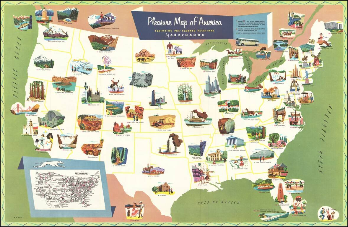
Scarce pictorial map of the United States, promoting pre-planned vacation packages offered by Greyhound. The map is illustrated with regional tourist attraction vignettes, with numbers keyed to Greyhound's vacation tour packages described on the...
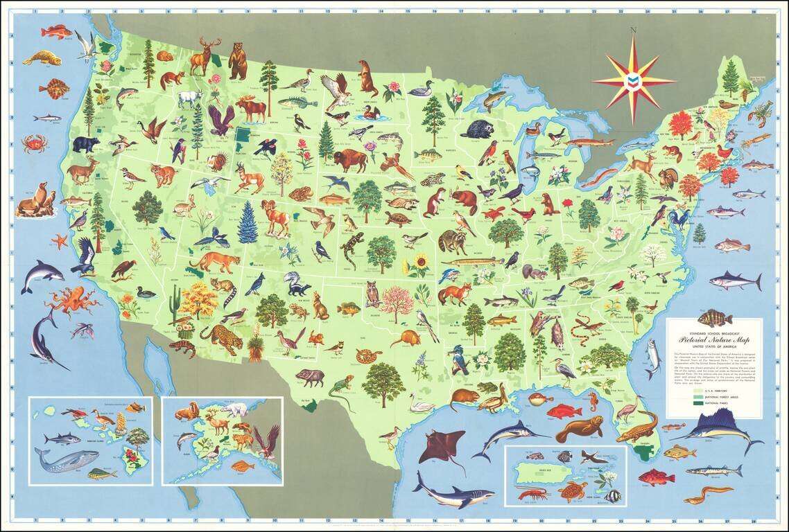
Lively "educational" map of the United States, produced for the Standard Oil Company of California (logo at the top right, in the compass rose). The map provides a rich tapestry of 100s of animals, birds, trees, reptiles, fish, plants and sea...
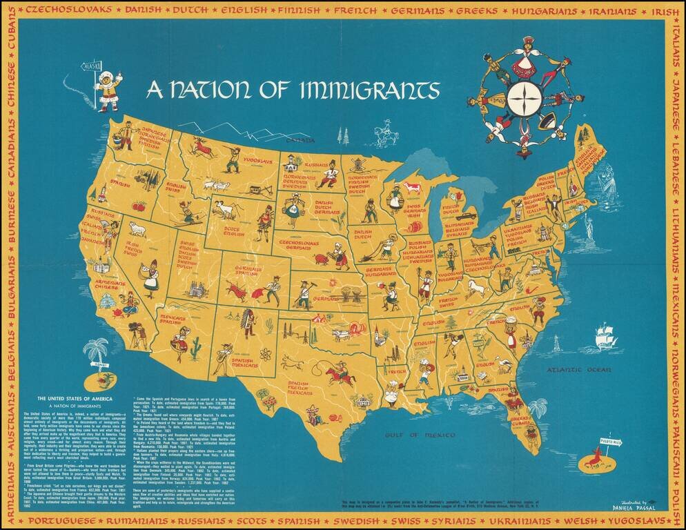
"The immigrants we welcome today and tomorrow will carry on this tradition and help us to retain, reinvigorate and strengthen the American spirit." Important vintage pictorial map by Daniela Passal, issued as a companion to John F. Kennedy's A Nation...
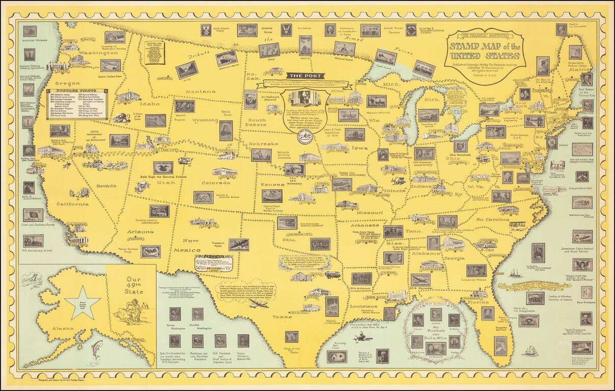
Scarce 1959 edition of Ernest Dudley Chase's stamp map, published for the Philatelic Institute. The map includes images of US Postage stamps arrayed across the states, many placed thematically based upon the places to which they correspond...
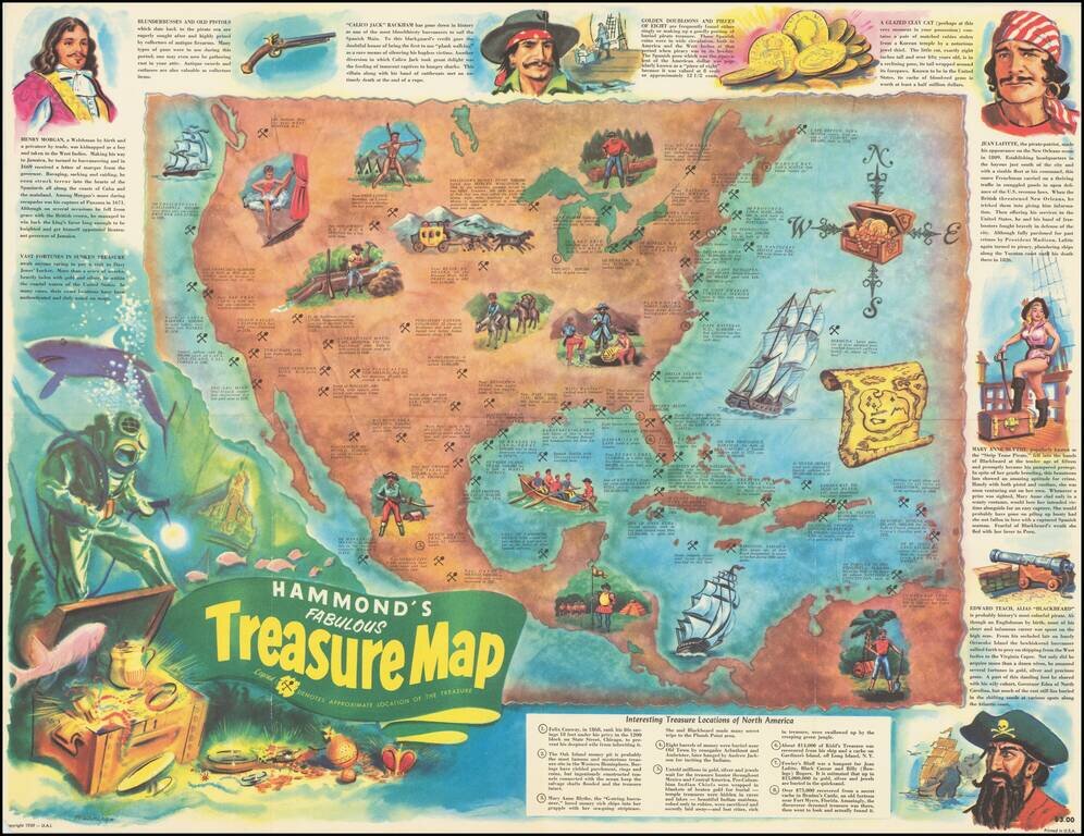
Pirates and Treasure! Lively pictorial map of North America, providing the locations of famous treasures, real and mythical, disbursed throughout the region. From the Lost Dutchman mine to John Dillinger's stash near Mercer Wisconsin, The map details...
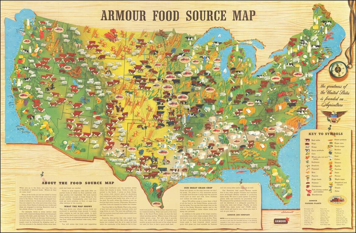
Scarce promotional map published by Armour & Company, displaying and illustrating the agricultural regions of the United States. This is the second of Armour's food maps, updated from the 1922 edition. It includes a lengthy text explanation of...
Interesting pictorial / gasoline map of the United States, illustrating on a state by state basis great events in American History. The map is geared toward children, providing a lively and sometimes politically off-color look at America's history....
Striking example of this American Airlines promotional map, introducing the upcoming launch of Stage II of the 707 Astrojet. First introduced in 1959, the Boeing 707 "Astrojet" would become the backbone of commercial aviation. The present map was...
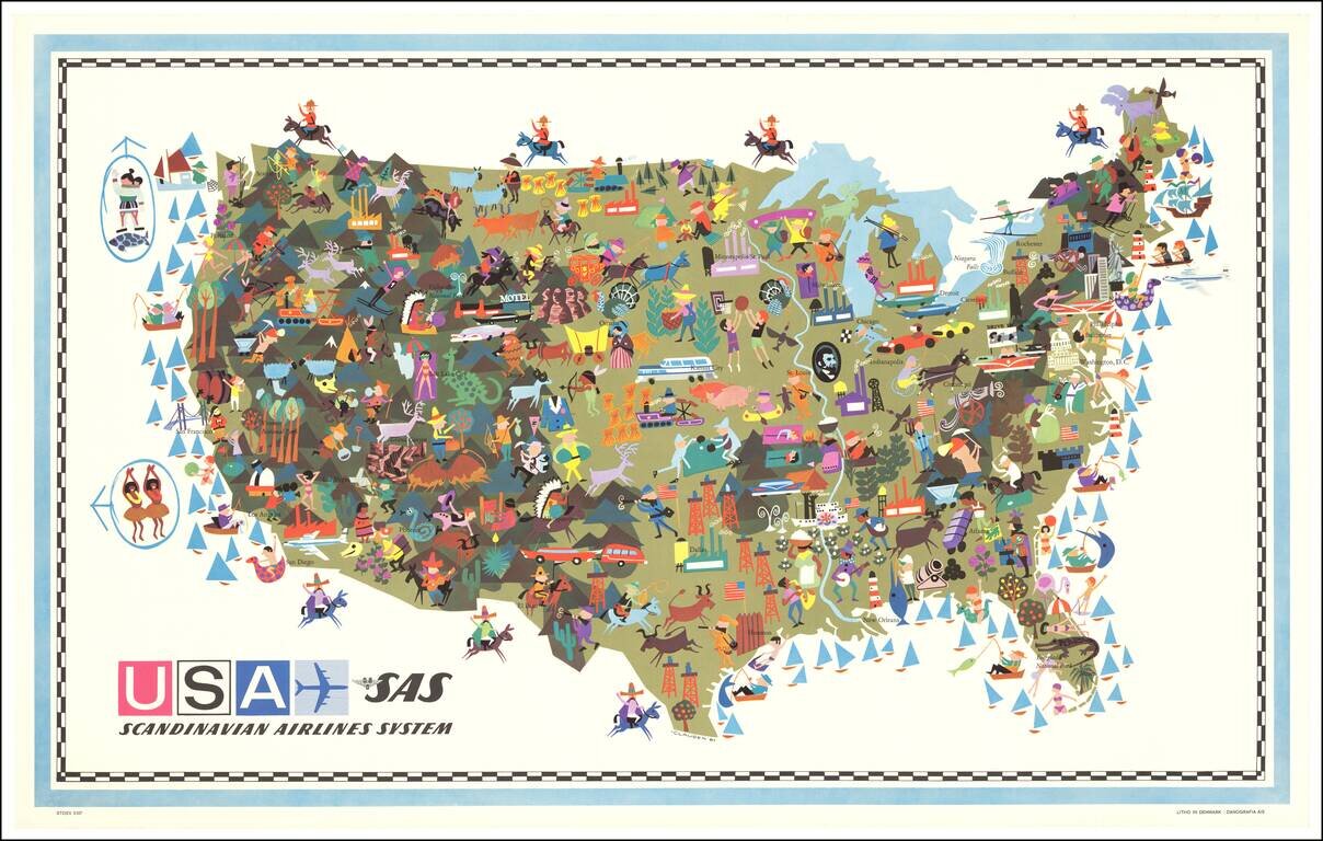
Decorative vintage pictorial map of the United States, published by Scandinavian Airlines System. An interesting and attractive pictorial map with some quaint and politically incorrect imagery, when viewed from a modern perspective. Signed "-CLAUSEN 61"